
Pleasant Grove Township in Lerna in Coles County, Illinois — The American Midwest (Great Lakes)
Civilian Conservation Corps Camp Shiloh Encampment Site
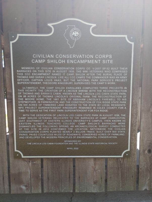
Photographed by Craig Doda, July 29, 2023
1. Civilian Conservation Corps Camp Shiloh Encampment Site Marker
Ultimately, the Camp Shiloh enrollees completed three projects in this vicinity: the creation of a Lincoln Shrine with the reconstruction of Thomas and Sarah's cabin, known as the Lincoln Log Cabin State Park, on 86 acres of Thomas Lincoln's original farm; the reconstruction of the Moore Home, the 1861 site of Abraham Lincoln's farewell to his stepmother, in Farmington; and the construction of Fox Ridge State Park on 500 acres of timbered land donated to the state by local residents. NPS project superintendent Kingsbury remained in Coles County for a time to serve as the first park superintendent for Fox Ridge.
With the dedication of Lincoln Log Cabin State Park in August 1936, the Camp Shiloh Veterans relocated to the
this page online
Erected 2022 by The Lincoln Log Cabin Foundation and The Illinois State Historical Society.
Topics and series. This historical marker is listed in these topic lists: Architecture • Charity & Public Work • Parks & Recreational Areas • War, World I. In addition, it is included in the Civilian Conservation Corps (CCC), and the Illinois State Historical Society series lists. A significant historical month for this entry is August 1935.
Location. 39° 22.815′ N, 88° 12.56′ W. Marker is in Lerna, Illinois, in Coles County. It is in Pleasant Grove Township. It is on South Lincoln Highway, on the right when traveling east. Touch for map.
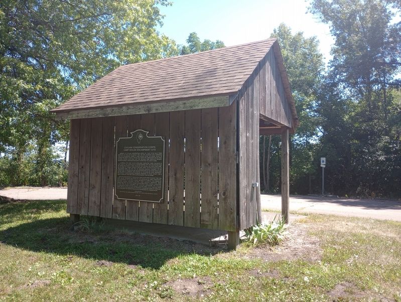
Photographed by Craig Doda, July 29, 2023
2. Civilian Conservation Corps Camp Shiloh Encampment Site Marker

Regionally, this marker is in Central Illinois. It is also in the American Midwest and in the Corn Belt. Globally, it is in North America, the Western Hemisphere, the Western World, and the Anglosphere. Historically, it finds itself in what was once the territory of the Mississippian Culture and also the Northwest Territory.
Other nearby markers. At least 8 other markers are within 2 miles of this marker, measured as the crow flies: The Last Lincoln Farm (a few steps from this marker); Lincoln's Care for His Family (approx. 0.3 miles away); The Reuben Moore Home (approx. 1.1 miles away); Moore House (approx. 1.1 miles away); Shiloh Cemetery (approx. 1½ miles away); Thomas Lincoln's Grave (approx. 1½ miles away); Thomas Lincoln, Kentucky Militiaman (approx. 1.6 miles away); Thomas and Sarah Bush Lincoln (approx. 1.6 miles away). Touch for a list and map of all markers in Lerna.
Credits. This page was last revised on August 17, 2023. It was originally submitted on August 2, 2023, by Craig Doda of Napoleon, Ohio. This page has been viewed 463 times since then and 69 times this year. Photos: 1, 2. submitted on August 2, 2023, by Craig Doda of Napoleon, Ohio. • Andrew Ruppenstein was the editor who published this page.
