Boyle Heights in Los Angeles in Los Angeles County, California — The American West (Pacific Coastal)
Brooklyn & Soto
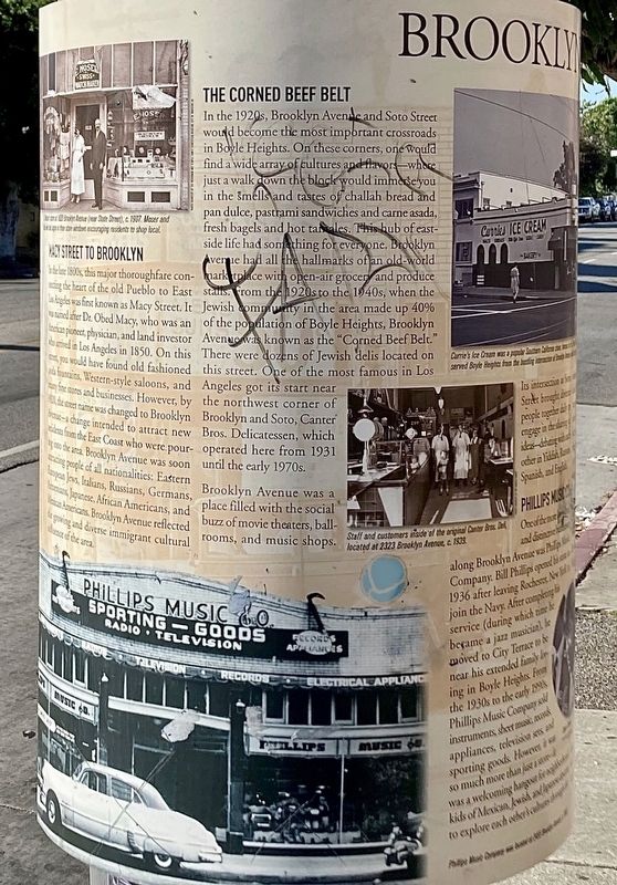
Macy Street to Brooklyn
In the late 1800s, this major thoroughfare connecting the heart of the old Pueblo to East Los Angeles was first known as Macy Street. It was named after Dr. Obed Macy, who was an American pioneer, physician, and land investor who arrived in Los Angeles in 1850. On this street, you would have found old fashioned soda fountains, Western-style saloons, and many fine stores and businesses. However, by 1920, the street name was changed to Brooklyn Avenue — a change intended to attract new residents from the East Coast who were pouring into the area. Brooklyn Avenue was soon attracting people of all nationalities: Eastern European Jews, Italians, Russians , Germans, Armenians, Japanese, African Americans, and Mexican Americans. Brooklyn Avenue reflected the growing and diverse immigrant cultural influence of the area.
The Corned Beef Belt
In the 1922s, Brooklyn Avenue and Soto Street would become the most important crossroads in Boyle Heights. On these corners, one would find a wide array of cultures and flavors — where just a walk down the block would immerse you in the smells and tastes of challah bread and pan dulce, pastrami sandwiches and carne asada, fresh bagels and hot tamales. This hub of east-side life had something for everyone. Brooklyn Avenue had all the hallmarks of an old-world marketplace with open-air grocery and produce stalls. From the 1920s to the 1940s, when the Jewish community in the area made up 40% of the population of Boyle Heights, Brooklyn Avenue was known as the "Corned Beef Belt." There were dozens of Jewish delis located on this street. One of the most famous in Los Angeles got its start near the northwest corner of Brooklyn and Soto, Canter Bros. Delicatessen, which operated here from 1931 until the early 1970s. Brooklyn Avenue was a place filled with the social buzz of movie theaters, ballrooms, and music shops.
Its intersection at Soto Street brought diverse people together daily to engage in the sharing of ideas — debating with each other in Yiddish, Russian, Spanish, and English.
Phillips Music Co.
One of the more long-lived and distinctive businesses along Brooklyn Avenue was Phillips Music Company. Bill Phillips opened his store in 1936 after leaving Rochester, New York to join the Navy. After completing his service (during which time he became a jazz musician) he moved to City Terrace to be near his extended family living in Boyle Heights. From the 1930s to the early 1990s Phillips Music Company sold instruments, sheet music, records, appliances, television sets, and sporting goods. However, it was so much more than just a store — it was a welcoming hang out for neighborhood kids of Mexican, Jewish, and Japanese descent to explore each other’s cultures through the shared love of music. Phillips was invested and involved in the community — volunteering his time as a music teacher, offering work opportunities to young customers, and supporting civic causes. Even after moving out of the neighborhood, Phillips never stopped working at the store (until well into his 80s) and bringing his enthusiasm for business, culture, music, and service to the neighborhood.
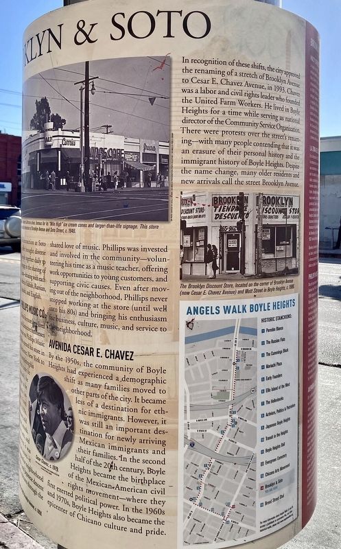
Avenida Cesar E. Chavez
By the 1950s, the community of Boyle Heights had experienced a demographic shift as many families moved to other parts of the city. It became less of a destination for ethnic immigrants. However, it was still an important destination for newly arriving Mexican immigrants and their families. In the second half of the 20th century, Boyle Heights became the birthplace of the Mexican-American civil rights movement — where they first exerted political power. In the 1960s and 1970s, Boyle Heights also became the epicenter of Chicano culture and pride.
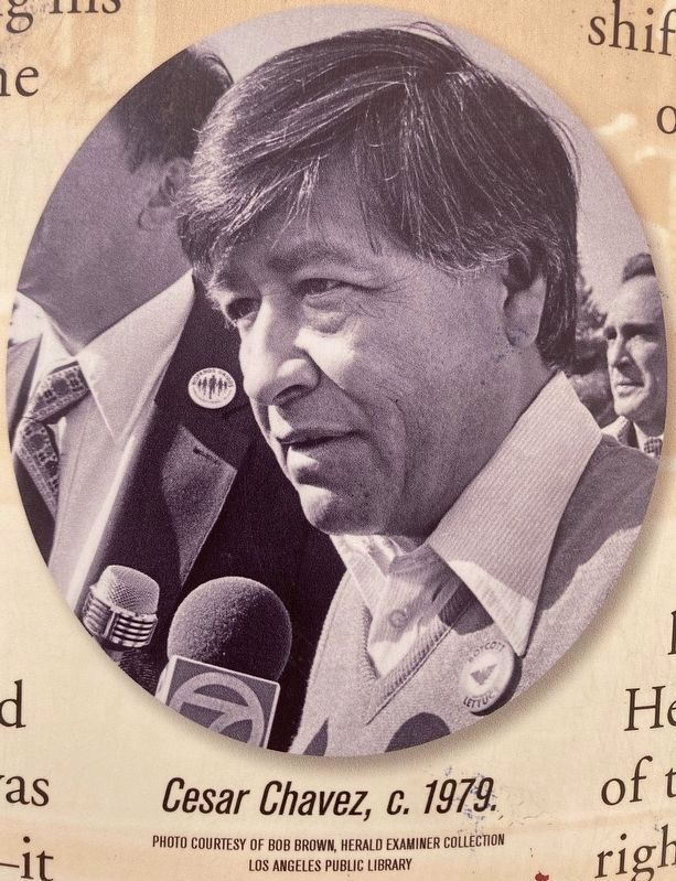
In recognition of these shifts, the city approved the renaming of a stretch of Brooklyn Avenue to Cesar E. Chavez Avenue, in 1993. Chavez was a labor and civil rights leader who founded the United Farm Workers. He lived in Boyle Heights for a time while serving as national director of the Community Service Organization. There were protests over the street's renaming — with many people contending that it was an erasure of their personal history and the immigrant history of Boyle Heights. Despite the name change, many older residents and new arrivals call the street Brooklyn Avenue.
Erected by City of Los Angeles.
Topics. This historical marker is listed in these topic lists: Industry & Commerce • Roads & Vehicles. A significant historical year for this entry is 1850.
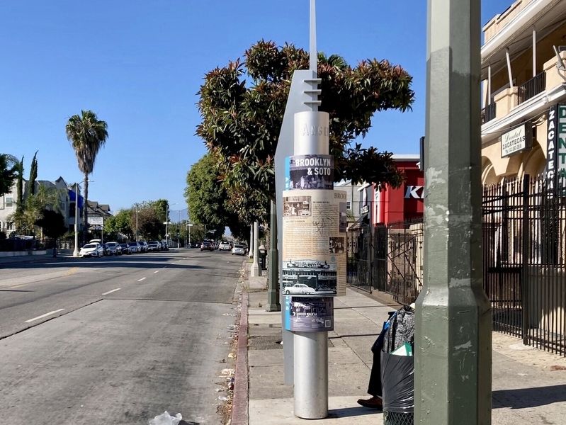
Location. 34° 2.822′ N, 118° 12.452′ W. Marker is in Los Angeles, California, in Los Angeles County. It is in Boyle Heights. Marker is on Soto Street just north of Cesar Chavez Avenue, on the right when traveling north. Touch for map. Marker is at or near this postal address: 308 N Soto St, Los Angeles CA 90033, United States of America. Touch for directions.
Other nearby markers. At least 8 other markers are within walking distance of this marker. Brooklyn Avenue (about 300 feet away, measured in a direct line); Chicano Arts Movement (about 400 feet away); Otomisan Restaurant (approx. 0.3 miles away); Japanese Hospital (approx. 0.3 miles away); The Hollenbecks (approx. 0.4 miles away); Japanese-American Soldiers (approx. half a mile away); Hollenbeck Park (approx. 0.6 miles away); Mariachi Plaza (approx. 0.7 miles away). Touch for a list and map of all markers in Los Angeles.
Also see . . . Angels Walk L.A. Self-guided walking tours of historic neighborhoods in Los Angeles. The Brooklyn & Soto marker is part of the Boyle Heights walk. (Submitted on August 5, 2023.)
Credits. This page was last revised on August 9, 2023. It was originally submitted on August 5, 2023, by Craig Baker of Sylmar, California. This page has been viewed 277 times since then and 145 times this year. Photos: 1, 2, 3, 4. submitted on August 5, 2023, by Craig Baker of Sylmar, California.


