Near Shadeland in Tippecanoe County, Indiana — The American Midwest (Great Lakes)
Scott's Expedition
Against the Wea
Inscription.
Side A
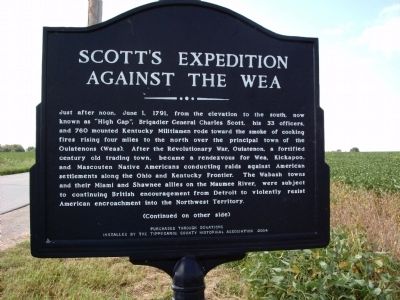
Just after noon, June 1, 1791, from the elevation to the south, now known as “High Gap”, Brigadier General Charles Scott, his 33 officers, and 760 mounted Kentucky Militiamen rode toward the smoke of cooking fires rising four miles to the north over the principal town of the Ouiatenons (Weas). After the Revolutionary War, Ouiatenon, a fortified century old trading town, became a rendezvous for Wea, Kickapoo, and Mascouten Native Americans conducting raids against American settlements along the Ohio and Kentucky Frontier. The Wabash towns and their Miami and Shawnee allies on the Maumee River, were subject to continuing British encouragement from Detroit to violently resist American encroachment into the Northwest Territory.
Side B
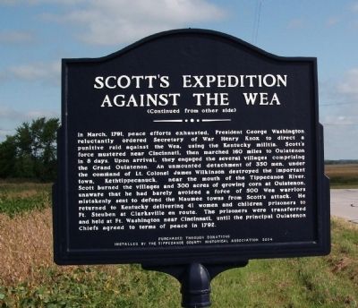
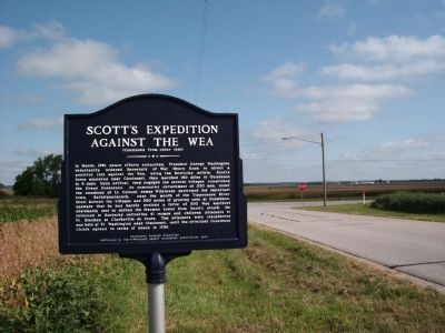
In March, 1791, peace efforts exhausted, President George Washington reluctantly ordered Secretary of War Henry Knox to direct a punitive raid against the Wea, using the Kentucky militia. Scott’s force mustered near Cincinnati, then marched 160 miles to Ouiatenon in 8 days. Upon arrival, they engaged the several villages comprising the Grand Ouiatenon. An unmounted detachment of 350 men, under the command of lt. Colonel James Wilkinson destroyed the important town, Kethtippecanuck, near the mouth of the Tippecanoe River. Scott burned the villages and 300 acres of growing corn at Ouiatenon, unaware that he had barely avoided a force of 500 Wea warriors mistakenly sent to defend the Maumee towns from Scott’s attack. He returned to Kentucky delivering 41 women and children prisoners to Ft. Steuben at Clarksville en route. The prisoners were transferred and held at Ft. Washington near Cincinnati, until the principal Ouiatenon Chiefs agreed to terms of peace in 1792.
Erected 2004 by Through Donations, Tippecanoe County Historical Association.
Topics. This historical marker is listed in these topic lists: Native Americans • Settlements & Settlers. A significant historical month for this entry is March 1791.
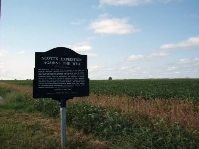
Location. Marker has been reported missing. It was located near 40° 21.531′ N, 86° 58.533′ W. Marker was near Shadeland, Indiana, in Tippecanoe County. Marker was on County Road S 375 W south of State Road 25, on the right when traveling south. Touch for map. Marker was in this post office area: Lafayette IN 47909, United States of America. Touch for directions.
Other nearby markers. At least 8 other markers are within 5 miles of this location, measured as the crow flies. Farmers Institute Academy (approx. 2.7 miles away); Post Ouiatenon Site (approx. 3.3 miles away); Site of the Birth Place of Rev. Anthony Foucher (approx. 3.3 miles away); Liberty Tree
(approx. 3.4 miles away); Fort Ouiatenon (approx. 3.4 miles away); The Buddell Sleeper House (approx. 3.4 miles away); The Wea Plains (approx. 4.2 miles away); Granville (approx. 4.6 miles away).
Credits. This page was last revised on August 14, 2023. It was originally submitted on August 27, 2010, by Al Wolf of Veedersburg, Indiana. This page has been viewed 1,093 times since then and 21 times this year. Last updated on August 6, 2023, by Trevor L Whited of Kokomo, Indiana. Photos: 1, 2, 3, 4. submitted on August 27, 2010, by Al Wolf of Veedersburg, Indiana. • Bill Pfingsten was the editor who published this page.


