Near Fredericksburg in Stafford County, Virginia — The American South (Mid-Atlantic)
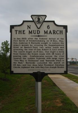
The Mud March
Erected 1998 by Department of Historic Resources. (Marker Number N-6.)
Topics and series. This historical marker is listed in this topic list: War, US Civil. In addition, it is included in the Virginia Department of Historic Resources (DHR) series list. A significant historical month for this entry is January 1863.
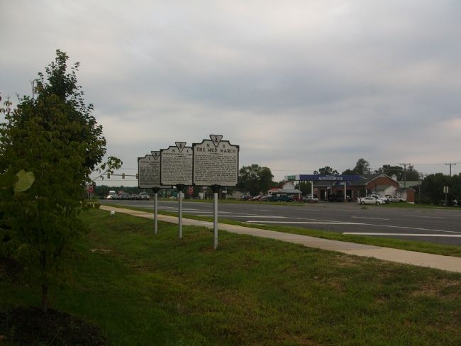
Location. 38° 21.616′ N, 77° 31.191′ W. Marker is near Fredericksburg, Virginia, in Stafford County. Marker is on Warrenton Road (U.S. 17) 0.1 miles east of Greenbank and Berea Church Roads (County Route 656), on the right when traveling east. Touch for map. Marker is at or near this postal address: 29 Banks Ford Pkwy, Fredericksburg VA 22406, United States of America. Touch for directions.
Other nearby markers. At least 8 other markers are within 3 miles of this marker, measured as the crow flies. Fredericksburg Campaign (here, next to this marker); Civilian Conservation Corps Company 2363 (a few steps from this marker); a different marker also named Mud March (approx. 1.7 miles away); War Balloons (approx. 1.7 miles away); Original Bell of Hulls Memorial Baptist Church (approx. 2.2 miles away); Hulls Memorial Baptist Church (approx. 2.2 miles away); Lake Mooney Reservoir (approx. 2.3 miles away); Milton Snellings (approx. 2.3 miles away). Touch for a list and map of all markers in Fredericksburg.
More about this marker. This marker replaces a marker dating from the 1940s with the same number and title that was located on the old alignment of Route 17, now Fleet Road, just north of Berea Church Road. It read, “Here passed a part of the Army of the Potomac moving westward toward the fords of the Rappahannock, January 20-21, 1863. Burnside, commanding, sought to get in the rear of Lee, who was at Fredericksburg. A storm, making the roads deep in mud, forced the abandonment of the movement.”
Credits. This page was last revised on August 7, 2023. It was originally submitted on August 30, 2007, by Kevin W. of Stafford, Virginia. This page has been viewed 2,362 times since then and 35 times this year. Last updated on August 7, 2023, by Anonymous of Fredericksburg, Virginia. Photos: 1, 2. submitted on August 30, 2007, by Kevin W. of Stafford, Virginia. • Bernard Fisher was the editor who published this page.

