Near Nassau in Rensselaer County, New York — The American Northeast (Mid-Atlantic)
Mohican Homelands
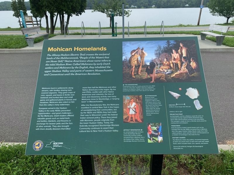
The Albany-Hudson Electric Trail crosses the ancestral lands of the Muhheconneok, "People of the Waters that are Never Still," Native Americans whose name refers to the tidal Hudson River. Called Mahicans by early Dutch settlers and Mohicans by the English, they inhabited the upper Hudson Valley and parts of western Massachusetts and Connecticut until the American Revolution.
Mohicans lived in settlements along streams, with families sharing bark-covered wigwams. They grew crops of corn, squash, and beans in fertile river lowlands and hunted deer and small game and gathered plants in forests and meadows. Mohicans also relied on fish from the valley's many waterways.
European arrival in the Hudson Valley in the early 1600s presented opportunities - and great challenges - for the Mohicans. Dutch traders offered valuable goods such as metal tools and kettles, blankets, and firearms in exchange for beaver pelts and the furs of other animals. They also brought with them deadly diseases that killed more than half the Mohicans and other Native Americans in the region. By the mid-1700s, conflict with other Native Americans and colonists, the loss of land, and missionary activity saw many Mohicans move to Stockbridge, a "praying town" in Massachusetts.
After the Revolutionary War, the Mohicans resettled in central New York in the hopes of reestablishing their communities, but by the 1820s and 1830s they had made their way to Wisconsin under the federal Indian removal policy. There they joined with Munsees, people originally from the lower Hudson Valley. Today, the federally recognized Stockbridge-Munsee Community continues to assert their cultural ties to New York's Hudson Valley.
(right inset)
Artifacts, left to right
PROJECTILE POINT
Archaeologists call this a Madison projectile point, on arrowhead used by regional Native Americans from about 1350 until Europeans arrived in the early 1600s. This example is made of chert, a flint-like stone prized for making tools and weapons
TRADE BEAD
Early Europeans traded colorful beads such as this example from the late 1600s recovered from a Mohican site in the upper Hudson Valley. Beads made from shell called wampum, were used by natives and Europeans as a medium of exchange in the trade for furs.
POTTERY SHARDS
The Mohicans mode clay pottery recovered fragments of which are shown here, to store and cook their staple foods, which included meat com squash, and beans.
Source (for all artifacts) Hartgen Archaeological Associates Inc.
(photos, top to bottom)
"THE GRANDFATHER"
Contemporary artist Len Tantillo painted this early 1600s scene of a tribal elder retelling a story to a captivated audience of a Mohican village on the Hudson River near present-day Castleton, New York. Source: Len Tantillo
ETOWAUKAUM
Mohican leader Etowaukaum visited England in 1710 to meet with Queen Anne to warn her of rising tensions with the French and their Indian allies. During the visit, Dutch artist Jan Verst painted this portrait of Etowaukaum. Source: Library and Archives Canada.
ARTIFACT REPATRIATION
An archaeologist and members of the Stockbridge-Musee Community examine artifacts recovered from a Mohican site in the Hudson River Valley. Source: Stockbridge-Munsee Community.
Erected by Empire State Trail.
Topics. This historical marker is listed in this topic list: Native Americans.
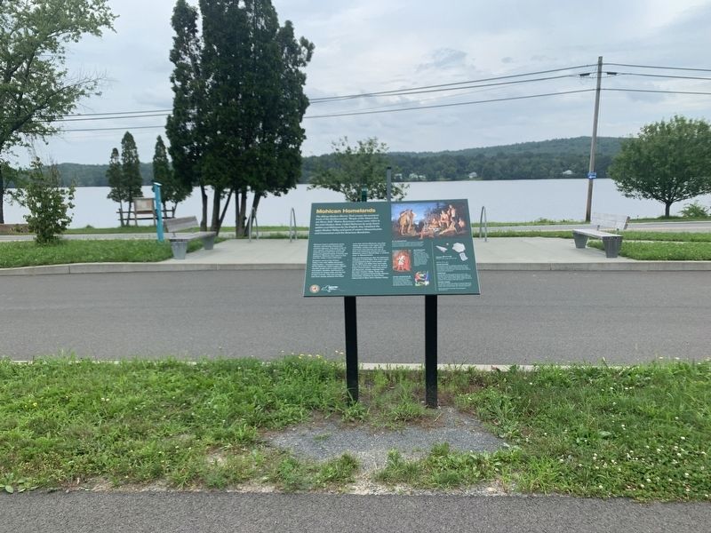
Location. 42° 32.125′ N, 73° 36.519′ W. Marker is near Nassau, New York, in Rensselaer County. Marker is on Schodack-Nassau Road north of Old Forge Road, on the right when traveling south. The marker is twenty yards removed from the road and beside the Albany-Hudson Electric Trail Trail at the Nassau Lake Parking Area. Touch for map. Marker is at or near this postal address: 216 Schodack-Nassau Road, Nassau NY 12123, United States of America. Touch for directions.
Other nearby markers. At least 8 other markers are within 4 miles of this marker, measured as the crow flies. Empire State Trail (here, next to this marker); Passenger and Freight Depots (approx. 1.2 miles away); Nassau Academy (approx. 1.3 miles away); Nassau Village (approx. 1.3 miles away); a different marker also named The Empire State Trail (approx. 1˝ miles away); The Nassau Fair (approx. 1.6 miles away); The Valatie Kill (approx. 1.9 miles away); Gen. Henry Knox Trail (approx. 3.3 miles away). Touch for a list and map of all markers in Nassau.
Also see . . . Mohicans (Wikipedia). (Submitted on August 9, 2023, by Steve Stoessel of Niskayuna, New York.)
Credits. This page was last revised on August 16, 2023. It was originally submitted on August 9, 2023, by Steve Stoessel of Niskayuna, New York. This page has been viewed 88 times since then and 43 times this year. Photos: 1, 2. submitted on August 9, 2023, by Steve Stoessel of Niskayuna, New York. • Andrew Ruppenstein was the editor who published this page.

