Garfield Heights in Cuyahoga County, Ohio — The American Midwest (Great Lakes)
German Corners
⎯⎯⎯
St. John Evangelical Lutheran Church

Photographed by Grant & Mary Ann Fish, July 22, 2023
1. German Corners Marker (Side A)
German Corners. The intersection of Turney and Granger Roads, called German Corners in the 1800s, later became known as South Newburgh Centre. At its earliest Turney Road was known as State Road and then Fisher Road. Finally, it was named for Joseph Turney, area resident and two-term treasurer of the state of Ohio. Granger Road was named after John Albert Granger, a major pioneer landowner in the area and the third son of Gideon Granger, an original investor in the Connecticut Land Company and U. S. Postmaster General under Presidents Thomas Jefferson and James Madison. Located here are St. John Lutheran Church, school and cemetery, established by German settlers that settled this farm community. Nearby is the Garfield Heights Historical Society Museum in a house built in 1890 for the German teachers.
St. John Evangelical Lutheran Church. In January 1854, a German Evangelical Lutheran Congregation of St. John was organized in Independence Township. The majority of the men who organized the congregation were immigrants from northwestern Germany who came to Cleveland and later moved to outlying townships, including Independence.
this page online
Erected 2002 by City of Garfield Heights, St. John Evangelical Lutheran Church, Ohio Historical Society. (Marker Number 29-18.)
Topics and series. This historical marker is listed in these topic lists: Religion & Religious Structures • Settlements & Settlers. In addition, it is included in the Ohio Historical Society / The Ohio History Connection series list. A significant historical month for this entry is January 1854.
Location. 41° 25.047′ N, 81° 36.367′ W. Marker is in Garfield Heights, Ohio, in Cuyahoga County. It is at the intersection of Turney Road and Granger Road, on the right when traveling north on Turney Road. Touch for map. Marker is at or near this postal address: 5317 Turney Road, Cleveland OH 44125, United States of America. Touch for directions.

Regionally,

Photographed by Grant & Mary Ann Fish, July 22, 2023
2. St. John Evangelical Lutheran Church Marker (Side B)
Other nearby markers. At least 8 other markers are within 3 miles of this marker, measured as the crow flies: Growing the community (approx. 1.8 miles away); Route to the Coalfields (approx. 2.1 miles away); Industrial Cleveland (approx. 2.1 miles away); Cataract Falls (approx. 2.1 miles away); Ride the Rails (approx. 2.1 miles away); Moving a Waterfall (approx. 2.2 miles away); Late Prehistoric Period (approx. 2.3 miles away); South Park Village and the Whittlesley Tradition (approx. 2.3 miles away).

Photographed by Grant & Mary Ann Fish, July 22, 2023
3. Marker with the church in the background
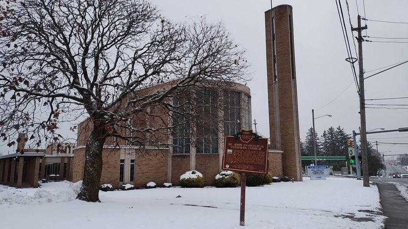
Photographed by Craig Doda, December 7, 2025
4. German Corners / St. John Evangelical Lutheran Church Marker
Credits. This page was last revised on December 19, 2025. It was originally submitted on August 1, 2023, by Grant & Mary Ann Fish of Galloway, Ohio. This page has been viewed 572 times since then and 70 times this year. Last updated on August 11, 2023, by Grant & Mary Ann Fish of Galloway, Ohio. Photos: 1, 2, 3. submitted on August 1, 2023, by Grant & Mary Ann Fish of Galloway, Ohio. 4. submitted on December 14, 2025, by Craig Doda of Napoleon, Ohio. • Andrew Ruppenstein was the editor who published this page.
