Sherman in Fairfield County, Connecticut — The American Northeast (New England)
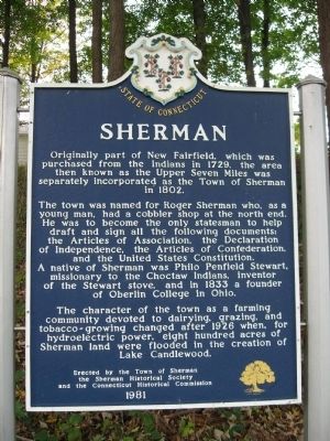
Sherman
The town was named for Roger Sherman who, as a young man, had a cobbler shop at the north end. He was to become the only statesman to help draft and sign all of the following documents: the Articles of Association, the Declaration of Independence, the Articles of Confederation, and the United States Constitution. A native of Sherman was Philo Penfield Stewart, missionary to the Choctaw Indians, inventor of the Stewart stove, and in 1833 a founder of Oberlin College in Ohio.
The Character of the town as a farming community devoted to dairying, grazing, and tobacco-growing changed after 1926 when, for hydroelectric power, eight hundred acres of Sherman land were flooded in the creation of Lake Candlewood.
Erected 1981 by Town of Sherman, Sherman Historical Society, Connecticut Historical Commission.
Topics. This historical marker is listed in these topic lists: Colonial Era • Settlements & Settlers. A significant historical year for this entry is 1729.
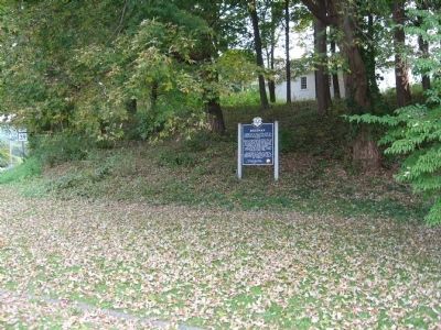
Location. 41° 34.739′ N, 73° 29.804′ W. Marker is in Sherman, Connecticut, in Fairfield County. Marker is at the intersection of Connecticut Route 39 and Gaylordsville Road, on the left when traveling north on State Route 39. Touch for map. Marker is in this post office area: Sherman CT 06784, United States of America. Touch for directions.
Other nearby markers. At least 8 other markers are within 4 miles of this marker, measured as the crow flies. Sherman World War I Memorial (about 600 feet away, measured in a direct line); Sherman Veterans Memorial (about 600 feet away); Oblong Meeting House (approx. 2.3 miles away in New York); The First Oblong Friends Meeting House (approx. 2.3 miles away in New York); Akin Hall (approx. 3 miles away in New York); Mizzen Top Hotel (approx. 3.1 miles away in New York); Living Memorial (approx. 3.2 miles away in New York); The Oblong (approx. 3.8 miles away in New York). Touch for a list and map of all markers in Sherman.
Credits. This page was last revised on June 16, 2016. It was originally submitted on October 7, 2009, by Michael Herrick of Southbury, Connecticut. This page has been viewed 1,266 times since then and 43 times this year. Photos: 1, 2. submitted on October 7, 2009, by Michael Herrick of Southbury, Connecticut. • Bill Pfingsten was the editor who published this page.

