Heidelberg, Baden-Württemberg, Germany — Central Europe
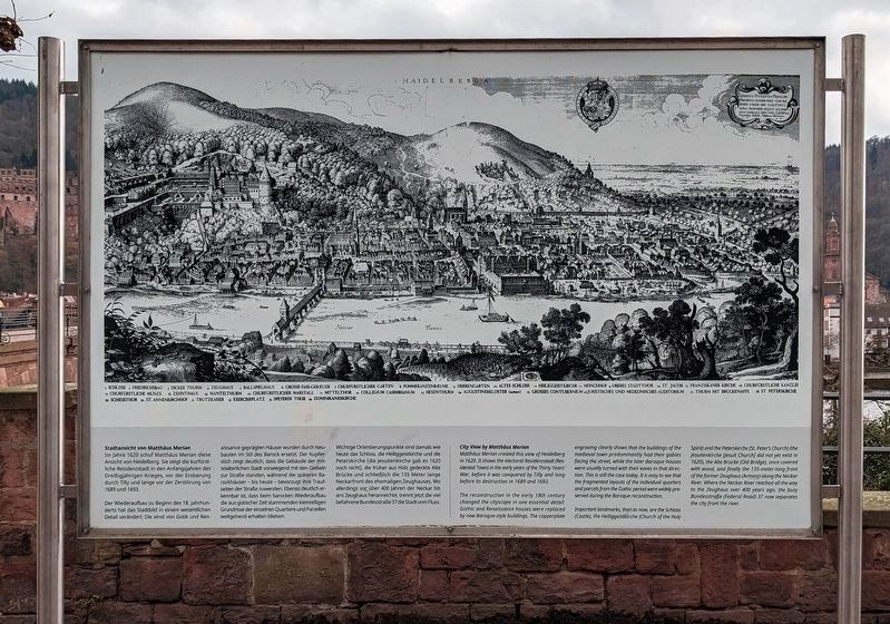
Stadtansicht von Matthäus Merian / City View by Matthäus Merian
Der Wiederaufbau zu Beginn des 18. Jahrhunderts hat das Stadtbild in einem wesentlichen Detail verändert: Die einst von Gotik und Renaissance geprägten Häuser wurden durch Neubauten im Stil des Barock ersetzt. Der Kupferstich zeigt deutlich, dass die Gebäude der mittelalterlichen Stadt vorwiegend mit den Giebeln zur Straße standen, während die späteren Barockhäuser – bis heute – bevorzugt ihre Traufseiten der Straße zuwenden. Ebenso deutlich erkennbar ist, dass beim barocken Wiederaufbau die aus gotischer Zeit stammenden kleinteiligen Grundrisse der einzelnen Quartiere und Parzellen weitgehend erhalten blieben.
Wichtige Orientierungspunkte sind damals wie heute das Schloss, die Heiliggeistkirche und die Peterskirche (die Jesuitenkirche gab es 1620 noch nicht), die früher aus Holz gedeckte Alte Brücke und schließlich die 135 Meter lange Neckarfront des ehemaligen Zeughauses. Wo allerdings vor über 400 Jahren der Neckar bis ans Zeughaus heranreichte, trennt jetzt die viel befahrene Bundesstraße 37 die Stadt vom Fluss.
-
Matthäus Merian created this view of Heidelberg in 1620. It shows the electoral Residenzstadt (Residential Town) in the early years of the Thirty Years' War, before it was conquered by Tilly and long before its destruction in 1689 and 1693.
The reconstruction in the early 18th century changed the cityscape in one essential detail: Gothic and Renaissance houses were replaced by new Baroque-style buildings. The copperplate engraving clearly shows that the buildings of the medieval town predominantly had their gables facing the street, while the later Baroque houses were usually turned with their eaves in that direction. This is still the case today. It is easy to see that the fragmented layouts of the individual quarters and parcels from the Gothic period were widely preserved during Baroque reconstruction.
Important landmarks, then as now, are the Schloss (Castle), the Heiliggeistkirche (Church of the Holy Spirit) and the Peterskirche (St. Peter's Church) (the Jesuitenkirche [Jesuit Church] did not yet exist in 1620), the Alte Brücke (Old Bridge), once covered with wood, and finally the 135-meter-long front of the former Zeughaus (Armory) along The Neckar River. Where the Neckar River reached all the way to the Zeughaus over 400 years ago, the busy Bundesstraße (Federal Road) 37 now separates the city from the river.
Topics. This historical marker is listed in these topic lists: Architecture • Arts, Letters, Music • Wars, Non-US. A significant historical year for this entry is 1620.
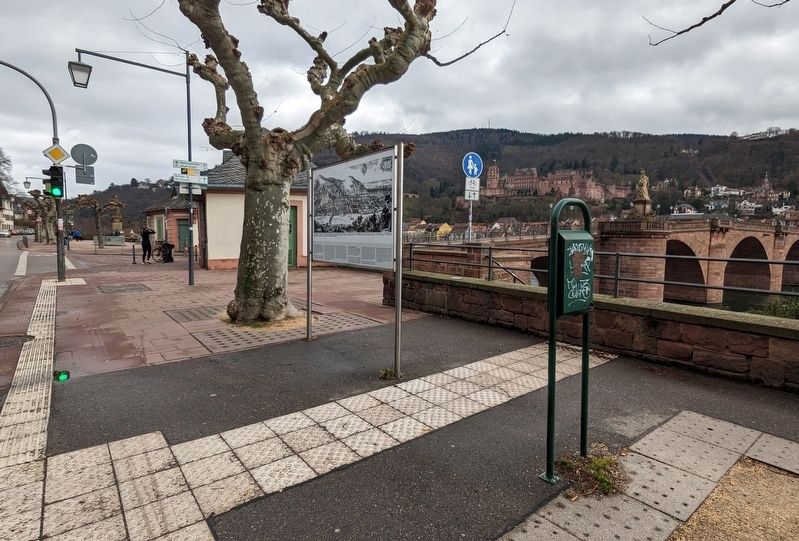
Location. 49° 24.9′ N, 8° 42.55′ E. Marker is in Heidelberg, Baden-Württemberg. Marker is on Neuenheimer Landstraße, on the right when traveling east. Touch for map. Marker is in this post office area: Heidelberg BW 69120, Germany. Touch for directions.
Other nearby markers. At least 8 other markers are within walking distance of this marker. Der Schlangenweg (within shouting distance of this marker); Haus Traitteur / House Traitteur (approx. 0.3 kilometers away); Heidelberg War Memorial (approx. 0.3 kilometers away); Haus zum Ritter / Knight's House (approx. 0.4 kilometers away); Rathaus / City Hall (approx. 0.4 kilometers away); Ehemalige Hofapotheke / Former Court Pharmacy (approx. 0.4 kilometers away); Heidelberg Chronik / Heidelberg Chronicle (approx. 0.4 kilometers away); Sulpiz and Melchior Boisserée (approx. 0.4 kilometers away). Touch for a list and map of all markers in Heidelberg.
Credits. This page was last revised on August 17, 2023. It was originally submitted on August 14, 2023. This page has been viewed 48 times since then and 11 times this year. Photos: 1, 2. submitted on August 14, 2023. • Andrew Ruppenstein was the editor who published this page.

