Near Stanley in Page County, Virginia — The American South (Mid-Atlantic)
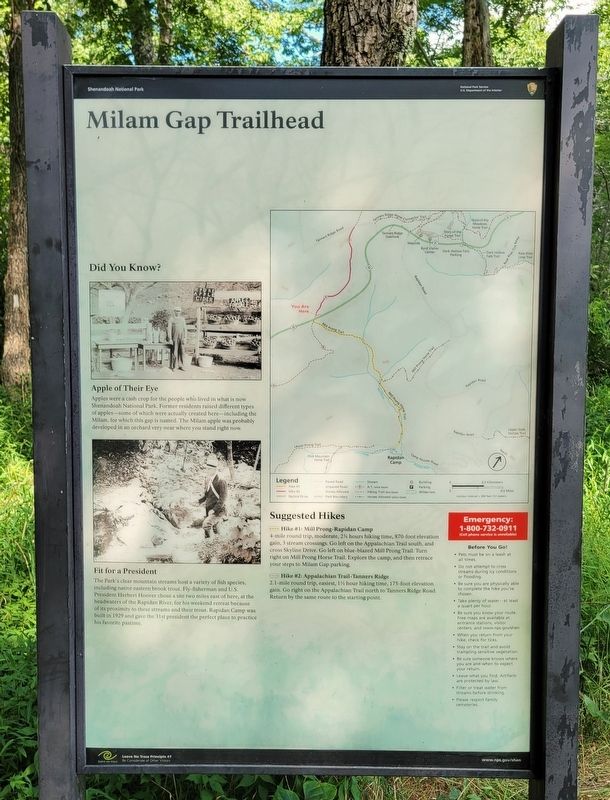
Milam Gap Trailhead
Did You Know?
Apple of Their Eye
Apples were a cash crop for the people who lived in what is now Shenandoah National Park. Former residents raised different types of apples-some of which were actually created here-including the Milam, for which this gap is named. The Milam apple was probably developed in an orchard very near where you stand right now.
Fit for a President
The Park's clear mountain streams host a variety of fish species, including native eastern brook trout. Fly-fisherman and U.S. President Herbert Hoover chose a site two miles east of here, at the headwaters of the Rapidan River, for his weekend retreat because of its proximity to these streams and their trout. Rapidan Camp was built in 1929 and gave the 31st president the perfect place to practice his favorite pastime.
Suggested Hikes
Hike #1: Mill Prong-Rapidan Camp
4-mile round trip, moderate, 24 hours hiking time, 870-foot elevation gain, 3 stream crossings. Go left on the Appalachian Trail south, and cross Skyline Drive. Go left on blue-blazed Mill Prong Trail. Turn right on Mill Prong Horse Trail. Explore the camp, and then retrace your steps to Milam Gap parking.
Hike #2: Appalachian Trail-Tanners Ridge
2.1-mile round trip, easiest, 1˝ hour hiking time, 175-foot elevation gain. Go right on the Appalachian Trail north to Tanners Ridge Road. Return by the same route to the starting point.
Erected by National Park Service U.S. Department of the Interior.
Topics and series. This historical marker is listed in these topic lists: Animals • Industry & Commerce • Parks & Recreational Areas. In addition, it is included in the Former U.S. Presidents: #31 Herbert Hoover series list. A significant historical year for this entry is 1929.
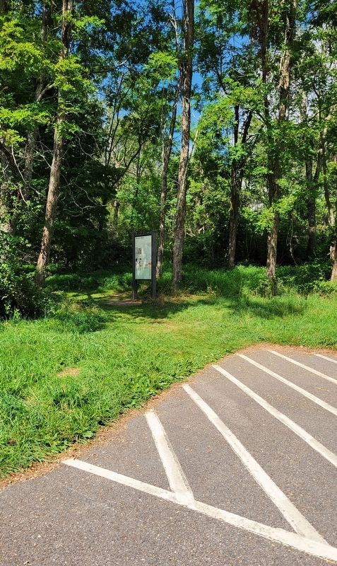
Location. 38° 30.013′ N, 78° 26.756′ W. Marker is near Stanley, Virginia, in Page County. Marker is on Skyline Drive (just north of milepost 53), 1˝ miles south of Big Meadows Entrance Road, on the right when traveling south. Marker is located at the south end of the Milam Gap Trailhead parking lot. Touch for map. Marker is in this post office area: Stanley VA 22851, United States of America. Touch for directions.
Other nearby markers. At least 8 other markers are within 2 miles of this marker, measured as the crow flies. Mountain Contrast (approx. 1.1 miles away); Civilian Conservation Corps (approx. 1.2 miles away); Skyline Drive Historic District (approx. 1.3 miles away); Iron Mike (approx. 1.3 miles away); National Park Service CCC Camps (approx. 1.4 miles away); “Five Tents” (approx. 1˝ miles away); "Here is peace and quietude" (approx. 1˝ miles away); Rapidan Camp (approx. 1˝ miles away).
Credits. This page was last revised on August 16, 2023. It was originally submitted on August 16, 2023, by Bradley Owen of Morgantown, West Virginia. This page has been viewed 99 times since then and 48 times this year. Photos: 1, 2. submitted on August 16, 2023, by Bradley Owen of Morgantown, West Virginia.

