Rices Landing in Greene County, Pennsylvania — The American Northeast (Mid-Atlantic)
Monongahela River
River Formation
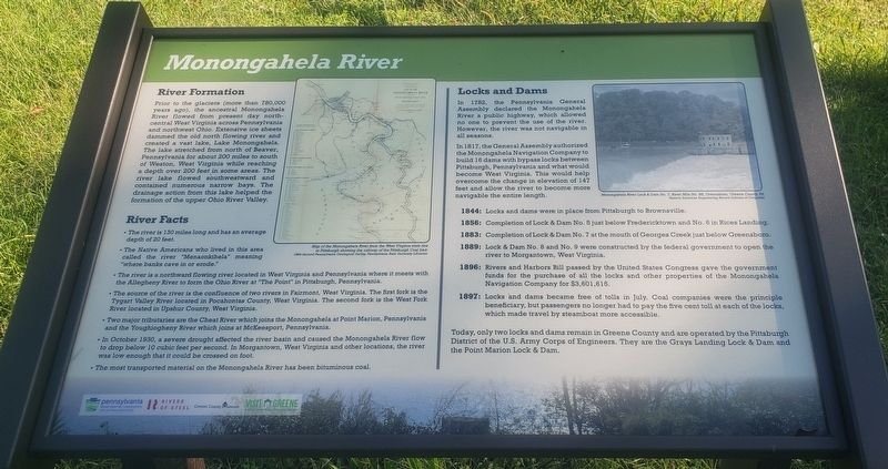
Prior to the glaciers (more than 780,000 years ago), the ancestral Monongahela River flowed from present day north central West Virginia across Pennsylvania and northwest Ohio. Extensive ice sheets dammed the old north flowing river and created a vast lake, Lake Monongahela. The lake stretched from north of Beaver, Pennsylvania for about 200 miles to south of Weston, West Virginia while reaching a depth over 200 feet in some areas. The river lake flowed southwestward and contained numerous narrow bays. The drainage action from this lake helped the formation of the upper Ohio River Valley.
River Facts
• The river is 130 miles long and has an average depth of 20 feet.
• The Native Americans who lived in this area called the river "Menaonkihela" meaning "where banks cave in or erode."
• The river is a northward flowing river located in West Virginia and Pennsylvania where it meets with the Allegheny River to form the Ohio River at "The Point" in Pittsburgh, Pennsylvania.
• The source of the river is the confluence of two rivers in Fairmont, West Virginia. The first fork is the Tygart Valley River located in Pocahontas County, West Virginia. The second fork is the West Fork River located in Upshur County, West Virginia.
• Two major tributaries are the Cheat River which joins the Monongahela at Point Marion, Pennsylvania and the Youghiogheny River which joins at McKeesport, Pennsylvania.
• In October 1930, a severe drought affected the river basin and caused the Monongahela River flow to drop below 10 cubic feet per second. In Morgantown, West Virginia and other locations, the river was low enough that it could be crossed on foot.
• The most transported material on the Monongahela River has been bituminous coal.
Locks and Dams
In 1782, the Pennsylvania General Assembly declared the Monongahela River a public highway, which allowed no one to prevent the use of the river. However, the river was not navigable in all seasons.
In 1817, the General Assembly authorized the Monongahela Navigation Company to build 16 dams with bypass locks between Pittsburgh, Pennsylvania and what would become West Virginia. This would help overcome the change in elevation of 147 feet and allow the river to become more navigable the entire length.
1844: Locks and dams were in place from Pittsburgh to Brownsville.
1856: Completion of Lock & Dam No. 5 just below Fredericktown and No. 6 in Rices Landing.
1883: Completion of Lock & Dam No. 7 at the mouth of Georges Creek just below Greensboro.
1889: Lock
& Dam No. 8 and No. 9 were constructed by the federal government to open the river to Morgantown, West Virginia.
1896: Rivers and Harbors Bill passed by the United States Congress gave the government funds for the purchase of all the locks and other properties of the Monongahela Navigation Company for $3,601,615.
1897: Locks and dams became free of tolls in July. Coal companies were the principle beneficiary, but passengers no longer had to pay the five cent toll at each of the locks, which made travel by steamboat more accessible.
Today, only two locks and dams remain in Greene County and are operated by the Pittsburgh District of the U.S. Army Corps of Engineers. They are the Grays Landing Lock & Dam and the Point Marion Lock & Dam.
(Photo Captions):
Map of the Monongahela River from the West Virginia state line to Pittsburgh showing the outcrop of the Pittsburgh Coal bed.
1884 Second Pennsylvania Geological Survey Pennsylvania State University Libraries
Monongahela River Lock & Dam No. 7, River Mile No. 85, Greensboro, Greene County, PA
Historic American Engineering Record (Library of Congress)
Erected 2020 by Pennsylvania Department of Conservation and Natural Resources, Rivers of Steel, Greene County Museum, Greene County Tourist Promotion Agency.
Topics. This historical marker is listed in this topic list: Waterways & Vessels. A significant historical month for this entry is October 1930.
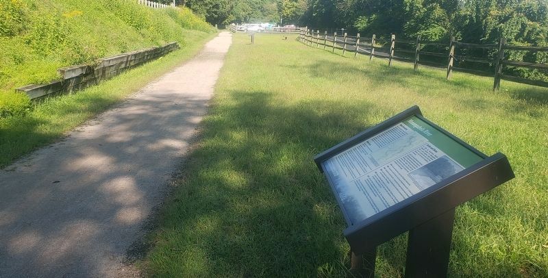
Location. 39° 57.067′ N, 80° 0.19′ W. Marker is in Rices Landing, Pennsylvania, in Greene County. Marker can be reached from Main Street north of Rices Landing Road (County Route 1010), on the left when traveling north. Marker is located on the Greene River Trail just south of the Rices Landing Trailhead parking lot. The parking lot is located on Main Street across from Rices Landing United Methodist Church. Touch for map. Marker is at or near this postal address: 125 Main Street, Rices Landing PA 15357, United States of America. Touch for directions.
Other nearby markers. At least 8 other markers are within walking distance of this marker. Rices Landing (within shouting distance of this marker); Railroad (within shouting distance of this marker); Rice's Landing Jail (approx. 0.2 miles away); Isaac Hewitt Pottery (approx. ¼ mile away); Foundry (approx. ¼ mile away); Gateway Mine (approx. 0.3 miles away); W.A. Young & Sons Foundry and Machine Shop (approx. 0.3 miles away); Dilworth Mine (approx. 0.4 miles away). Touch for a list and map of all markers in Rices Landing.
Regarding Monongahela River. For the year 1897, "principle" is used but it should be "principal".
Credits. This page was last revised on August 29, 2023. It was originally submitted on September 9, 2021, by Bradley Owen of Morgantown, West Virginia. This page has been viewed 426 times since then and 92 times this year. Last updated on August 17, 2023, by Carl Gordon Moore Jr. of North East, Maryland. Photos: 1, 2. submitted on September 9, 2021, by Bradley Owen of Morgantown, West Virginia. • J. Makali Bruton was the editor who published this page.

