Marker Logo HMdb.org THE HISTORICAL
MARKER DATABASE
“Bite-Size Bits of Local, National, and Global History”
Guilford in Windham County, Vermont — The American Northeast (New England)
 

Vermont’s Interstate Highway System


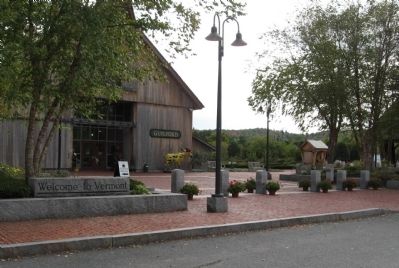
Vermont’s Interstate Highway System Marker image. Click for full size.
Photographed By Michael Herrick, October 2, 2009
1. Vermont’s Interstate Highway System Marker
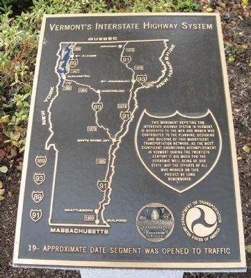
Inscription. This monument depicting the Interstate highway system in Vermont is dedicated to the men and women who contributed to the planning, designing and building of this magnificent transportation network. As the most significant engineering accomplishment in Vermont during the twentieth century it did much for the economic well being of our state. May the efforts of all who worked on this project be long remembered.
 
Topics. This historical marker is listed in this topic list: Roads & Vehicles.
 
Location. 42° 48.733′ N, 72° 33.986′ W. Marker is in Guilford, Vermont, in Windham County. Marker can be reached from Interstate 91 at milepost 5, on the right when traveling north. Located in front of the Vermont Welcome Center, Guilford, VT. Touch for map. Marker is at or near this postal address: Vermont Welcome Center, Brattleboro VT 05301, United States of America. Touch for directions.
 
Other nearby markers. At least 8 other markers are within 3 miles of this marker, measured as the crow flies. Abijah and Lucy Terry Prince (about 300 feet away, measured in a direct line); Broad Brook House (approx. 0.6 miles away); Fort Dummer (approx. 1.6 miles away); Site of Fort Dummer (approx. 1.6 miles away); Upon This Ground (approx. 1.7 miles away); Veterans Memorial (approx. 2.2 miles away);
Paid Advertisement
Click on the ad for more information.
Please report objectionable advertising to the Editor.
Click or scan to see
this page online
Fort Bridgman (approx. 2.3 miles away); Prospect Hill Soldier's Lot (approx. 2.3 miles away). Touch for a list and map of all markers in Guilford.
 
Vermont’s Interstate Highway System Marker image. Click for full size.
Photographed By Michael Herrick, October 2, 2009
2. Vermont’s Interstate Highway System Marker
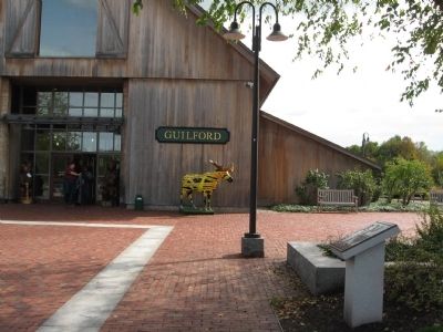
Vermont Welcome Center image. Click for full size.
Photographed By Michael Herrick, October 2, 2009
3. Vermont Welcome Center
The marker is visible at the right, in front of the first tree and small kiosk.
 
 
Credits. This page was last revised on January 25, 2020. It was originally submitted on October 9, 2009, by Michael Herrick of Southbury, Connecticut. This page has been viewed 1,504 times since then and 21 times this year. Photos:   1, 2, 3. submitted on October 9, 2009, by Michael Herrick of Southbury, Connecticut. • Bill Pfingsten was the editor who published this page.
Share this page.  
Share on Tumblr
m=23111

CeraNet Cloud Computing sponsors the Historical Marker Database.
This website earns income from purchases you make after using our links to Amazon.com. We appreciate your support.
Paid Advertisement
May. 8, 2024