New Augusta in Indianapolis in Marion County, Indiana — The American Midwest (Great Lakes)
Salem Evangelical Lutheran Church
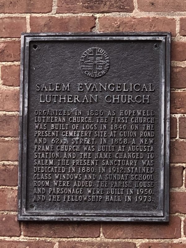
Photographed by Duane and Tracy Marsteller, August 5, 2023
1. Salem Evangelical Lutheran Church Marker
Topics and series. This historical marker is listed in this topic list: Religion & Religious Structures. In addition, it is included in the National Register of Historic Places (NRHP) series list. A significant historical year for this entry is 1840.
Location. 39° 53.007′ N, 86° 14.391′ W. Marker is in Indianapolis, Indiana, in Marion County. It is in New Augusta. It is at the intersection of West 72nd Street and Pollard Street, on the right when traveling east on West 72nd Street. Touch for map. Marker is at or near this postal address: 4700 W 72nd St, Indianapolis IN 46268, United States of America. Touch for directions.

Regionally, this marker is in Central Indiana. It is also
this page online
Other nearby markers. At least 8 other markers are within 5 miles of this marker, measured as the crow flies: New Augusta (about 300 feet away, measured in a direct line); Patrick H. Sullivan 1824 (approx. 3.9 miles away); Toll House - Michigan Road (approx. 4 miles away); Town of Meridian Hills (approx. 4.2 miles away); Central Canal & Towpath (approx. 4.6 miles away); Original Plat Historical Block No. 8 (approx. 4.7 miles away); Oldfields (approx. 4.7 miles away); Patrick H. Sullivan (approx. 4.7 miles away). Touch for a list and map of all markers in Indianapolis.
Also see . . .
1. Our History. The Klingensmiths were strict God-fearing Lutherans who could not live long in any place without their Church, and in 1842 they deeded for $5.00 one-half acre and eight rods for the use [of] a Lutheran meeting house and grave yard. (Salem Lutheran Church)
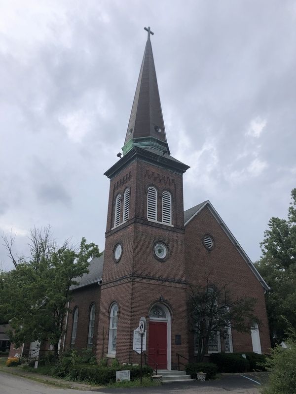
Photographed by Duane and Tracy Marsteller, August 5, 2023
2. Salem Evangelical Lutheran Church Marker
2. New Augusta Historic District (PDF). National Register of Historic Places nomination for the district, of which the church is a contributing building. (National Archives) (Submitted on August 26, 2023, by Duane and Tracy Marsteller of Murfreesboro, Tennessee.)
Credits. This page was last revised on August 26, 2023. It was originally submitted on August 26, 2023, by Duane and Tracy Marsteller of Murfreesboro, Tennessee. This page has been viewed 234 times since then and 31 times this year. Photos: 1, 2. submitted on August 26, 2023, by Duane and Tracy Marsteller of Murfreesboro, Tennessee.
