Rivercrest in Arlington in Arlington County, Virginia — The American South (Mid-Atlantic)
Clay and Randolph Duel
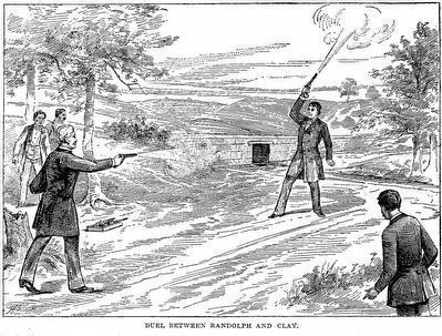
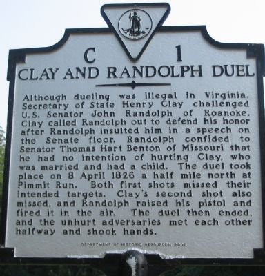
Although dueling was illegal in Virginia, Secretary of State Henry Clay challenged U.S. Senator John Randolph of Roanoke. Clay called Randolph out to defend his honor after Randolph insulted him in a speech on the Senate floor. Randolph confided to Senator Thomas Hart Benton of Missouri that he had no intention of hurting Clay, who was married and had a child. The duel took place on 8 April 1826 a half mile north at Pimmit Run. Both first shots missed their intended targets. Clay’s second shot also missed, and Randolph raised his pistol and fired it in the air. The duel then ended, and the unhurt adversaries met each other half way and shook hands.
Erected 2000 by Department of Historic Resources. (Marker Number C-1.)
Topics and series. This historical marker is listed in these topic lists: Government & Politics • Notable Events. In addition, it is included in the Virginia Department of Historic Resources (DHR) series list. A significant historical date for this entry is April 8, 1826.
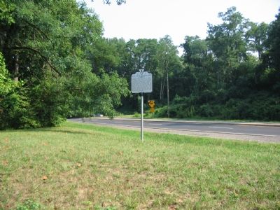
Location. 38° 55.549′ N, 77° 7.283′ W. Marker is in Arlington, Virginia, in Arlington County. It is in Rivercrest. Marker is on North Glebe Road (Virginia Route 120) near North Randolph Street. Located in the triangle formed by North Glebe Road, Randolph Street, and North Richmond Street. Touch for map. Marker is in this post office area: Arlington VA 22207, United States of America. Touch for directions.
Other nearby markers. At least 8 other markers are within walking distance of this marker. Communications along the Defensive Line (about 800 feet away, measured in a direct line); Fort Ethan Allen—What to Look For (about 800 feet away); Lives of the Soldiers (approx. 0.2 miles away); Protecting the Fort (approx. 0.2 miles away); The View in 1865 (approx. 0.2 miles away); A Defensive Artillery Fort (approx. 0.2 miles away); A Bastion-Style Fort Is a Mighty Fortress (approx. 0.2 miles away); A Defensive Stronghold, Heavily Armed (approx. 0.2 miles away). Touch for a list and map of all markers in Arlington.
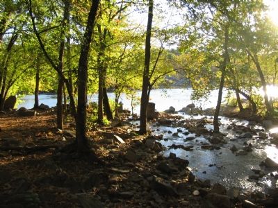
Regarding Clay and Randolph Duel. The general location of the duel described was near the present day Chain Bridge Road, where Pimmit Run empties into the Potomac River.
This marker replaces a previous C 1 which stood along Chain Bridge Road (Route 123) near the county line. That marker read, “Near here Henry Clay and John Randolph of Roanoke fought a duel April 8, 1826. Randolph had called Clay a ‘blackleg’ in a speech. Both men were unhurt, but Randolph’s coat was pierced by a bullet.”
At the time the term “blackleg” was used to describe one who cheats at cards.
Also see . . . The Duel That Wasn't. Today I Found Out website entry (Submitted on August 27, 2023, by Larry Gertner of New York, New York.)

By unknown artist, published by William S. Bryan and John Clark Ridpath, 1893
3. Duel Between Randolph and Clay
From: The Wonderful, the Curious and the Beautiful in the World's History: as recorded in the historical literature of Europe and America, from the earliest period to the present time …, 1893 by William S. Bryan and John Clark Ridpath. (Internet Archive)
Credits. This page was last revised on August 27, 2023. It was originally submitted on September 4, 2007, by Craig Swain of Leesburg, Virginia. This page has been viewed 6,233 times since then and 465 times this year. It was the Marker of the Week April 2, 2023. Photos: 1, 2. submitted on September 4, 2007, by Craig Swain of Leesburg, Virginia. 3. submitted on January 11, 2016, by Allen C. Browne of Silver Spring, Maryland. 4. submitted on November 5, 2007, by Craig Swain of Leesburg, Virginia. • J. J. Prats was the editor who published this page.


