Old Glebe in Arlington in Arlington County, Virginia — The American South (Mid-Atlantic)
Walker Chapel
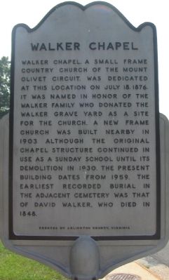
Photographed by Craig Swain, August 24, 2007
1. Walker Chapel Marker
Erected by Arlington County, Virginia.
Topics. This historical marker is listed in this topic list: Religion & Religious Structures. A significant historical month for this entry is July 1826.
Location. 38° 55.301′ N, 77° 7.752′ W. Marker is in Arlington, Virginia, in Arlington County. It is in Old Glebe. It is at the intersection of North Glebe Road (Virginia Route 120) and Old Glebe Road on North Glebe Road. In front of Walker Chapel United Methodist Church. Touch for map. Marker is at or near this postal address: 4102 North Glebe Road, Arlington VA 22207, United States of America. Touch for directions.

Regionally, this marker is in the Washington Metropolitan Area and in Northern Virginia. It is also in the American South, specifically in the Upper South, in the Mid-Atlantic, and on the Eastern Seaboard. Globally, it is in the North Atlantic Region, North America, the Western Hemisphere, the Western World, and the Anglosphere. Historically, it finds itself in what was once the territory of the Mississippian Culture, one of the original Thirteen Colonies, one of the Confederate States of America, and the Antebellum South.
Other nearby markers. At least 8 other markers are within walking distance of this marker: RADM Paul A. Holmberg (approx. 0.2 miles away); a different marker also named
this page online
Another marker is no longer nearby. Fort Ethan Allen (was approx. ¼ mile away but has been replaced with another marker now near it).
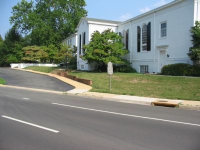
Photographed by Craig Swain, August 24, 2007
2. Marker along Glebe Road
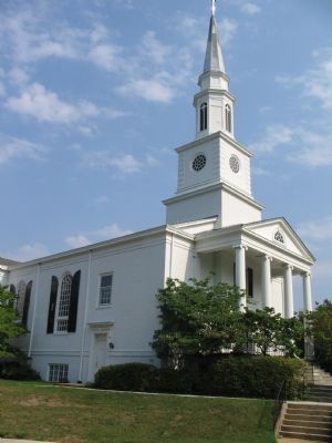
Photographed by Craig Swain, August 24, 2007
3. Walker Chapel
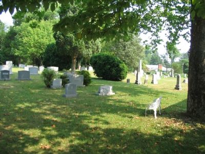
Photographed by Craig Swain, August 24, 2007
4. The Cemetery
Credits. This page was last revised on February 1, 2023. It was originally submitted on September 4, 2007, by Craig Swain of Leesburg, Virginia. This page has been viewed 2,668 times since then and 72 times this year. Photos: 1, 2, 3, 4. submitted on September 4, 2007, by Craig Swain of Leesburg, Virginia. • J. J. Prats was the editor who published this page.
