Stanhope in Sussex County, New Jersey — The American Northeast (Mid-Atlantic)
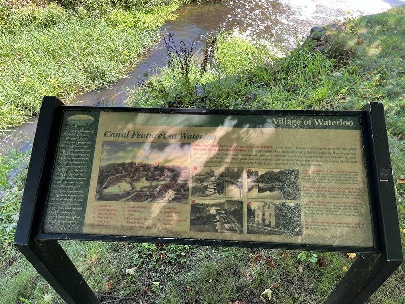
Canal Features at Waterloo
Village of Waterloo
Waterloo Village had a unique combination of canal features, found at no other location. The village boasted an inclined plane, a combined guard lock/aqueduct, two mule bridges, a dam, a blacksmith shop, a canal store, and workers' housing. The incline plane, one of 23 along the Morris Canal, carried boats over an 80-foot change in elevation. The guard lock, unlike lift locks, helped to regulate the flow of water into the canal and boats to enter natural bodies of water. Most of these features survive today, either intact like the canal store or in part like the inclined plane.
[Captions:]
A. The Top of Plane 4 West looking toward the village. The men are standing on the cribbing which guided boats into the cradle car for the trip down the plane. A mule bridge, the plane tender's house, and the powerhouse are a short distance away.
B. An empty canal boat leaves the cradle car that carries it down the inclined plane. The mules, standing on the bridge, will be hooked to the tow rope and the boat will continue on its journey.
C. Mules, heading west, pull a canal boat from the lock at Waterloo. This lock/aqueduct combination, or water bridge, over the outflow from the mills, is probably the only one of its kind. The mules crossed the bridge on the left before proceeding along the towpath.
D. A canal boat sits alongside Smith's General Store. Mule feed was stored on the boat in the food box on the far right.
Topics and series. This historical marker is listed in these topic lists: Animals • Industry & Commerce • Settlements & Settlers • Waterways & Vessels. In addition, it is included in the Morris Canal series list.
Location. 40° 54.865′ N, 74° 45.296′ W. Marker is in Stanhope, New Jersey, in Sussex County. Marker can be reached from Waterloo Valley Road west of Hermitage Road, on the right when traveling east. Touch for map. Marker is at or near this postal address: 525 Waterloo Rd, Andover NJ 07821, United States of America. Touch for directions.
Other nearby markers. At least 8 other markers are within 2 miles of this marker, measured as the crow flies. Morris Canal (within shouting distance of this marker); The Morris Canal 1824-1924 (within shouting distance of this marker); Waterloo: A Transportation Crossroads (within shouting distance of this marker); The Morris Canal Inclined Planes (within shouting distance of this marker); Let This Tablet Honor Them and All Who Live For the Good of the Community (within shouting distance of this marker); Waterloo, A Canal Town (within shouting distance of this marker);
Credits. This page was last revised on April 11, 2024. It was originally submitted on August 28, 2023, by Devry Becker Jones of Washington, District of Columbia. This page has been viewed 60 times since then and 18 times this year. Photos: 1, 2. submitted on August 28, 2023, by Devry Becker Jones of Washington, District of Columbia.

