Augusta in Eau Claire County, Wisconsin — The American Midwest (Great Lakes)
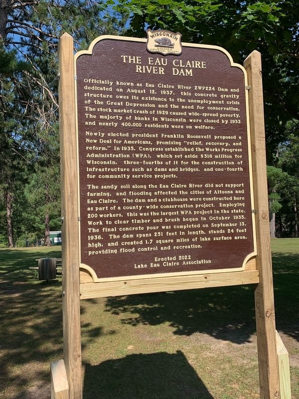
The Eau Claire River Dam
Officially known as Eau Claire River 2WP224 Dam and dedicated on August 12, 1937, this concrete gravity structure owes its existence to the unemployment crisis of the Great Depression and the need for conservation. The stock market crash of 1929 caused wide-spread poverty. The majority of banks in Wisconsin were closed by 1933 and nearly 400,000 residents were on welfare.
Newly elected president Franklin Roosevelt proposed a New Deal for Americans, promising “relief, recovery, and reform.” In 1935, Congress established the Works Progress Administration (WPA), which set aside $318 million for Wisconsin, three-fourths of it for the construction of infrastructure such as dams and bridges, and one-fourth for community service projects.
The sandy soil along the Eau Claire River did not support farming, and flooding affected the cities of Altoona and Eau Claire. The dam and a clubhouse were constructed here as part of a county-wide conservation project. Employing 200 workers, this was the largest WPA project in the state. Work to clear timber and brush began in October 1935. The final concrete pour was completed on September 13, 1936. The dam spans 251 feet in length, stands 24 feet high, and created 1.7 square miles of lake surface area, providing flood control and recreation.
Erected 2023 by Lake Eau Claire Association. (Marker Number 607.)
Topics. This historical marker is listed in these topic lists: Architecture • Charity & Public Work • Industry & Commerce • Parks & Recreational Areas. A significant historical date for this entry is August 12, 1937.
Location. 44° 45.407′ N, 91° 8.408′ W. Marker is in Augusta, Wisconsin, in Eau Claire County. Marker is on County Road SD. Eau Claire County Park. The historical marker is roughly centered in the parking lot where there is a pathway leading down to a clubhouse. Touch for map. Marker is at or near this postal address: 19150 County Rd SD, Augusta WI 54722, United States of America. Touch for directions.
Other nearby markers. At least 8 other markers are within 13 miles of this marker, measured as the crow flies. Dells Mill (approx. 2.2 miles away); Iron Brigade (approx. 5.2 miles away); Augusta Veterans Memorial (approx. 5.4 miles away); Citizen Soldier Monument (approx. 12˝ miles away); Wisconsin Veterans Tribute (approx. 12˝ miles away); Edson Union Cemetery (approx. 12.9 miles away); The Gravesite of Lansing A. Wilcox (approx. 13 miles away); Welcome to Osseo! (approx. 13.1 miles away). Touch for a list and map of all markers in Augusta.
Credits. This page was last revised on August 31, 2023. It was originally submitted on August 29, 2023, by Fitzie Heimdahl of Eau Claire, Wisconsin. This page has been viewed 171 times since then and 64 times this year. Photo 1. submitted on August 31, 2023, by Fitzie Heimdahl of Eau Claire, Wisconsin. • J. Makali Bruton was the editor who published this page.
Editor’s want-list for this marker. A wide view photo of the marker and the surrounding area together in context. • Can you help?
