Cambridge in Waterloo Region, Ontario — Central Canada (North America)
Main Street Bridge

Photographed by Tim Boyd, August 28, 2023
1. Main Street Bridge Marker
Wooden bridges 1819, 1832, 1834, 1840, 1854, 1857, 1867
Steel bridge 1878
Concrete bowstring arch bridge 1931
Restoration 2008
Spanning the Generations
Since the early days of settlement along the banks of the Grand River and its tributaries, bridges have been important focal points for communities. Our significant heritage bridges have become distinctive landmarks that contribute to a strong sense of place. These links to our past span the generations as well as our waterways.
The future of our bridges cannot be taken for granted as the ravages of time take their toll. The challenge for our generation is to maintain their symbolic as well as their functional integrity.
Bridge Design
The Main Street Bridge is a two-span concrete bowstring bridge. The 58.22 metre bridge is a reinforced concrete version of a contoured steel truss bridge. The bridge abutments and pier are built solidly on limestone bedrock. This type of bridge was designed to carry heavy trathc and became more common with the increasing popularity of the automobile.
Bridge History
The Main Street Bridge was built in 1931 during the Great
this page online
The W. H. Yates Construction Co. Ltd's tender was accepted to build the bridge at a cost of $52,000. It was the lowest of the 14 tenders received. The workmen were paid 40 cents an hour. The bridge was opened in December of 1931, due in part to the local merchants who petitioned the City to open the bridge early for the Christmas trade.
Restoration
The bridge has been resurfaced and repaired since 1931, but without significant modifications. In 2008 and
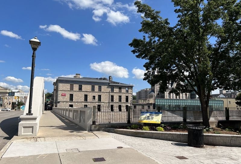
Photographed by Tim Boyd, August 28, 2023
2. Main Street Bridge Marker
The Main Street Bridge Crossing
This location is one of the oldest Grand River crossings in Waterloo Region. The first bridge was a wooden structure built in 1819 by Absalom Shade beside his store on Water Street. The bridge was called Dickson's Bridge after William Dickson who had contributed £800 towards the £2.000 cost of construction. The bridge contributed to the early development of Shade's Mill (later Galt and now Cambridge) by linking the east and west sides or the river.
Floods, Floods and More Floods
Floods plagued the Grand River. The first bridge was washed out in 1832 and was replaced with another wooden bridge that was washed out in 1834. Additional replacement bridges were required in 1840, 1854 and 1857. In 1866, the west end of the bridge began to sag and the "unstable bridge was replaced in 1867 at a cost of $1,300. only to be washed out again in 1878.
On Dec. 31, 1878, a new steel bridge built by the Hamilton Bridge and Tool Company for $4,370 was officially opened.
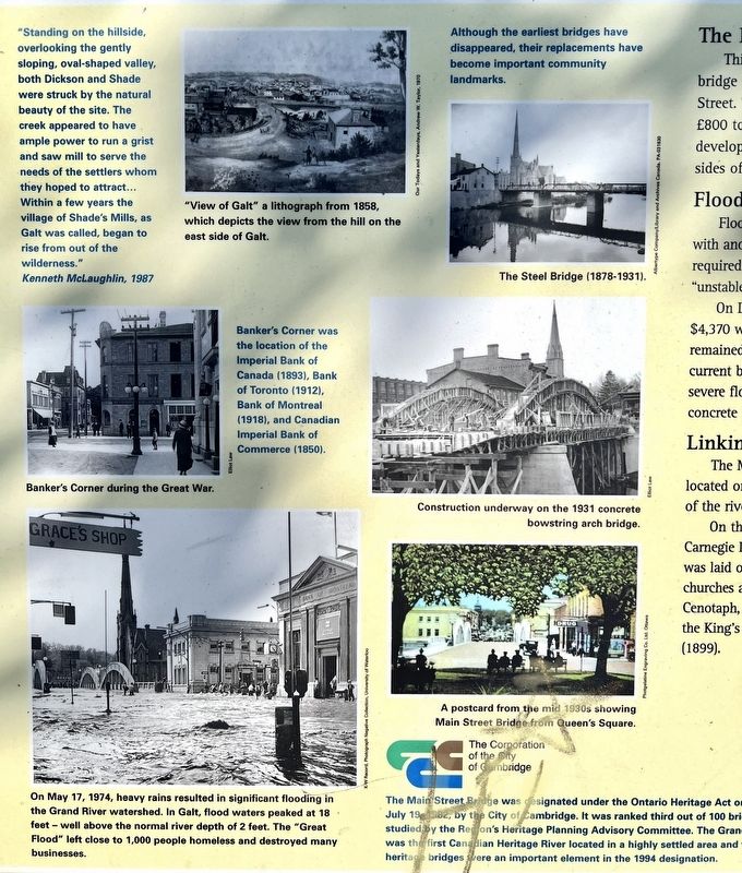
Photographed by Tim Boyd, August 28, 2023
3. Main Street Bridge illustrations detail
Linking East and West
The Main Street Bridge has long been the link between the historic commercial district located on the east side of the river and the many community landmarks on the west side of the river.
On the east side stands the former Banker's Corner (also known as Four Banks Comer), Carnegie Library (1903) and Galt Post Office (1885). On the west side is Queen's Square, which was laid out as a community focal point by William Dickson in 1835. There are several churches and monuments located at Queen's Square, including the Crimean War cannon, Cenotaph, Wrens monument and Portuguese monument. This area was the former location of the kings Arms Hotel (1835), YMCA (1913), Galt Curling Club (1887) and Scott's Opera House (1899).
Concrete
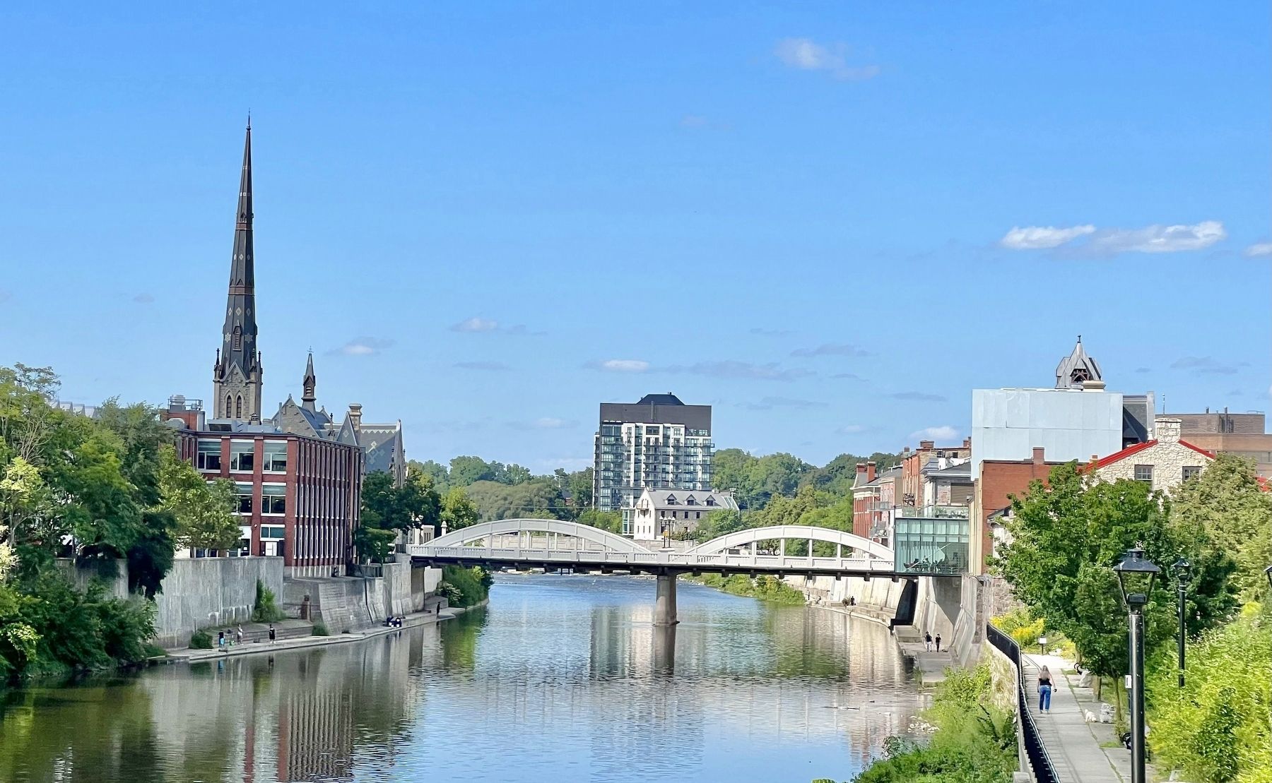
Photographed by Tim Boyd, August 28, 2023
4. Main Street Bridge, 2023
Designer: Archie B. Crealock
Construction: W. H. Yates Construction Co. Ltd.
Total cost of the bridge: $52,000
Region of Waterloo
Erected by Region of Waterloo.
Topics. This historical marker is listed in this topic list: Bridges & Viaducts. A significant historical month for this entry is December 1931.
Location. 43° 21.535′ N, 80° 18.984′ W. Marker is in Cambridge, Ontario, in Waterloo Region. It is at the intersection of Main Street and Queen’s Square, on the right when traveling east on Main Street. Touch for map. Marker is in this post office area: Cambridge ON N1S 1H3, Canada. Touch for directions.

Regionally, this marker is in the Huron-Perth-Waterloo-Wellington Area and in Southwestern Ontario. It is also in Central Canada. Globally, it is in North America, the Western Hemisphere, the Western World, and the Anglosphere. Historically, it finds itself in what was once a British colony, the Viceroyalty of New France, the Haudenosaunee (Iroquois) Confederacy, and Rupert’s Land.
Other nearby markers. At least 8 other markers are within walking distance of this marker: The Honourable James Young 1835-1913 / L'Honorable James Young, 1835-1913
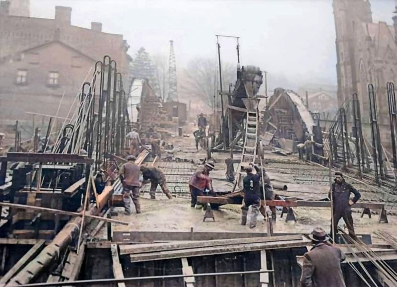
1931
5. Main Street Bridge under construction, 1931
Also see . . . HistoricPlaces.ca - Cambridge Main Street Bridge.
The Cambridge Main Street Bridge is located in the historic centre of the former City of Galt and spans the Grand River, a Canadian Heritage River. It is part of a group of four multiple-span concrete bow string arch bridges spanning the Grand River that were erected in the same time period. They are all similar in style. These bridges are a part of the upgrading work that took place to the transportation networks in Ontario, after the First World War, to accommodate the increased number of automobiles.(Submitted on August 29, 2023, by Tim Boyd of Hamilton, Ontario.)
Credits. This page was last revised on August 31, 2023. It was originally submitted on August 29, 2023, by Tim Boyd of Hamilton, Ontario. This page has been viewed 230 times since then and 37 times this year. Photos: 1, 2, 3, 4, 5. submitted on August 29, 2023, by Tim Boyd of Hamilton, Ontario. • Andrew Ruppenstein was the editor who published this page.
