East Cook in Cook County, Minnesota — The American Midwest (Upper Plains)
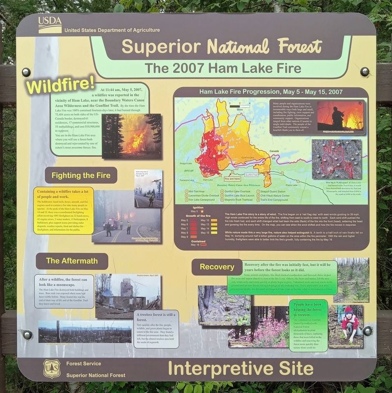
The 2007 Ham Lake Fire
Superior National Forest Interpretive Site
Wildfire!
At 11.44 am, May 5, 2007, a wildlife was reported in the vicinity of Ham Lake, near the Boundary Waters Canoe Area Wilderness and the Gunflint Trail. By the time the Ham Lake Fire was 100% contained fourteen days later, it had burned through 75,484 acres on both side of the US-Canada border, destroyed 61 residences, 17 commercial structures, 55 outbuildings, and cost $10,900,000 to suppress. You are in the Ham Lake Fire area where you will see a forest both destroyed and rejuvenated by one of nature's most awesome forces: fire.
Fighting the Fire
Containing a wildfire takes a lot of people and work.
The bulldozers, hand tools, hoses, aircraft, and fire engines used to contain a fire take many people to operate. At the peak of the Ham Lake Fire on May 14 and 15, there was a coordinated firefighting effort involving 1091 firefighters on 32 hand crews, 42 engine crews, 3 water tenders, 13 helicopters, 8 bulldozers, plus support teams providing radio dispatch, weather reports, food and shelter for firefighters, and information for the public.
The Aftermath
After a wildfire, the forest can look like a moonscape.
The Ham Lake Fire destroyed both buildings and trees. Bare rock was exposed where none had been visible before. Many feared this was the end of their way of life and of the Gunflint Trail they knew and loved.
A treeless forest is still a forest.
Very quickly after the fire, people, wildlife, and green plants began to return to the fire area. They found a different environment than they had left, but the almost treeless area held the seeds of regrowth.
Ham Lake Fire Progression, May 5 - May 15, 2007
Many people and organizations were involved during the Ham Lake Fire in innumerable ways both large and small, including fire fighting, crew support and coordination, public information, and community support. Organizations ranged from other nations (Canada) to single individuals. The people of the Gunflint Trail community extend a heartfelt thank you to them all.
How big is 75,443 acres? If Ham Lake had burned in the Twin Cities, it would have burned both downtown St. Paul and Minneapolis, and stretched from I-694 in the south to I-494 in the north.
The Ham Lake Fire story is a story of wind. The fire began on a 'red flag day' with east winds gusting to 39 mph. High winds continued for the entire life of the fire, shifting from east to south to west to north. Each wind shift pushed the fire into fresh fuel, and each shift changed what had been the side (flank) of the fire into the front (head), widening the head and growing the fire every time. On the
map, you can see when the wind shifted and how the fire moved in response.
While nature made this a very large fire, nature also helped extinguish it. A tenth to a half inch of rain finally fell on May 14, dumping around half a billion gallons of water on the area within the fire perimeter. With the rain and higher humidity, firefighters were able to better limit the fire's growth, fully containing the fire by May 19.
Recovery
Recovery after the fire was initially fast, but it will be years before the forest looks as it did.
Some animals and plants, life black-backed woodpeckers and fireweed, thrive in post fire areas and appear almost as soon as the fire is out. Others, like bear and moose, left the area only temporarily and return quickly as plants begin to grow. Unharmed seeds and root stocks in the ground send up new shoots, taking advantage of the unshaded sun. Trees, particularly jack pine, also appear rapidly, but the small seedlings will take years to become what we recognize as a forest.
People have been helping the forest to recover.
The volunteers of Gunflint Green Up worked with National Forest silviculturalists to plant thousands of trees, replacing those that were killed in the wildfire and renewing the forest more quickly than nature alone could do.
Erected by United States Forest Service.
Topics. This historical marker is listed in these topic lists: Disasters • Environment • Horticulture & Forestry. A significant historical month for this entry is May 2007.
Location. 48° 4.746′ N, 90° 45.736′ W. Marker is in East Cook, Minnesota, in Cook County. Marker is on Gunflint Trail (County Route 12) south of Gunflint Lake Road, on the right when traveling north. Touch for map. Marker is in this post office area: Grand Marais MN 55604, United States of America. Touch for directions.
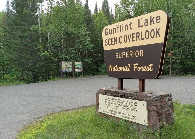
Other nearby markers. At least 8 other markers are within 9 miles of this marker, measured as the crow flies. Gunflint Trail (here, next to this marker); Gunflint Lake Scenic Overlook (a few steps from this marker); Canot du Nord (North Canoe) Replica (approx. 0.7 miles away); History of Saganaga Lake (approx. 8.1 miles away); Portage Canoe Rest (approx. 8.2 miles away); Step back in time... (approx. 8.2 miles away); The American Plan Cabin (approx. 8.3 miles away); This Log (approx. 8.3 miles away). Touch for a list and map of all markers in East Cook.
Credits. This page was last revised on August 31, 2023. It was originally submitted on August 31, 2023, by McGhiever of Minneapolis, Minnesota. This page has been viewed 82 times since then and 29 times this year. Photos: 1, 2. submitted on August 31, 2023, by McGhiever of Minneapolis, Minnesota. • J. Makali Bruton was the editor who published this page.

