Maidenhead in Berkshire, England, United Kingdom — Northwestern Europe (the British Isles)
Maidenhead Boundary Walk
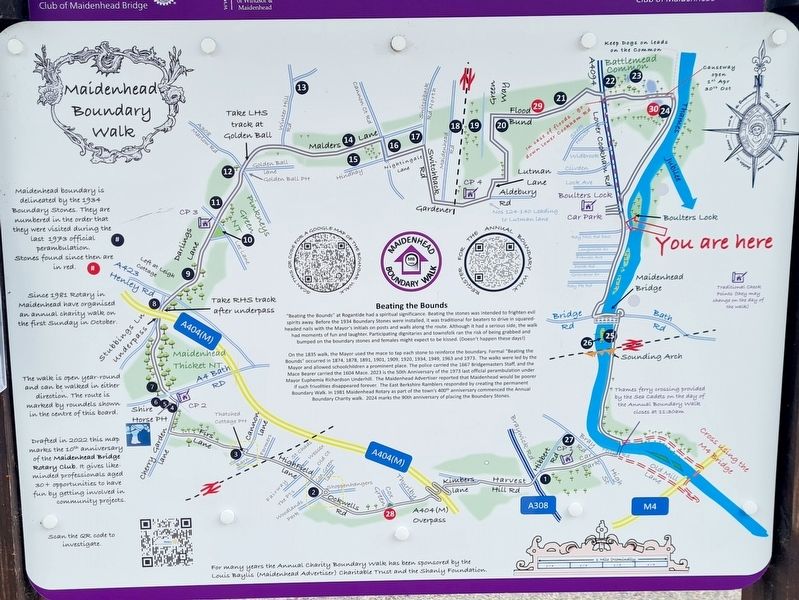
Beating The Bounds
"Beating the Bounds" at Rogantide had a spiritual significance. Beating the stones was intended to frighten evil spirits away. Before the 1934 Boundary Stones were installed, it was traditional for beaters to drive in squared- headed nails with the Mayor's initials on posts and walls along the route. Although it had a serious side, the walk had moments of fun and laughter. Participating dignitaries and townsfolk ran the risk of being grabbed and bumped on the boundary stones and females might expect to be kissed. (Doesn't happen these days!)
On the 1835 walk, the Mayor used the mace to tap each stone to reinforce the boundary. Formal "Beating the Bounds" occurred in 1874, 1878, 1891, 1901, 1909, 1920, 1934, 1949, 1963 and 1973. The walks were led by the Mayor and allowed schoolchildren a prominent place. The police carried the 1667 Bridgemasters Staff, and the Mace Bearer carried the 1604 Mace. 2023 is the 50th Anniversary of the 1973 last official perambulation under Mayor Euphemia Richardson Underhill. The Maidenhead Advertiser reported that Maidenhead would be poorer if such frivolities disappeared forever. The East Berkshire Ramblers responded by creating the permanent Boundary Walk. In 1981 Maidenhead Rotary as part of the town's 400th anniversary commenced the Annual Boundary Charity walk. 2024 marks the 90th anniversary of placing the Boundary Stones.
Erected by Rotary Club of Maidenhead Bridge.
Topics and series. This historical marker is listed in these topic lists: Parks & Recreational Areas • Political Subdivisions. In addition, it is included in the Rotary International series list.
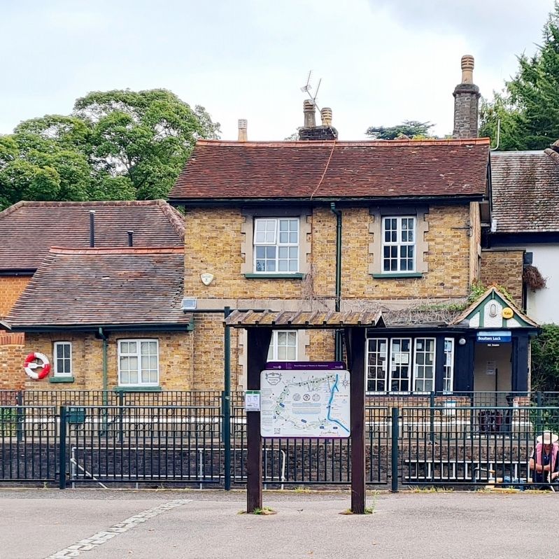
Location. 51° 32.003′ N, 0° 41.991′ W. Marker is in Maidenhead, England, in Berkshire. Marker is on Lower Cookham Road. Marker is in front of Boulter's Lock. Touch for map. Marker is at or near this postal address: 14 Lower Cookham Rd, Maidenhead, England SL6 8PE, United Kingdom. Touch for directions.
Other nearby markers. At least 8 other markers are within 2 kilometers of this marker, measured as the crow flies. Richard Dimbleby CBE (within shouting distance of this marker); Welcome to Ray Mill Island (within shouting distance of this marker); Boulter's Weir (approx. 0.3 kilometers away); Welcome to Bridge Gardens (approx. one kilometer away); Maidenhead Bridge (approx. 1.1 kilometers away); Maidenhead Floods 1947 (approx. 1.1 kilometers away); The Sounding Arch (1838) (approx. 1.4 kilometers away); Prize Pig (approx. 1.6 kilometers away). Touch for a list and map of all markers in Maidenhead.
Credits. This page was last revised on September 3, 2023. It was originally submitted on September 2, 2023, by Stephen Palmer of Ascot, England. This page has been viewed 85 times since then and 19 times this year. Photos: 1, 2. submitted on September 2, 2023, by Stephen Palmer of Ascot, England. • Andrew Ruppenstein was the editor who published this page.

