Connellsville in Fayette County, Pennsylvania — The American Northeast (Mid-Atlantic)
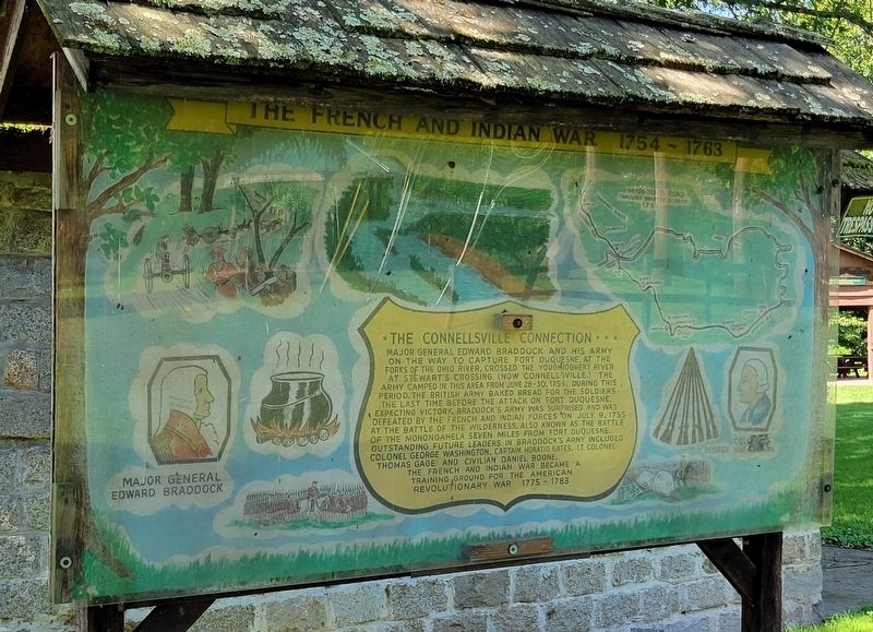
The French And Indian War 1754 - 1763
The Connellsville Connection
Major General Edward Braddock and his army on the way to capture Fort Duquesne, at the forks of the Ohio River, crossed the Youghiogheny River at Stewart's Crossing (now Connellsville.) The army camped in this area from June 28-30, 1755. During this period, the British Army baked bread for the soldiers the last time before the attack on Fort Duquesne. Expecting victory, Braddock's army was surprised and was defeated by the French and Indian forces on July 9, 1755 at the Battle of the Wilderness, also known as the Battle of the Monongahela seven miles from Fort Duquesne. Outstanding future leaders in Braddock's army included Colonel George Washington, Captain Horatio Gates, Lt. Colonel Thomas Gage and civilian Daniel Boone.
The French and Indian War became a training ground for the American Revolutionary War 1775 - 1783
Topics and series. This historical marker is listed in this topic list: War, French and Indian. In addition, it is included in the Braddock’s Road and Maj. Gen. Edward Braddock series list. A significant historical date for this entry is June 28, 1755.
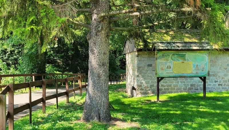
Location. 40° 1.218′ N, 79° 36.007′ W. Marker is in Connellsville, Pennsylvania, in Fayette County. Marker is at the intersection of North 7th Street and Torrance Avenue, on the left when traveling north on North 7th Street. Marker is located in the Yough River Park along the Great Allegheny Passage trail. Touch for map. Marker is at or near this postal address: 232 North 7th Street, Connellsville PA 15425, United States of America. Touch for directions.
Other nearby markers. At least 8 other markers are within walking distance of this marker. Connellsville, A River Runs Through It (here, next to this marker); Home of Colonel William Crawford (within shouting distance of this marker); Braddock's Twelfth Camp (within shouting distance of this marker); Col. William Crawford (about 500 feet away, measured in a direct line); a different marker also named Connellsville (about 500 feet away); a different marker also named Connellsville (about 500 feet away); a different marker also named Connellsville (about 500 feet away); Benjamin Wells (about 700 feet away). Touch for a list and map of all markers in Connellsville.
Regarding The French And Indian War 1754 - 1763. Marker includes a map of Braddock's Road through Fayette County 1755.
Credits. This page was last revised on September 3, 2023. It was originally submitted on September 3, 2023, by Bradley Owen of Morgantown, West Virginia. This page has been viewed 53 times since then and 10 times this year. Photos: 1, 2. submitted on September 3, 2023, by Bradley Owen of Morgantown, West Virginia.

