Sharpsburg in Washington County, Maryland — The American Northeast (Mid-Atlantic)
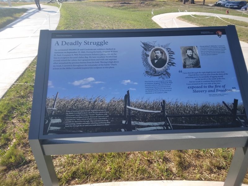
A Deadly Struggle
— Antietam National Battlefield —
(captions)
Some of Antietam's most horrific fighting took place in the Miller Cornfield located a short distance north of here. Lieutenant Colonel Alexander "Sandie" Pendleton, who served as part of Major General "Stonewall" Jackson's staff, remembered, "such a storm of balls I never conceived it possible for men to live through. Shot and shell shrieking and crashing, canister and bullets whistling and hissing most fiend-like through the air until you could almost see them."
After bravely recapturing his unit's flag at Antietam, Sergeant William H. Paul carried it until he suffered a wound at Gettysburg that prevented him from continuing as flag-bearer. He received the Medal of Honor for his actions at Antietam on November 3, 1896.
Private Julius F. Rabardy, Company K, 12th Massachusetts Infantry, also fought in Miller's Cornfield at Antietam. Decades later, he described the horrors of that bloody day. His words are now etched into this plaza's sculpture.
"I was shot through the right thigh by our own men. I had till then steered clear from the shots of the attacking party by painfully dragging myself on the north or south of the south of the tree, but too weak to continue those tactics, I was around on the east side of the tree, exposed to the fire of Slavery and Freedom."
Private Julius F. Rabardy, Private, Company K, 12th Massachusetts Infantry
Erected 2023 by National Park Service, U.S. Department of the Interior.
Topics. This historical marker is listed in this topic list: War, US Civil. A significant historical date for this entry is September 17, 1862.
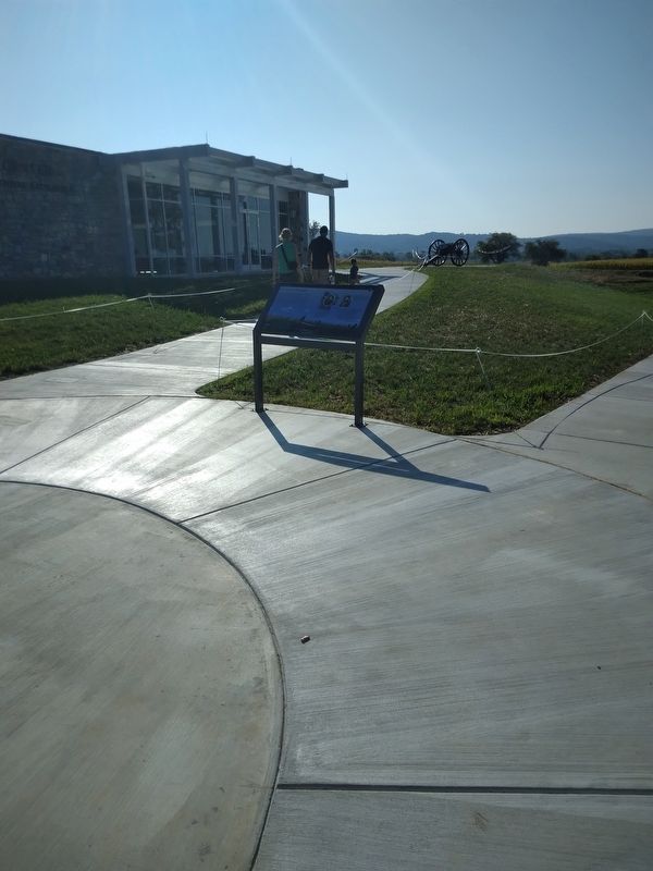
Location. 39° 28.45′ N, 77° 44.686′ W. Marker is in Sharpsburg, Maryland, in Washington County. Marker can be reached from Dunker Church Road, 0.2 miles east of Sharpsburg Pike (Maryland Route 65), on the right when traveling north. Marker is in front of the Antietam National Battlefield Visitor Center. Touch for map. Marker is at or near this postal address: 5831 Dunker Church Rd, Sharpsburg MD 21782, United States of America. Touch for directions.
Other nearby markers. At least 8 other markers are within walking distance of this marker. Battlefield Namesake (within shouting distance of this marker); The Maryland Campaign of 1862 (within shouting distance of this marker); Twentieth Regiment (within shouting distance of this marker); A Savage Continual Thunder (about 300 feet away, measured in a direct line); A Converging Storm of Iron (about 300 feet away); Model 1841 6-Pounder Gun (about 300 feet away); Model 1857 12-Pounder Gun-Howitzer (about 300 feet away); Battery A, 1st Rhode Island Light Artillery (about 300 feet away). Touch for a list and map of all markers in Sharpsburg.
Also see . . . Antietam National Battlefield. National Park Service (Submitted on September 3, 2023.)
Credits. This page was last revised on September 3, 2023. It was originally submitted on September 3, 2023, by Mike McKeown of Baltimore, Maryland. This page has been viewed 55 times since then and 16 times this year. Photos: 1, 2. submitted on September 3, 2023, by Mike McKeown of Baltimore, Maryland. • Bernard Fisher was the editor who published this page.

