Montjuïc in Barcelona, Catalonia, Spain — Southwestern Europe (Iberian Peninsula)
L'antic fortí / The early fort
El antiguo fortín / Le vieux fort
L'antic forti
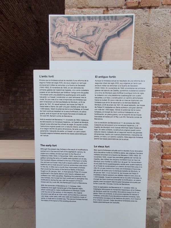
Encara que la fortalesa actual és resultat d'una reforma de la segona metat del segle XVII, els seus origens en tant que enclavament militar es remunten a la Guerra de Secessi (1640-1652). El novembre de 1640, en erabirades les primeres galeres de l'exèrcit de Castella, cinc-cents ciutadans pujaren al cim de Montjuic per fortificar l'antiga tome de guaita F'envoltaren amb una plataforma quadrangular amb quatre baluards i un fossati construire un cami atrierat versla clutat. En poc més d'un mes s'improvisà una fortalesa que servi d'escenari a la famosa Batalla de Montjuic, el 26 de gener de 1641. En aquell episodi, les tropes de Felip V installades a Sants van patir una gran desfeta amb més de 1.500 baixes. Veient el potencial de la nova fortalesa, el Consell de Cent continul treballant en la seva fortificació, en plena guerra, ambel suport de les tropes franceses enviades pel nel Luis XIII , flamant comte de Barcelona.
Amb la rendició de Barcelona 11 d'octubre de 1652, Catalunya es reincorpora a la monarquia hispanica, i el Castell de Montjuic visqué noves reformes fins a finals de segle. En aquest context, l'estructura original quedà com a reducte interior, envoltada d'un segon recinte de grans dimensions, fet amb nous paraments i baluards de pedra, un fossat i un cami cobert Aquesta segona fortalesa assentà les bases planimetriques de l'actual.
The early fort
Although the present day fortress is the result of modifications carried out in the second half of the eighteenth century, its origins as a military enclave go back to the Revolt of Catalonia (1640-1652). In November 1640, when the first galleys carrying the army of Castile were spotted out at sea, five hundred citizens climbed to the top of Montjuic to fortify the old look-out tower: they built a square platform with four bastions and a moat around it and an entrenched road down to the city. In little over a month they improvised a fortress that would be the scene of the famous Battle of Montjuic fought on 26 January 1641. In that episode Philip's troops positioned in the Sants district were heavily defeated and suffered over 1500 casualties. Realising the potential of the new fortress, the Conseil de Cent continued to strengthen the fortifications during the war, with the support of French troops sent by Louis XIII the flamboyant Count of Barcelona.
With the surrender of Barcelona on 11 October 1652, Catalonia
once again became part of the Spanish realm,
which continued to make modifications to Montjuic Castle
until the end of the century. In this respect, the original
structure was left as an inner ward, surrounded by a second,
very large, outer ward, with new walls and bastions made of
stone, a moat and a covered way. This second fortress formed
the basis of the layout of the existing structure.
El antiguo fortín
Aunque la fortaleza actual es resultado de una reforma de la segunda mitad del siglo XVI, sus orígenes en tanto que enclave militar se remontan a la Guerra de Secesión (1640-1652). En noviembre de 1640, al avistarse las primeras galeras del ejército de Castilla, quinientos ciudadanos subieron a la cima de Montjuic para fortificar la antigua tome de vigia la rodearon con una plataforma cuadrangular con cuatro baluartes y un foso y construyeron un camino atrincherado hacia la ciudad. En poco más de un mes se improvisó una fortaleza que sirvió de escenario a la famosa Batalla de Montjuic, el 26 de enero de 1641. En aquel episodio, las tropas de Felipe IV instaladas en Sants sufrieron una gran derrota con más de 1.500 bajas. Viendo el potencial de la nueva fortaleza, el Consell de Cent continuó trabajando en su fortificación, en plena guerra, con el soporte de las tropas francesas enviadas por el Rey Luis XIII, flamante conde de Barcelona.
Con la rendición de Barcelona el 11 de octubre de 1652. Cataluña se reincorporó a la monarquía hispánica, y el Castillo de Montjuic vivió nuevas reformas hasta finales de siglo. En este contexto, la estructura original quedó como reducto interior, rodeado de un segundo recinto de grandes dimensiones, hecho con nuevos paramentos y baluartes de piedra, un foso y un camino cubierto. Esta segunda fortaleza asentó las bases planimétricas de la actual.
Le vieux fort
Bien que la forteresse actuelle soit le résultat d'une rénovation de la deuxième moté du XVème siècle, ses origines d'enclave militaire remontent à la Querre de Sécesion (1640-1652). En novembre 1640, voyant les premières galères de l'armée de Castille, des milliers de citoyens montérent tout en haut de Mon pour fortifier la vieille tour de guet: ils l'enerient d'une plate-forme quadrangulaire camée avec quatre bastions et un fossé et construirent un chemin de tranchée jusqu'à la ville. En un peu moins d'un mois une forteresses'improvisa elle servit de sobne pour la fameuse bataille de Montjuc, le 26 janvier 1641. A ce moment-là, les troupes de Felipe IV installées à Sants subirent une défaite majeure avec plua de 1.500 blessés. Voyant le potentiel de la nouvelle forteresse, Consell de Cent continua à travailer la fortification, en pline guere, avec le support des troupes françaises envoyées par le Roi Louis XIII, nouveau Comte de Barcelone.
Avec la capitulation de Barcelone le 11 octobre 1662, a Catalogne reincorpora la monarchie hispanique, et le Chateau de Montjuic subit de nouvelles rénovations jusqu'à la fin du siècle. Dans ce contexte, la structure originale ft nduite à intrieur, entourée d'une deuxième enceinte immense, faite d'omments nouveaux et de bastions de pieme, d'un fossé ot d'un chemin couvert. Cette deuxième forteresse posa les bases planimatriques de l'actual.
Topics. This historical marker is listed in these topic lists: Colonial Era • Forts and Castles. A significant historical date for this entry is January 26, 1641.
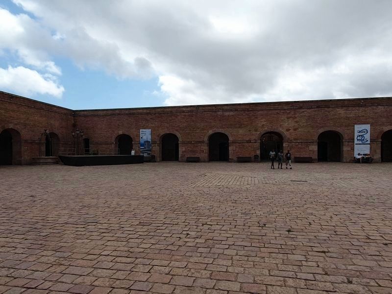
Location. 41° 21.787′ N, 2° 9.969′ E. Marker is in Barcelona, Cataluña (Catalonia). It is in Montjuïc. Marker can be reached from Carretera de Montjuïc. The marker is on the grounds of the Montjuic Castle, in the southwestern corner of the patio. Touch for map. Marker is at or near this postal address: Ctra de Montjuïc 66, Barcelona, Cataluña 08038, Spain. Touch for directions.
Other nearby markers. At least 8 other markers are within walking distance of this marker. El segon recinte / The outer ward (a few steps from this marker); Els calabossos del Castell / The Castle Dungeons / Los Calabozos del Castillo (a few steps from this marker); El pati d’armes o quadrat / The parade ground or courtyard (within shouting distance of this marker); El juidici del President Lluís Companys / The Trial of President Lluís Companys (within shouting distance of this marker); La torre de guaita / The Watchtower / La torre vigia / La tour de guet (within shouting distance of this marker); Méchain Etablí les Coordenades de Barcelona / Méchain Establishes the Coordinates of Barcelona (within shouting distance of this marker); El baluard de Sant Carles / The Sant Carles Bastion / El baluarte de Sant Carles (about 90 meters away, measured in a direct line); Gaspar de Portolà (about 90 meters away). Touch for a list and map of all markers in Barcelona.
Credits. This page was last revised on September 8, 2023. It was originally submitted on September 4, 2023, by J. Makali Bruton of Accra, Ghana. This page has been viewed 76 times since then and 19 times this year. Photos: 1, 2. submitted on September 4, 2023, by J. Makali Bruton of Accra, Ghana.

