Northeast Park in Minneapolis in Hennepin County, Minnesota — The American Midwest (Upper Plains)
The Quarry

Photographed by McGhiever, October 19, 2019
1. The Quarry marker
This site was originally used as a quarry in the early 1900's. Material similar to this stone was mined and used for the foundations and exterior finishes on many of the buildings in downtown Minneapolis.
"The Quarry" retail center was facilitated by a public/private partnership between the City of Minneapolis and Ryan Companies US. Inc..
Est. 1997
Topics. This historical marker is listed in these topic lists: Industry & Commerce • Natural Resources. A significant historical year for this entry is 1997.
Location. 45° 0.295′ N, 93° 13.914′ W. Marker is in Minneapolis, Minnesota, in Hennepin County. It is in Northeast Park. It is on New Brighton Boulevard south of 18th Avenue NE, on the right when traveling south. Marker is at the centerpoint of the Quarry shopping center, in front of a partially covered walkway leading north. Touch for map. Marker is at or near this postal address: 1580 New Brighton Blvd, Minneapolis MN 55413, United States of America. Touch for directions.

Regionally, this marker is in the Twin Cities Metropolitan Area. It is also in the American Midwest, in the Corn Belt, and in the Great
this page online
Other nearby markers. At least 8 other markers are within 2 miles of this marker, measured as the crow flies: Northeast Park Neighborhood (approx. ¼ mile away); Minneapolis Diagonal Trail (approx. 0.4 miles away); Beltrami Park (approx. ¾ mile away); Maple Hill Cemetery (approx. ¾ mile away); About Mid-City Industrial Area (approx. one mile away); About Como Neighborhood (approx. one mile away); Logan Field House (approx. 1.1 miles away); Bicycle Paths (approx. 1.6 miles away). Touch for a list and map of all markers in Minneapolis.
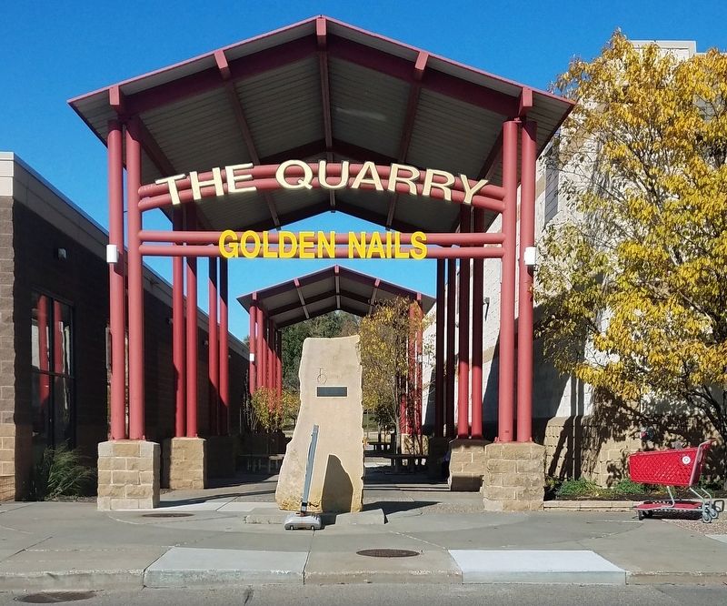
Photographed by McGhiever, October 19, 2019
2. Marker on stone slab in front of walkway at midpoint of shopping center
Credits. This page was last revised on September 6, 2023. It was originally submitted on December 24, 2020, by McGhiever of Minneapolis, Minnesota. This page has been viewed 5,204 times since then and 359 times this year. Last updated on September 5, 2023, by McGhiever of Minneapolis, Minnesota. Photos: 1, 2. submitted on December 24, 2020, by McGhiever of Minneapolis, Minnesota. • Devry Becker Jones was the editor who published this page.
