Mackinaw Township in Mackinaw City in Cheboygan County, Michigan — The American Midwest (Great Lakes)
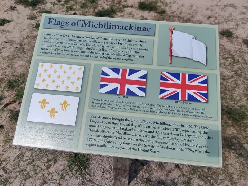
Flags of Michilimackinac
From 1715 to 1761, the pure white flag of France flew over Michilimackinac. The Fleur-de-lis, although part of the official royal flag of France, was rarely used on flags in French Canada. The white flag, flown over all ships and coastal forts, had been the official flag of the French Royal Navy since 1661. The residents of New France used this plain banner as their official flag from the earliest days of Canadian settlement to the end of the French regime.
British troops brought the Union Flag to Michilimackinac in 1761. The Union Flag had been the national flag of Great Britain since 1707, representing the united kingdoms of England and Scotland. Captain Arent DePeyster and other British officers at Michilimackinac used the flag to "display a certain necessary dignity" and to "return the compliments of tribes of Indians" in the 1770s. The Union Flag flew over the Straits of Mackinac until 1796, when the region finally became part of the United States.
Captions
Created in 1606 and officially adopted in 1707, the Union Flag combined the red and white Cross of St. George, the flag of England, with the blue and white St. Andew's Cross, the flag of Scotland. The modern Union Flag was created in 1801 with the addition of the red St. Patrick's Cross, representing Ireland.
Today many people assume the white and gold fleur-de-lis banner was the flag of New France. Flags with three or more fleur-de-lis did exist, but were not flown in French Canada.
Topics. This historical marker is listed in these topic lists: Forts and Castles • Native Americans • War, US Revolutionary. A significant historical year for this entry is 1715.
Location. 45° 47.273′ N, 84° 43.927′ W. Marker is in Mackinaw City, Michigan, in Cheboygan County. It is in Mackinaw Township. Marker is on 03-12. Touch for map. Marker is at or near this postal address: 42 03-12, Mackinaw City MI 49701, United States of America. Touch for directions.
Other nearby markers. At least 8 other markers are within walking distance of this marker. Mackinac Bridge (here, next to this marker); Revolutionary Times (within shouting distance of this marker); Michigan's First Jewish Settler (within shouting distance of this marker); Crossroads of the Fur Trade (within shouting distance of this marker); Fort Michilimackinac / Michilimackinac State Park (within shouting distance of this marker); The Community Outside the Walls: Suburbs of Michilimackinac (about 500 feet away, measured in a direct line); Ironworkers Walk of Fame (about 600 feet away); Lighthouses of the Mackinac Straits (about 600 feet away). Touch for a list and map of all markers in Mackinaw City.
Credits. This page was last revised on September 20, 2023. It was originally submitted on September 6, 2023, by John Ridley of Chelsea, Michigan. This page has been viewed 68 times since then and 21 times this year. Photo 1. submitted on September 6, 2023, by John Ridley of Chelsea, Michigan. • J. Makali Bruton was the editor who published this page.
Editor’s want-list for this marker. A wide view photo of the marker and the surrounding area together in context. • Can you help?
