Wawatam Township in Mackinaw City in Emmet County, Michigan — The American Midwest (Great Lakes)
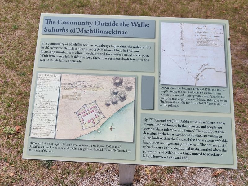
The Community Outside the Walls: Suburbs of Michilimackinac
Inscription.
The community of Michilimackinac was always larger than the military fort itself. After the British took control of Michilimackinac in 1761, an increasing number of civilian merchants and fur traders settled at the post. With little space left inside the fort, these new residents built homes to the east of the defensive palisade.
By 1778, merchant John Askin wrote that "there is near to one hundred houses in the subarbs, and people are now building tolerable good ones." The suburbs Askin described included a number of rowhouses similar to those built within the fort, and the houses were probably laid out on an organized grid pattern. The houses in the suburbs were either abandoned or dismantled when the community of Michilimackinac moved to Mackinac Island between 1779 and 1781.
Captions
Although it did not depict civilian homes outside the walls, this 1765 map of Michilimackinac included several stables and gardens, labelled "L" and "N," located to the south of the fort.
Drawn sometime between 1766 and 1769, this British map is among the first to document civilian homes outside the fort walls. Along with a wharf and the fort itself, the map depicts several "Houses Belonging to the Traders with out the fort," labelled "B," just to the east of the palisade.
Topics. This historical marker is listed in these topic lists: Anthropology & Archaeology • Forts and Castles • Settlements & Settlers.
Location. 45° 47.252′ N, 84° 44.045′ W. Marker is in Mackinaw City, Michigan, in Emmet County. It is in Wawatam Township. Marker is on Straits Avenue. The marker is on the footpath in the fort property, beyond the admission gate, before you get to the fort. Touch for map. Marker is at or near this postal address: 102 Straits Ave, Mackinaw City MI 49701, United States of America. Touch for directions.
Other nearby markers. At least 8 other markers are within walking distance of this marker. Crossroads of the Fur Trade (about 400 feet away, measured in a direct line); Michigan's First Jewish Settler (about 400 feet away); Revolutionary Times (about 400 feet away); Mackinac Bridge (about 500 feet away); Flags of Michilimackinac (about 500 feet away); Fort Michilimackinac (about 600 feet away); Fort Michilimackinac / Michilimackinac State Park (about 700 feet away); Ironworkers Walk of Fame (approx. 0.2 miles away). Touch for a list and map of all markers in Mackinaw City.
Credits. This page was last revised on October 5, 2023. It was originally submitted on September 6, 2023, by John Ridley of Chelsea, Michigan. This page has been viewed 46 times since then and 13 times this year. Photo 1. submitted on September 6, 2023, by John Ridley of Chelsea, Michigan. • J. Makali Bruton was the editor who published this page.
