Buford in Lancaster County, South Carolina — The American South (South Atlantic)
Honoring The Fallen
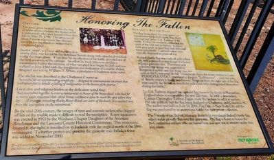
Obelisk
The mass grave located within the ring of white stones contains the bodies of 84 Continentals who were buried where they fell on May 29, 1780. The presence of these Patriots who made the ultimate sacrifice for our freedoms makes this a very sacred place.
Jacob Carnes*, a 17 year old working in a nearby field, was forced by the victorious British along with other local residents to dig the mass grave. Years later his recollection of the battle provided one of the best accounts of the carnage. An effort by local citizens to provide a memorial to honor the memory of what occurred here began in 1845 and was realized in June 1860 with the installation and dedication of a marble obelisk designed and cut by William T. White, a prominent Charleston stone cutter.
The obelisk was described in the Charleston Courier as:
"beautiful for its unpretending simplicity...designed to commemorate an event that will never fail to kindle a feeling of indignation in the bosom of the patriot."
Local civic and religious leaders at the dedication noted they:
"had assembled together to erect a monument in honor of the brave dead, who had for so many years tenanted their silent homes without a stone to mark the spot where they lay...A stranger traveling Rocky River Road can learn of the battle in a succinct way from the inscription on the monument."
By the mid-20th century, the ravages of time and souvenir seekers who chipped off bits of the marble made it difficult to read the inscription. A new monument was erected in 1955 by the Waxhaws Chapter Daughters of the American Revolution and the Lancaster County Historical Commission. This monument, located to the right, is inscribed on its backside with the original words of the 1860 monument. To further protect and preserve the gravesite and obelisk, a fence was added in November 2000.
Buford's Battle Flag
The flag flying above the mass grave is a reproduction of Buford's battle flag which was captured by Lt. Col. Tarleton at the battle. Colors, or standards, embodied the spirit of the unit and its history. Soldiers took great pride in their flags and defended them unto death. Captured colors were typically displayed as prizes of war.
Buford's battle flag was made of gold-yellow silk with a painted central design of a beaver felling a palmetto tree. The beaver and palmetto tree design was suggested by Benjamin Franklin and this image was also used on the Continental $6 bill. "PERSEVERANDO", translated to English "To Persevere"...until the yoke of British tyranny is overthrown. Strips cut from the right side of the flag were used by the British as awards for individuals who distinguished themselves during the battle.
Lt. Col. Tarleton shipped the captured flag home to his family in Hampshire, England where it remained for the next 226 years. In 2006 a descendent, Captain Christopher Tarleton Fagan, made the decision to sell it at auction. Pre-sale publicity had the flag being displayed in Charleston, and Columbia, SC. The auction was held on June 14, 2006, Flag Day, in New York City and the flag was purchased by an anonymous bidder for their private collection.
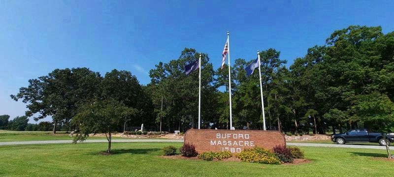
The Friends of the Buford Massacre Battlefield reproduced Buford's battle flag which today proudly flies over this grave site. The flag is flown to honor the 84 Continental soldiers who are buried here and now rest in eternity under their lost colors.
*Emily Carnes Franklin (1929—2017), a local resident and direct descendant of Jacob Carnes, worked tirelessly to maintain and publicize the Battleground and was the inspiration for forming The Friends of the Buford Massacre Battlefield in 2012.
Erected by Friends of the Buford Massacre Battlefield, Nutramax Laboratories.
Topics. This historical marker is listed in these topic lists: Cemeteries & Burial Sites • Patriots & Patriotism • War, US Revolutionary. A significant historical date for this entry is May 29, 1780.
Location. 34° 44.503′ N, 80° 37.571′ W. Marker is in Buford, South Carolina, in Lancaster County. Marker is at the intersection of Rocky River Road (State Highway 522) and Pageland Highway (State Highway 9), on the left when traveling south on Rocky River Road. Touch for map. Marker is at or near this postal address: 262 Rocky River Rd, Lancaster SC 29720, United States of America. Touch for directions.
Other nearby markers. At least 8 other markers are within walking distance of this marker. Buford Monument (here, next to this marker); Buford's Massacre (a few steps from this marker); Battle of the Waxhaws: Massacre or Myth? (a few steps from this marker); Buford's Defeat (a few steps from this marker); Buford Battleground (a few steps from this marker); Disaster in South Carolina (within shouting distance of this marker); Memorials and Archaeology (within shouting distance of this marker); Buford's Bloody Battleground (approx. 0.2 miles away). Touch for a list and map of all markers in Buford.
Also see . . . Friends of the Buford Massacre Battlefield. (Submitted on September 7, 2023.)
Credits. This page was last revised on September 8, 2023. It was originally submitted on September 7, 2023, by Ken Obriot of Fort Mill, South Carolina. This page has been viewed 104 times since then and 32 times this year. Last updated on September 7, 2023, by Ken Obriot of Fort Mill, South Carolina. Photos: 1, 2. submitted on September 7, 2023, by Ken Obriot of Fort Mill, South Carolina. • Bernard Fisher was the editor who published this page.

