Horseshoe Bend in Boise County, Idaho — The American West (Mountains)
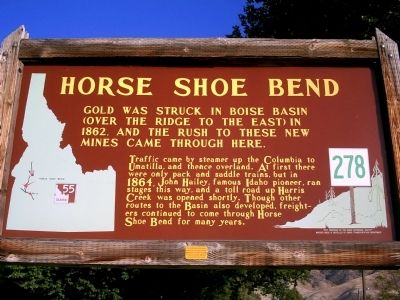
Horse Shoe Bend
Photographed by Rebecca Maxwell, October 11, 2009
1. Horse Shoe Bend Marker
Traffic came by steamer up the Columbia to Umatilla, and thence overland. At first there were only pack and saddle trains, but in 1864, John Hailey, famous Idaho pioneer, ran stages this way, and a toll road up Harris Creek was opened shortly. Though other routes to the Basin also developed, freighters continued to come through Horse Shoe Bend for many years.
Erected by Idaho Historical Society. (Marker Number 278.)
Topics and series. This historical marker is listed in this topic list: Settlements & Settlers. In addition, it is included in the Idaho State Historical Society series list. A significant historical year for this entry is 1862.
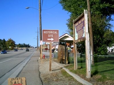
Location. 43° 54.859′ N, 116° 11.874′ W. Marker is in Horseshoe Bend, Idaho, in Boise County. It is on State Highway 55 at milepost 64, just south of West Boise Street, on the left when traveling south. Touch for map. Marker is in this post office area: Horseshoe Bend ID 83629, United States of America. Touch for directions.

Regionally, this marker is on the
this page online
Photographed by Rebecca Maxwell, October 11, 2009
2. Horse Shoe Bend Marker Along Hwy 55
Credits. This page was last revised on June 16, 2016. It was originally submitted on October 12, 2009, by Rebecca Maxwell of Boise, Idaho. This page has been viewed 2,305 times since then and 80 times this year. Photos: 1, 2. submitted on October 12, 2009, by Rebecca Maxwell of Boise, Idaho. • Craig Swain was the editor who published this page.
