Parole in Annapolis in Anne Arundel County, Maryland — The American Northeast (Mid-Atlantic)
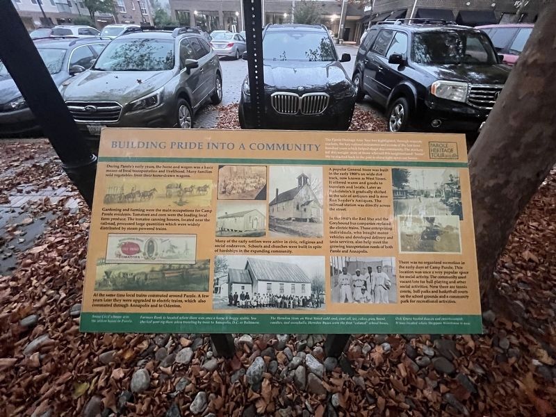
Building Pride into a Community
— Parole Heritage Tour —

Photographed By Devry Becker Jones (CC0), September 9, 2023
1. Building Pride into a Community Marker
During Parole's early years, the horse and wagon was a basic means of local transportation and livelihood. Many families sold vegetables from their horse-drawn wagons.
Gardening and farming were the main occupations for Camp Parole residents. Tomatoes and corn were the leading local farm produce. The tomatoe canning houses, located near the railroad, processed large quantities which were widely distributed by steam powered trains.
At the same time local trains commuted around Parole. A few years later they were upgraded to electric trains, which also commuted through Annapolis and to Odenton.
Many of the early settlers were active in civic, religious and social endeavors. Schools and churches were built in spite of hardships in the expanding community.
A popular General Store was built in the early 1900's on wide dirt track, now known as West Street. It offered wares and goods to travelers and locals. Later as Finkelstein's it gradually shifted to the sale of antiques and is now Ron Snyder's Antiques. The railroad station was directly across the street.
In the 1940's the Red Star and the Greyhound bus companies replaced the electric trains. Those enterprising individuals, who bought motor vehicles and developed delivery and taxis services, also help meet the growing transportation needs of both Parole and Annapolis.
There was no organized recreation in the early days of Camp Parole. This location was once a very popular space for social activity. The community used vacant lots for ball playing and other social activities. Now there are tennis courts, ball parks and basketball courts on the school grounds and a community park for recreational activities.
[Sidebar:]
Annie Cecil's house was the oldest house in Parole.
Farmers Bank is located where there was once a horse & buggy stable. You checked your rig there when traveling by train to Annapolis, D.C. or Baltimore.
The Herndon Store on West Street sold coal, coal oil, ice, cakes, pies, bread, candies, and snowballs. Herndon Buses were the first "colored" school buses.
Oak Grove hosted dances and entertainment. It was located where Shoppers Warehouse is now.
Erected by Anne Arundle County and the City of Annapolis. (Marker Number 6b.)
Topics. This historical marker is listed in these topic lists: African Americans • Agriculture • Railroads & Streetcars • Settlements & Settlers.
Location. 38° 58.776′ N, 76° 31.448′ W. Marker

Photographed By Devry Becker Jones (CC0), September 9, 2023
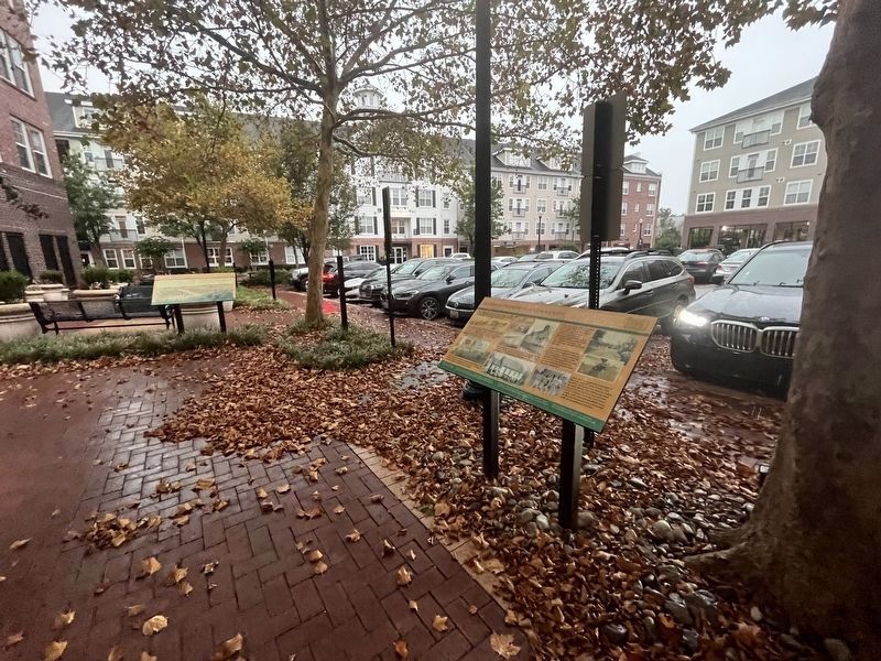
2. Building Pride into a Community Marker
Other nearby markers. At least 8 other markers are within walking distance of this marker. How Parole Named Its Streets (here, next to this marker); The Origin of the Parole Community (a few steps from this marker); Parole's Public Schools (approx. 0.2 miles away); Second Baptist Church (approx. 0.2 miles away); Cecil Memorial United Methodist Church (approx. ¼ mile away); Parole Health Center (approx. 0.3 miles away); Mount Olive African Methodist Episcopal Church (approx. 0.3 miles away); Political Representation in Ward Three, Parole (approx. 0.4 miles away). Touch for a list and map of all markers in Annapolis.
Credits. This page was last revised on December 14, 2023. It was originally submitted on September 10, 2023, by Devry Becker Jones of Washington, District of Columbia. This page has been viewed 52 times since then and 11 times this year. Photos: 1, 2. submitted on September 10, 2023, by Devry Becker Jones of Washington, District of Columbia.