Parole in Annapolis in Anne Arundel County, Maryland — The American Northeast (Mid-Atlantic)
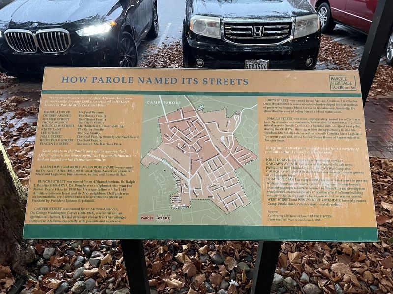
How Parole Named Its Streets
— Parole Heritage Tour —
Many streets were named after African-American pioneers who became land owners, and built their homes in Parole after the Civil War:
Bausum Drive: Mr. Fred Bausum
Dorsey Avenue: The Dorsey Family
Gilmer Street: The Gilmer Family
Hicks Avenue: The Hicks Family
Holeclaw Street: Mr. Hausclaw (correct spelling)
Kirby Lane: The Kirby Family
Lee Street: The Lee Family
Neal Street: The Neal Family, (formerly Dan Neal's Grove)Reidsville Street: The Reid Family
Vincent Street: The son of Mr. Harrison Price
Some streets in the Parole area honor non-resident African-Americans whose significant accomplishments had an impact on the Parole community:
Allen Drive and Aris T. Allen Boulevard were named for Dr. Aris T. Allen (1910-1991), an African-American physician, Maryland Legislator, businessman, author, and humanitarian.
Bunche Street was named for an African-American, Dr. Ralph J. Bunche (1904-1971). Dr. Bunche was a diplomat who won the Nobel Peace Prize in 1950 for his negotiation of the 1949 Armistice between Israel and its Arab neighbors. Dr. Bunch was an international civil servant and was awarded the Medal of Freedom by President Lyndon B. Johnson.
Carver Street was named for an African-American, Dr. George Washington Carver (1864-1943), a scientist and an agricultural chemist. He did extensive research at The Tuskegee Institute in Alabama, especially with peanuts and soybeans.
Drew Street was named for an African-American, Dr. Charles Drew (1904-1950). He was a scientist who developed the first method of preserving human blood for use in transfusions. Ironically Dr. Drew died because of being denied a blood transfusion.
Smalls Street was most appropriately named for a Civil War hero. Serviceman and statesman, Robert Smalls (1839-1915) was born into slavery in South Carolina. He became such an expert boat pilot during the Civil War, that it gave him the opportunity to win his freedom. Mr. Smalls later served as a South Carolina State Legislator for seven years and, in the United States House of Representatives for nine years.
This group of street names was derived from a variety of previous natural characteristics or uses.
Forest Drive was once a heavily wooded corridor.
Oaklawn Avenue had some of the largest old oak trees.
Parole Street honors the nearby Civil War Camp site.
Chinquapin Round Road was built through a dense growth of chinquapin trees.
DominoRoad: The story is told that there was a move to prevent African-American residents from building more homes beyond a certain geographical area in Parole. The attempt to stop development was defeated and consequently a "domino effect" in home building resulted. The street built at the demarcation line was so named.
West Street and West Street Extended, formerly named Camp Parole Road, run in a west - east direction.
Source:
Celebrating 130 Years of Spirit: Parole Week: From the Civil War to the Present. 1995
Erected by Anne Arundle County and the City of Annapolis. (Marker Number 6c.)
Topics and series. This historical marker is listed in these topic lists: African Americans • Roads & Vehicles • Settlements & Settlers. In addition, it is included in the Former U.S. Presidents: #36 Lyndon B. Johnson, the George Washington Carver, and the Historically Black Colleges and Universities series lists. A significant historical year for this entry is 1950.
Location. 38° 58.779′ N, 76° 31.447′ W. Marker is in Annapolis, Maryland, in Anne Arundel County. It is in Parole. Marker can be reached from West Street (Maryland Route 450) west of Chinquapin Round Road, on the right when traveling east . Touch for map. Marker is at or near this postal address: 1901 West St, Annapolis MD 21401, United States of America. Touch for directions.
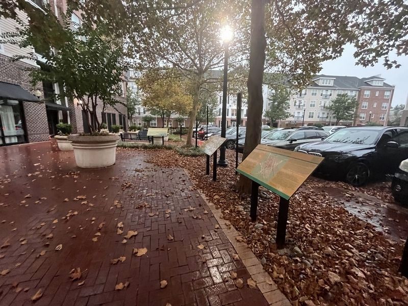
Other nearby markers. At least 8 other markers are within walking distance of this marker. Building Pride into a Community (here, next to this marker); The Origin of the Parole Community (a few steps from this marker); Parole's Public Schools (approx. 0.2 miles away); Second Baptist Church (approx. 0.2 miles away); Cecil Memorial United Methodist Church (approx. ¼ mile away); Parole Health Center (approx. 0.3 miles away); Mount Olive African Methodist Episcopal Church (approx. 0.3 miles away); Political Representation in Ward Three, Parole (approx. 0.4 miles away). Touch for a list and map of all markers in Annapolis.
Credits. This page was last revised on December 14, 2023. It was originally submitted on September 10, 2023, by Devry Becker Jones of Washington, District of Columbia. This page has been viewed 226 times since then and 166 times this year. Photos: 1, 2. submitted on September 10, 2023, by Devry Becker Jones of Washington, District of Columbia.

