North Loop in Minneapolis in Hennepin County, Minnesota — The American Midwest (Upper Plains)
Navigation on the Upper Mississippi River
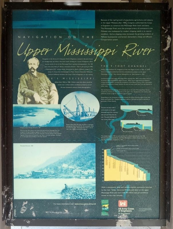
Because of the rapid growth of population, agriculture, and industry in the Upper Midwest after 1900, Congress authorized the Corps of Engineers to construct the Mississippi River locks and dams. The Mississippi River, once the principal artery of commerce in the Midwest, was inadequate for modern shipping needs in its natural condition. And as shipping costs increased, the growing numbers of Midwest businessmen and farmers demanded a cheap and efficient transportation system.
Henry Bosse's Mississippi
Forgotten in the library of a long-past Chief of Engineers, stowed in the pilot house of a dredge boat, set aside in the clock tower building of a Corps of Engineers office lay the works of one of the Mississippi River's greatest photographers. For 100 years, the artist, Henry P. Bosse, remained unknown. Then in the spring of 1990, a Washington, D.C. antique dealer discovered an album of Bosses images in the study of a house that had belonged to Major General Alexander McKenzie. General McKenzie had been the Corps' Chief of Engineers, or top ranking officer, from 1904 to 1908. Within a year, this album would be work over a million dollars and Bosse praised as one of the late nineteenth century's finest photographers.
Bosse's album held 169 large, oval, blue or cyanotype photographs that chronicle the first systematic effort to recast the upper Mississippi River from a natural river into a modern commercial highway.
Wingdams below Nininger, Minnesota 1891
Since the mid-19th century, the Corps had improved the Mississippi River for navigation through dredging, snagging and clearing, and channel constriction. The Corps constricted the river with wing dams and the closing of side channels. Together, these measures forced the river down a narrower passage, allowing it to cut through sand and debris in the main channel.
Minneiska, Minnesota 1885
The 9-Foot Channel
Federal improvements for navigation on the river began as early as 1824. In 1878, the U.S. Congress authorized the first comprehensive project on the upper Mississippi; a 4 1/2 - foot channel, followed by a 6 - foot channel in 1907.
Commercial use of the Upper Mississippi River declined after 1892 as the timber industry, its primary user, exhausted the region's forests. Other factors aggravated the Midwest's transportation problem including the completion of the Panama Canal in 1914. Now goods could be shipped more cheaply between the east and west coasts than from the Midwest to either coast.
New developments in shipping and increased use on the lower Mississippi River demonstrated the promise of a deep channel on the upper river. Businessmen,
civic leaders, and politicians joined to fight for the 9-foot channel project.
Responding to the movement, Congress included the 9-foot channel project in the 1930 Rivers and Harbor Act. Congress approved a series of 23 locks and dams to be built to guarantee a 9-foot channel.
The locks and dams make a series of pools on the upper Mississippi, much like a stairway, with each pool lower than the next. The pools help keep the river at least 9 feet deep.
The project began in 1931 at Lock and Dam 15 in Rock Island, Illinois. By 1940, 26 locks and dams crossed the river from Minneapolis to Alton, Illinois. Lock and dam No. 1 had been completed in 1917.
With a consistently deep and reliable channel, commerce returned to the river. Today, there are 29 locks and dams on the upper Mississippi River and more than 90 million tons of commerce moves on the river annually.
Erected by US Army Corps of Engineers, St. Paul District.
Topics. This historical marker is listed in these topic lists: Arts, Letters, Music • Industry & Commerce • Waterways & Vessels. A significant historical year for this entry is 1878.
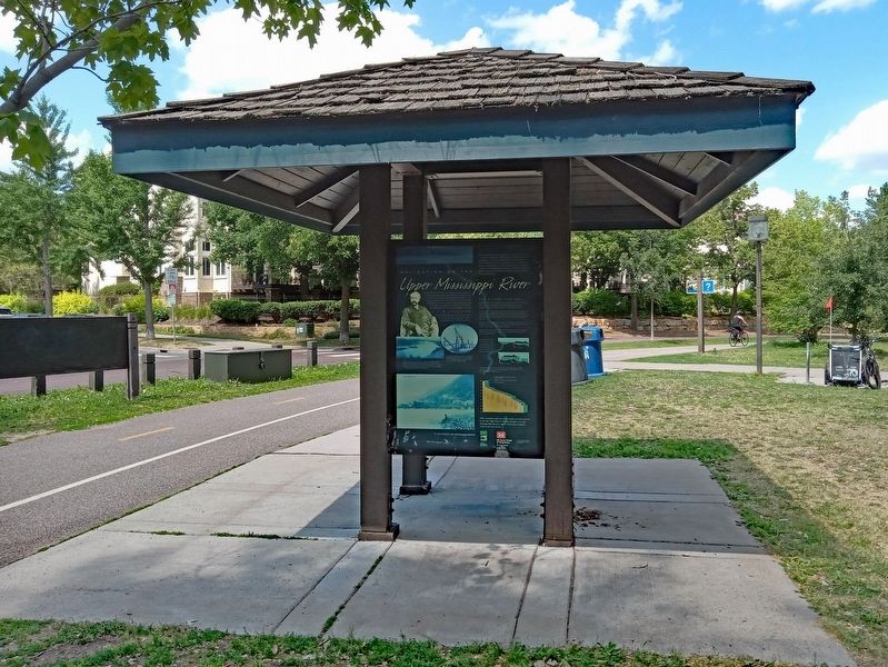
Location. 44° 59.321′ N, 93° 16.128′ W. Marker is in Minneapolis, Minnesota, in Hennepin County. It is in North Loop. Marker is at the intersection of West River Parkway and N. 4th Avenue, on the right when traveling north on West River Parkway. The marker is in James I. Rice Park, on a kiosk between the bike path and the North Loop Playground. Touch for map. Marker is at or near this postal address: 402 West River Parkway, Minneapolis MN 55415, United States of America. Touch for directions.
Other nearby markers. At least 8 other markers are within walking distance of this marker. Bridge Square to the Gateway (approx. 0.3 miles away); Father Louis Hennepin Bridge (approx. 0.3 miles away); Bridging the Stream (approx. 0.4 miles away); Stevens House (approx. 0.4 miles away); The House of John H. Stevens (approx. 0.4 miles away); Nicollet Island Businesses (approx. 0.4 miles away); Joseph N. Nicollet (approx. half a mile away); Indians at the Falls (approx. half a mile away). Touch for a list and map of all markers in Minneapolis.
Credits. This page was last revised on September 13, 2023. It was originally submitted on September 10, 2023, by McGhiever of Minneapolis, Minnesota. This page has been viewed 63 times since then and 14 times this year. Photos: 1, 2. submitted on September 10, 2023, by McGhiever of Minneapolis, Minnesota. • J. Makali Bruton was the editor who published this page.

