Stillwater Township in Washington County, Minnesota — The American Midwest (Upper Plains)
Bridging Brown's Creek
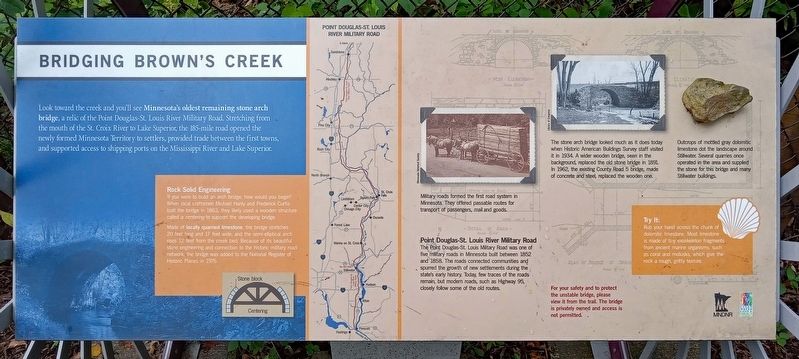
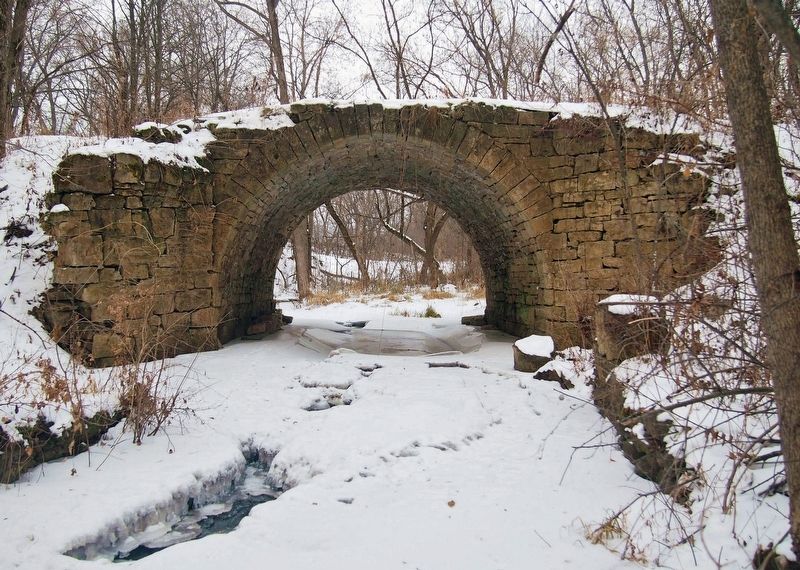
Look toward the creek and you'll see Minnesota's oldest remaining stone arch bridge, a relic of the Point Douglas-St. Louis River Military Road. Stretching from the mouth of the St. Croix River to Lake Superior, the 185-mile road opened the newly formed Minnesota Territory to settlers, provided trade between the first towns, and supported access to shipping ports on the Mississippi River and Lake Superior.
Rock Solid Engineering
If you were to build an arch bridge, how would you begin? When local craftsmen Michael Hanly and Frederick Curtis built the bridge in 1863, they likely used a wooden structure called a centering to support the developing bridge.
Made of locally quarried limestone, the bridge stretches 20 feet long and 17 feet wide, and the semi-eliptical arch rises 12 feet from the creek bed. Because of its beautiful stone engineering and connection to the historic military road network, the bridge was added to the National Register of Historic Places in 1975.
Military roads formed the first road system in Minnesota. They offered passable routes for transport of passengers, mail and goods.
Point Douglas-St. Louis River Military Road
The Point Douglas-St. Louis Military Road was one of five military roads in Minnesota built between 1852 and 1858. The roads connected communities and spurred the growth of new settlements during the state's early history. Today, few traces of the road remain, but modern roads, such as Highway 95, closely follow some of the old routes.
The stone arch bridge looked much as it does today when Historic American Buildings Survey staff visited it in 1934. A wider wooden bridge, seen in the background, replaced the old stone bridge in 1891. In 1962, the existing County Road 5 bridge, made of concrete and steel, replaced the wooden one.
Outcrops of mottled gray dolomitic limestone dot the landscape around Stillwater. Several quarries once operated in the area and supplied the stone for this bridge and many Stillwater buildings.
Try It:
Rub your hand across the chunk of dolomitic limestone. Most limestone is made of tiny exoskeleton fragments from ancient marine organisms, such as coral and mollusks, which give the rock a rough, gritty texture.
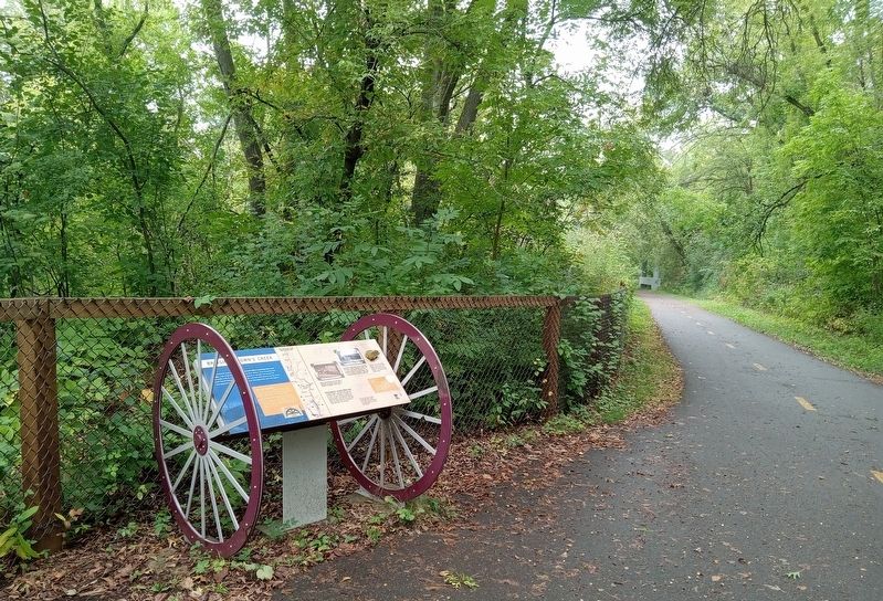
For your safety and to protect the unstable bridge, please view it from the trail. The bridge is privately owned and access is not permitted.
Erected by Minnesota Department of Natural Resources.
Topics. This historical marker is listed in these topic lists: Bridges & Viaducts • Roads & Vehicles. A significant historical year for this entry is 1863.
Location.
45° 4.535′ N, 92° 49.779′ W. Marker is near Stillwater, Minnesota, in Washington County. It is in Stillwater Township. Marker is on Brown's Creek State Trail (at milepost 2) west of Stonebridge Trail N. (County Route 55), on the right when traveling west. Touch for map. Marker is in this post office area: Stillwater MN 55082, United States of America. Touch for directions.
Other nearby markers. At least 8 other markers are within 2 miles of this marker, measured as the crow flies. Brown's Creek Revival (approx. 0.8 miles away); Tamarack House (approx. 1.2 miles away); Indian Battleground (approx. 1.4 miles away); The Warden's House (approx. 1˝ miles away); See You on the Trail / From Small Springs (approx. 1˝ miles away); St. Croix Lumber Mills / Stillwater Manufacturing Company (approx. 1˝ miles away); Connolly Shoe Company Building (approx. 1.7 miles away); 114 North Main Street (approx. 1.7 miles away). Touch for a list and map of all markers in Stillwater.
Also see . . . The Point Douglas–St. Louis River Road Bridge on Wikipedia. (Submitted on September 16, 2023, by McGhiever of Minneapolis, Minnesota.)
Credits. This page was last revised on September 16, 2023. It was originally submitted on September 16, 2023, by McGhiever of Minneapolis, Minnesota. This page has been viewed 81 times since then and 40 times this year. Photos: 1, 2, 3. submitted on September 16, 2023, by McGhiever of Minneapolis, Minnesota. • J. Makali Bruton was the editor who published this page.


