Imperial in Jefferson County, Missouri — The American Midwest (Upper Plains)
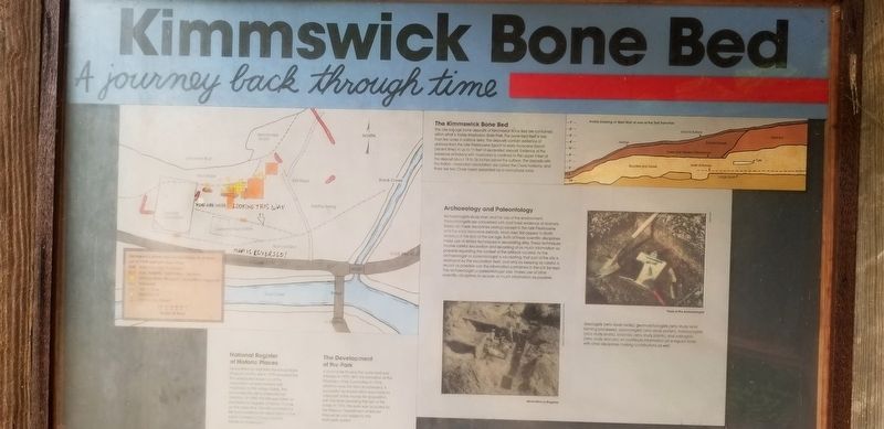
Kimmswick Bone Bed
A Journey Back Through Time
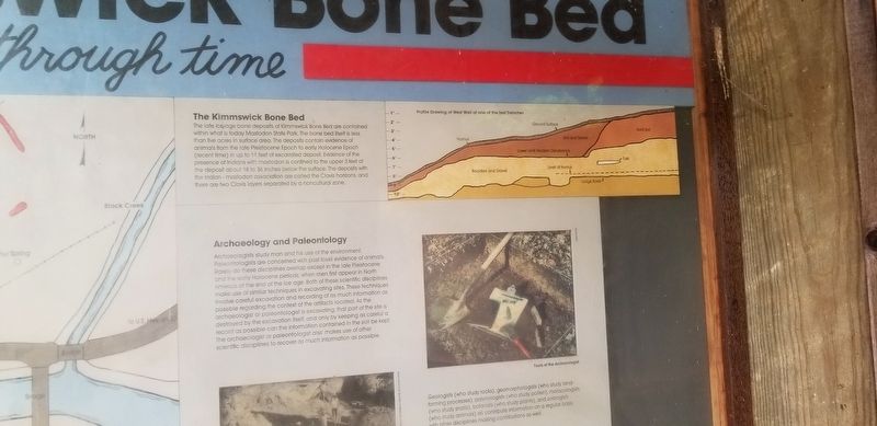
The Kimmswick Bone Bed
The late ice-age bone deposits of Kimmswick Bone Bed are contained within what is today Mastodon State Park. The bone bed itself is less than five acres in surface area. The deposits contain evidence of animals from the late Pleistocene Epoch to early Holocene Epoch (recent time) in up to 11 feet of excavated deposit. Evidence of the presence of Indians with mastodon is confined to the upper 3 feet of the deposit about 18 to 36 inches below the surface. The deposits with the Indian-mastodon association are called the Clovis horizons, and there are two Clovis layers separated by a noncultural zone.
Archaeology and Paleontology
Archaeologists study man and his use of the environment. Paleontologists are concerned with past fossil evidence of animals. Rarely do these disciplines overlap except in the late Pleistocene and the early Holocene periods, when men first appear in North America at the end of the ice age. Both of these scientific disciplines make use of similar techniques in excavating sites. These techniques involve careful excavation and recording of as much information as possible regarding the context of the artifacts located. As the archaeologist or paleontologist is excavating, that part of the site is destroyed by the excavation itself, and only by keeping as careful a record as possible can the information contained in the soil be kept. The archaeologist or paleontologist also makes use of other scientific disciplines to recover as much information as possible Geologists (who study rocks), geomorphologists (who study land- forming processes), palynologists (who study pollen), malacologists (who study snails), botanists (who study plants), and zoologists (who study animals) all contribute information on a regular basis with other disciplines making contributions as well.
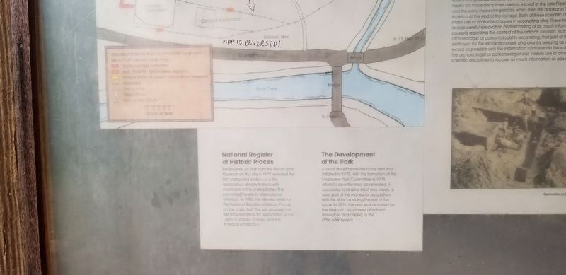
National Register of Historic Places
Excavations by staff from the Illinois State Museum on this site in 1979 revealed the first undisputed evidence of the association of early Indians with mastodon in the United States. This promoted the site to international attention. In 1980, the site was listed on the National Register of Historic Places on the basis that "the site provided the first solid evidence for association of the Llano Complex (Clovis) and the American mastodon."
The Development of the Park
A local drive to save the bone bed was initiated in 1970. With the formation of the Mastodon Park Committee in 1974, efforts to save the tract accelerated. A successful fund-drive effort was made to raise part of the money for acquisition, with the state providing the rest of the funds. In 1976, the park was acquired by the Missouri Department of Natural Resources and added to the state park system.
Topics. This historical marker is listed in these topic lists: Paleontology • Parks & Recreational Areas.
Location. 38° 22.698′ N, 90° 23.046′ W. Marker is in Imperial, Missouri, in Jefferson County. Marker can be reached from Charles J Becker Drive west of West Outer Road, on the right. Touch for map. Marker is at or near this postal address: 1050 Charles J Becker Drive, Imperial MO 63052, United States of America. Touch for directions.
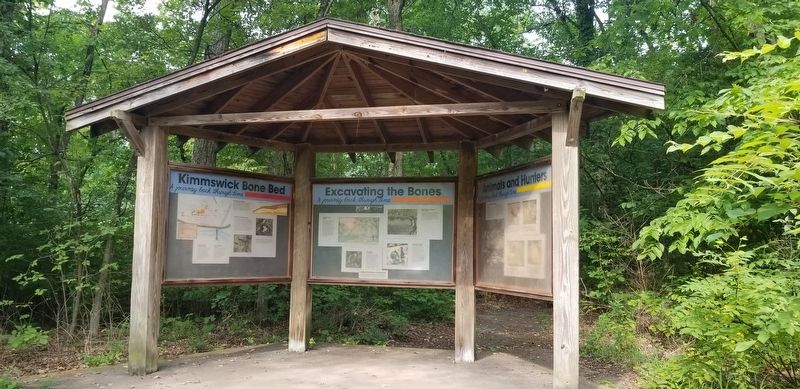
Other nearby markers. At least 8 other markers are within 4 miles of this marker, measured as the crow flies. Excavating the Bones (here, next to this marker); Quarry Operations (within shouting distance of this marker); Bring Us Home (approx. 0.9 miles away); Flame of Freedom (approx. 0.9 miles away); El Camino Real (approx. 1.2 miles away); Windsor Harbor Road Bridge (approx. 1˝ miles away); Welcome to Sulphur Springs Landing (approx. 2.9 miles away); POW * MIA (approx. 3.8 miles away). Touch for a list and map of all markers in Imperial.
More about this marker. Located in the Mastodon State Park of Missouri on the "Wildflower Trail". Rugged terrain but the trail is an easy/moderate hike. Lots of stairways to get to this site. Hiking trails are free, admission charged for the museum area.
Credits. This page was last revised on September 16, 2023. It was originally submitted on September 16, 2023, by Cajun Scrambler of Assumption, Louisiana. This page has been viewed 57 times since then and 20 times this year. Photos: 1, 2, 3, 4. submitted on September 16, 2023, by Cajun Scrambler of Assumption, Louisiana.


