Indian Wells in Riverside County, California — The American West (Pacific Coastal)
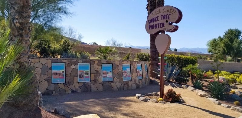
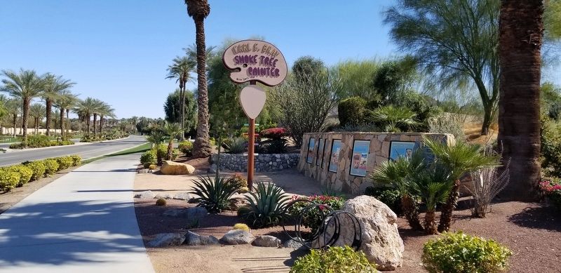
Carl G. Bray, Smoke Tree Painter
Here Since 1936
Kavanish Village
For some 400-500 years, the Indian Wells area was home to a series of Indian villages. Best known was the Cahuilla village of Kavanish. It was located north of the Whitewater River and northwest of where the Miles Avenue bridge is today. It would have extended within the confines of the now Indian Wells Golf Resort. The village supported two Cahuilla clans, the Mountian Cahuilla Ateiteem clan of Coyote Moiety and the Desert Cahuilla Nonkaiam clan of Wildcat Moiety. In 1852, Theodoro, of the Ateiteem clan, signed the Treaty of Temecula for the Kavinish people as alcalde to Juan Antonio, making the village primarily a part of the Mountain Cahuilla clan. By 1863, however, the village was mostly abandoned, possibly due to a smallpox epidemic during 1862. Members of the Ateiteem clan migrated west to join others at Agua Caliente (Palm Springs) and the Nonkaiam clan moved east to La Mesa, near Coachella. Relics of the village — pipes, pottery shards, human figurines, arrowheads, etc. — are buried beneath this site.
Indian Wells
Water in the desert is essential! One of the best features in the entire California desert was near here in the shadow of the mountains surrounding Point Happy. It's been documented that an Indian well was dug into the Whitewater River bed (again, near the Miles Ave. bridge) and was located in a grove of mesquite bushes at the base of a high sand dune and was about 25 feet deep. It was funnel shaped — wide at the top, narrowing with depth — and was accessed by steps made of sun-hardened clay. Each time the well had to be deepened, clay had to be removed and was done so by hand. Chief Francisco Patencio, in his writings, said the well was once a spring and that even the spring had to be dug out as the water table dropped. This well has been referred to by the names Palma Seca (Dry Palm) and Pozo Hondo (Deep Well). The well provided water to the Kavinish people and later to travelers using Bradshaw’s (stage) Road. The early well provided the name for the present City of Indian Wells.
In early accounts of this same desert area, several other wells were said to be in evidence and some residents, today, claim an old well in their backyard.
Bradshaw’s Road
In 1862, gold fever gripped Southern California. In that year, gold was discovered in La Paz, Arizona, and word quickly spread to Los Angeles. Beginning in July, hundreds of people headed east by stagecoach to the La Paz "diggins" via Needles, California or Yuma, Arizona. One man, William "Bill" Bradshaw, sought a shorter route, hopingto cut weeks off the trip. Luckily for Bradshaw, local Indians showed him a much more direct route, through the Orocopia and Chuckawalla Mountains to the Coloradao River. After travelers crossed the river La Paz lay but 4 miles upstream. With this knowledge, Bradshaw returned to Los Angeles and described his "discover." The new road soon took on the name Bradshaw’s Road, or simply the Road to La Paz.
Because of the Civil War and the initial rush for gold, usage of the road dwindled. The coming of the railroad in the late 1870’s all but ended its use. However, there were still enough travelers through the valley to warrant a new well. By efforts of the State of California and the County of San Bernardino, a new well was dug and was used for a number of years thereafter. With the proper vehicle, Bradshwa’s may be traversed today and still looks like it did 150 years ago.
Indian Wells Village
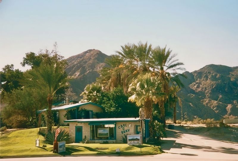
In the 1900’s, as the Coachella Valley became more than just a "watering hole," settlements began to emerge. Indian Wells village was one of many and soon bustled with amenities such as a date shop, a market (Dan’s Market with a public phone booth), a trailer park (with showers and laundry facilities), cabins, a post office, a bar and grill (The Hogan) and best of all the Snake Pit, which was a local tourist attraction displaying live rattlesnakes. Alongside Hwy. 111 was The House of Purple Glass, where the owners sold purple glass exposed to the desert sun. By the late 1940’s — early 50’s, the Indian Wells area sported two gas station, Shell Oil at the northwest corner of Hwy. 111 and Miles Ave., and on the northeast corner, Chevron Oil. The Carl Bray home and gallery were the last structures to be built and (as it turned out) the last to go down. This plaque is a reminder of what was once a small village, merely a rest stop, which later gave birth to an international resort destination.
The Landscape Brings Artists to the Valley
The desert is like an inexhaustible mine of beauty, and all a man has to do is dig it out. — John Hilton
The confluence of water, shelter and beauty lured Carl Bray and many others to the spot where the Whitewater River once met a sheltering cove. The serrated hills before you (Point Happy) can be seen as far away as Mt. Jacinto and on to the San Gorgonio Pass. The cove was abundant with groundwater and thickets of mesquite grew in dunes 30 feet high. With legends of lost gold, stagecoaches and ancient wells, Point Happy inspired the eyes and imaginations of landscape artists such as John Hilton, Paul Grimm, Jimmy Swinnerton, Carl Eytel, Bill Bender, Fred Chisnall and Indian Wells’ own artist-in-residence, Carl Bray.
Artist Carl Bray
To
those traveling through the Coachella Valley in the 1950’s, a palette-shaped sign — Home of the Smoke Tree Artist — was a familiar landmark along this stretch of Hwy. 111. When Carl Bray first discovered the perfect desert spot, the Oklahoma-born native was living in the Los Angeles area and came to the desert simply to paint. There were sand dunes in every direction, rolling hills and towering mountains, and desert flora in huge abundance as far as the eye coud see. For Carl and his wife, Luella, this would become "home." Carl Bray, artist, as well as brakeman for the Southern Pacific Railroad, began building a house and studio. By 1953 he was far enough along to bring his family to their dwelling where the Brays resided until 1999. The Bray house was built by Carl, himself, and included railroad ties and steel bars (discards from the railroad yard), boulders hauled from the nearby canyons, along with rocks his four children collected. The gallery became a gethering place for that group of landscape artists already known to the area — now called artists of the Smoke Tree School — whose works are highly valued by collectors today.
Home developments, luxury resorts and country clubs grew up around Bray’s "outpost." In time, the Brays sold and after a few years the property stood empty. Preservationists waged a campaign to save the vintage home and gallery, but it was ultimately torn down in 2010. Today, this memorial site serves as a tribute to a history of things past and to a man remembered by travelers from all over the world. Carl Bray’s paintings are prized today for their blue collar mysticism, lonely freight trains, and glowing smoke trees. His home and work are examples of pure desert Americana, now rooted in this place.
Carl Bray died in Banning, California on July 23, 2011 at the age of 94.
Topics. This historical marker is listed in these topic lists: Arts, Letters, Music • Native Americans.
Location. 33° 43.11′ N, 116° 18.577′ W. Marker is in Indian Wells, California, in Riverside County. Marker is on California Route 111 west of Mountain Cove Drive, on the right when traveling east. Touch for map. Marker is at or near this postal address: 77689 Rte 111, Indian Wells CA 92210, United States of America. Touch for directions.
Other nearby markers. At least 8 other markers are within 5 miles of this marker, measured as the crow flies. The Bradshaw Trail / Point Happy (approx. 0.9 miles away); Eisenhower Mountain (approx. 1.6 miles away); Indian Wells (approx. 1.6 miles away); Dwight David Eisenhower (approx. 1.7 miles away); Eisenhower Walk of Honor (approx. 1.7 miles away); Palm Springs Land and Irrigation Company (approx. 3 miles away); Jimmy Swaggart's "Date" (approx. 4.6 miles away); Palm Desert Historical Society Vietnam War Memorial (approx. 4.8 miles away). Touch for a list and map of all markers in Indian Wells.
Credits. This page was last revised on October 3, 2023. It was originally submitted on September 18, 2023, by Douglass Halvorsen of Klamath Falls, Oregon. This page has been viewed 111 times since then and 52 times this year. Photos: 1, 2, 3, 4. submitted on September 18, 2023, by Douglass Halvorsen of Klamath Falls, Oregon. • Devry Becker Jones was the editor who published this page.


