Schuylkill Haven in Schuylkill County, Pennsylvania — The American Northeast (Mid-Atlantic)
Columbia Hotel
Schuylkill Haven Heritage Trail
Photographed by William Fischer, Jr., September 13, 2023
1. Columbia Hotel Marker
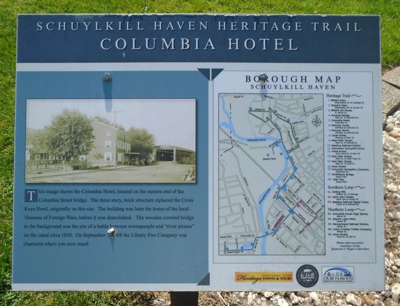
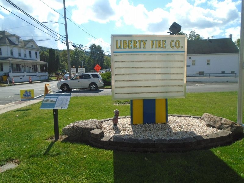
This image shows the Columbia Hotel, located on the eastern end of the Columbia Street bridge. The three story, brick structure replaced the Cross Keys Hotel, originally on this site. The building was later the home of the local Veterans of Foreign Wars, before it was demolished. The wooden covered bridge in the background was the site of a battle between townspeople and "river pirates" on the canal circa 1850. On September 1908 the Liberty Fire Company was chartered where you now stand.
Borough Map [and] Heritage Trail [key]
Erected by Schuylkill River Heritage Towns & Tours, Schuylkill Haven Borough, and Our Haven Foundation. (Marker Number 5.)
Topics and series. This historical marker is listed in this topic list: Notable Buildings. In addition, it is included in the Pennsylvania, Schuylkill Haven Heritage Trail series list. A significant historical year for this entry is 1850.
Location. 40° 37.478′ N, 76° 10.435′ W. Marker is in Schuylkill Haven, Pennsylvania, in Schuylkill County. It is at the intersection of Columbia Street (Pennsylvania Route 443) and St. James Street, on the right when traveling west on Columbia
this page online

Regionally, this marker is in Pennsylvania’s Anthracite Coal Region. It is also in the American Northeast, in the Mid-Atlantic, in Appalachia, and specifically in Northern Appalachia. Globally, it is in North America, the Western Hemisphere, the Western World, and the Anglosphere. Historically, it finds itself in what was once the Haudenosaunee (Iroquois) Confederacy and also one of the original Thirteen Colonies.
Other nearby markers. At least 8 other markers are within walking distance of this marker: Covered Bridge (within shouting distance of this marker); Bittle's Ice House (about 800 feet away, measured in a direct line); Parkway North (approx. 0.2 miles away); Parkway South (approx. 0.2 miles away); War Memorial (approx. 0.2 miles away); Site of the Schuylkill Navigation Canal (approx. 0.2 miles away); Schuylkill Canal Lock No. 12 (approx. 0.2 miles away); Neptune (approx. 0.2 miles away). Touch for a list and map of all markers in Schuylkill
Photographed by William Fischer, Jr., September 13, 2023
2. Columbia Hotel Marker
Also see . . . Schuylkill Haven History. (Submitted on September 20, 2023, by William Fischer, Jr. of Reynoldsburg, Ohio.)
Credits. This page was last revised on November 17, 2024. It was originally submitted on September 20, 2023, by William Fischer, Jr. of Reynoldsburg, Ohio. This page has been viewed 206 times since then and 20 times this year. Photos: 1, 2. submitted on September 20, 2023, by William Fischer, Jr. of Reynoldsburg, Ohio.
