Schuylkill Haven in Schuylkill County, Pennsylvania — The American Northeast (Mid-Atlantic)
Electric Light Plant
Schuylkill Haven Heritage Trail
Photographed by William Fischer, Jr., September 13, 2023
1. Electric Light Plant Marker
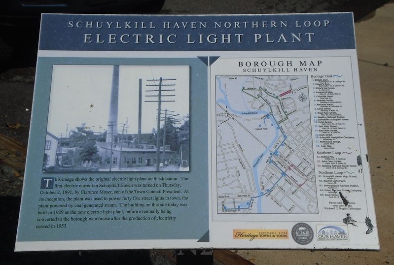
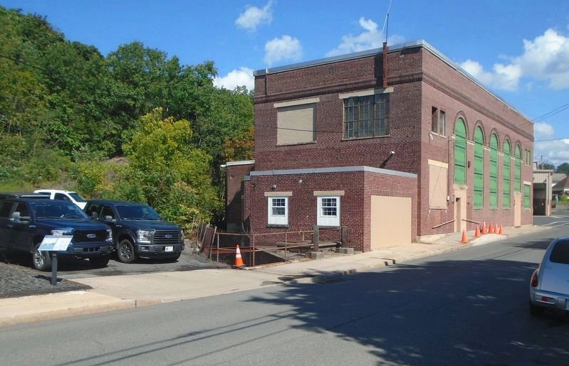
This image shows the original electric light plant on this location. The first electric current in Schuylkill Haven was turned on Thursday, October 2, 1891, by Clarence Moser, son of the Town Council President. At its inception, the plant was used to power forty five street lights in town, the plant powered by coal generated steam. The building on this site today was built in 1929 as the new electric light plant, before eventually being converted to the borough warehouse after the production of electricity ceased in 1953.
Borough Map [and] Heritage Trail [key]
Erected by Schuylkill River Heritage Towns & Tours, Schuylkill Haven Borough, and Our Haven Foundation. (Marker Number N2.)
Topics and series. This historical marker is listed in this topic list: Charity & Public Work. In addition, it is included in the Pennsylvania, Schuylkill Haven Heritage Trail series list. A significant historical date for this entry is October 2, 1891.
Location. 40° 38.131′ N, 76° 10.392′ W. Marker is in Schuylkill Haven, Pennsylvania, in Schuylkill County. It is on Haven Street 0.1 miles east of Dock Street (Pennsylvania Route 443), on the left
this page online

Regionally, this marker is in Pennsylvania’s Anthracite Coal Region. It is also in the American Northeast, in the Mid-Atlantic, in Appalachia, and specifically in Northern Appalachia. Globally, it is in North America, the Western Hemisphere, the Western World, and the Anglosphere. Historically, it finds itself in what was once the Haudenosaunee (Iroquois) Confederacy and also one of the original Thirteen Colonies.
Other nearby markers. At least 8 other markers are within walking distance of this marker: Jerusalem Evangelical Lutheran Church Labyrinth (about 400 feet away, measured in a direct line); Pennsylvania Railroad Station (about 600 feet away); Dock Street (about 700 feet away); Schuylkill Haven High School (about 800 feet away); Schuylkill Navigation Company (approx. 0.2 miles away); McWilliams Bridge (approx. ¼ mile away); Union Traction Trolley Company (approx. ¼ mile away); a different marker also named Dock Street (approx. ¼ mile away).
Photographed by William Fischer, Jr., September 13, 2023
2. Former Electric Light Plant and Marker
Credits. This page was last revised on September 20, 2023. It was originally submitted on September 20, 2023, by William Fischer, Jr. of Reynoldsburg, Ohio. This page has been viewed 184 times since then and 30 times this year. Photos: 1, 2. submitted on September 20, 2023, by William Fischer, Jr. of Reynoldsburg, Ohio.
