San Miguel de Cozumel in Cozumel, Quintana Roo, Mexico — The Yucatan Peninsula (The Southeast)
Calendario maya / Mayan calendar
Mayan calendar
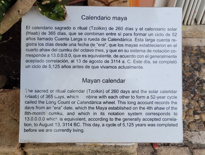
The sacred or ritual calendar (Tzolkin) of 260 days and the solar calendar (Haab) of 365 days, which combine with each other to form a 52-year cycle called the Long Count or Calendárica wheel. This long account records the days from an "era" date, which the Maya established on the 4th ahaw of the 8th-month cumku, and which in its notation system corresponds to 13.0.0.0.0 which is equivalent, according to the generally accepted correlation, to August 13, 3114 BC. This day, a cycle of 5,125 years was completed before we are currently living.
Topics. This historical marker is listed in this topic list: Native Americans. A significant historical year for this entry is 3114 BCE.
Location. 20° 28.562′ N, 86° 58.487′ W. Marker is in San Miguel de Cozumel, Quintana Roo, in Cozumel. Marker is on Quintana Roo C-1, 0.2 kilometers south of Av. Claudio Canto. The marker is located in central section of the Puerto Maya Cruise Ship Maritime Terminal. Touch for map. Marker is in this post office area: San Miguel de Cozumel QR 77675, Mexico. Touch for directions.
Other nearby markers. At least 8 other markers are within walking distance of this marker. Chac mool (here, next to this marker); Los Sacerdotes Mayas / The Mayan Priests (a few steps from this marker); Land of Chocolate (a few steps from this marker); Diosa Ixchel / Goddess Ixchel (within shouting distance of this marker); Coral Reefs (within shouting distance of this marker); Ancient Heritage (within shouting distance of this marker); Chac-Mool (about 120 meters away, measured in a direct line); Tzolkin (approx. 0.3 kilometers away). Touch for a list and map of all markers in San Miguel de Cozumel.
Also see . . . Maya calendar. Wikipedia (Submitted on September 20, 2023, by James Hulse of Medina, Texas.)
Credits. This page was last revised on September 20, 2023. It was originally submitted on September 20, 2023, by James Hulse of Medina, Texas. This page has been viewed 48 times since then and 13 times this year. Photos: 1, 2, 3. submitted on September 20, 2023, by James Hulse of Medina, Texas.


