Statesville in Iredell County, North Carolina — The American South (South Atlantic)
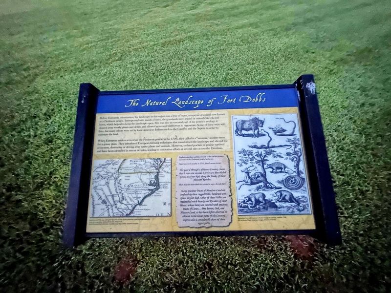
The Natural Landscape of Fort Dobbs
When European settlers arrived on the Piedmont prairie in the 1700s, they called it a "savanna," another term for a grassy plain. They introduced European farming techniques that transformed the landscape and altered the ecosystem, destroying or driving away native plants and animals. However, isolated pockets of prairie survived and have been identified in recent decades, leading to restoration efforts at several sites across the Carolinas.
English naturalists published some of the earliest written accounts of the Piedmont prairie landscape.
After his travels, nearby in 1701, John Lawson wrote:
We pass'd through a delicious Country, (none that I ever saw exceeds it.) We saw fine bladed Grass, six Foot high, along the Banks of these pleasant Rivulets.
Mark Cately described the terrain he saw a decade later:
Many spacious Tracts of Meadow-Land are confined by these rugged Hills, burdened with Grass six feet high. Other of these Vallies are replenished with Brooks and Rivulets of clear Water, whose banks are covered with spacious tracts of Canes... Pine barren, Oak and Hiccory-Land, as has been before observed to abound in the lower parts of the Country, engross also a considerable share of these upper parts.
Topics. This historical marker is listed in these topic lists: Animals • Forts and Castles • Native Americans • Settlements & Settlers. A significant historical year for this entry is 1701.
Location. 35° 49.286′ N, 80° 53.814′ W. Marker is in Statesville, North Carolina, in Iredell County. Marker is on Fort Dobbs Road, 0.3 miles west of Natures Trail, on the right when traveling west. Touch for map. Marker is at or near this postal address: 438 Fort Dobbs Road, Statesville NC 28625, United States of America. Touch for directions.
Other nearby markers. At least 8 other markers are within 3 miles of this marker, measured as the crow flies. Anglo-Cherokee War (1759 - 1761) (here, next to this marker); They found the fire very hot … February 27, 1760 (a few steps from this marker); Hugh Waddell (within shouting distance of this marker); Site of Fort Dobbs (within shouting distance of this marker); a different marker also named Site of Fort Dobbs (within shouting distance of this marker); Preserving the Past (within shouting distance of this marker); Fort Dobbs (approx. 1.3 miles away); Iredell County Korea & Vietnam War Memorial (approx. 2.4 miles away). Touch for a list and map of all markers in Statesville.
Credits. This page was last revised on September 25, 2023. It was originally submitted on September 21, 2023, by J.T. Lambrou of New Boston, Michigan. This page has been viewed 54 times since then and 10 times this year. Photos: 1, 2. submitted on September 21, 2023, by J.T. Lambrou of New Boston, Michigan. • Bernard Fisher was the editor who published this page.

