Casco Antiguo in Zaragoza, Aragón, Spain — Southwestern Europe (Iberian Peninsula)
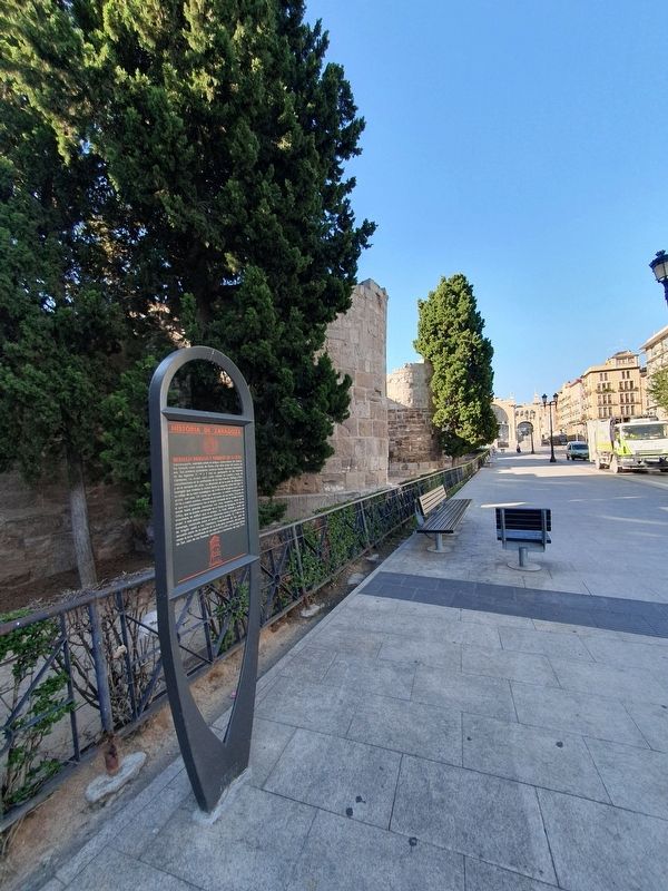
Roman Walls and the Tower of Zuda
Historia de Zaragoza
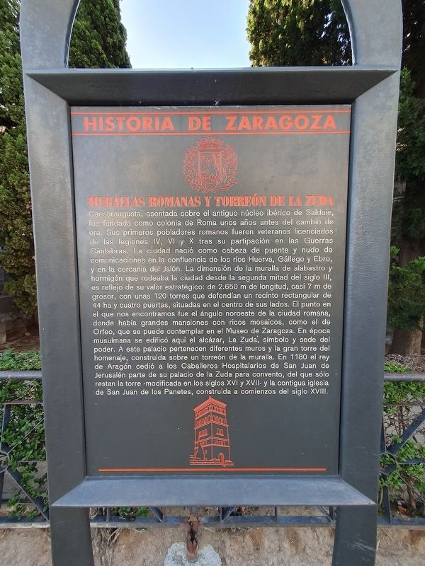
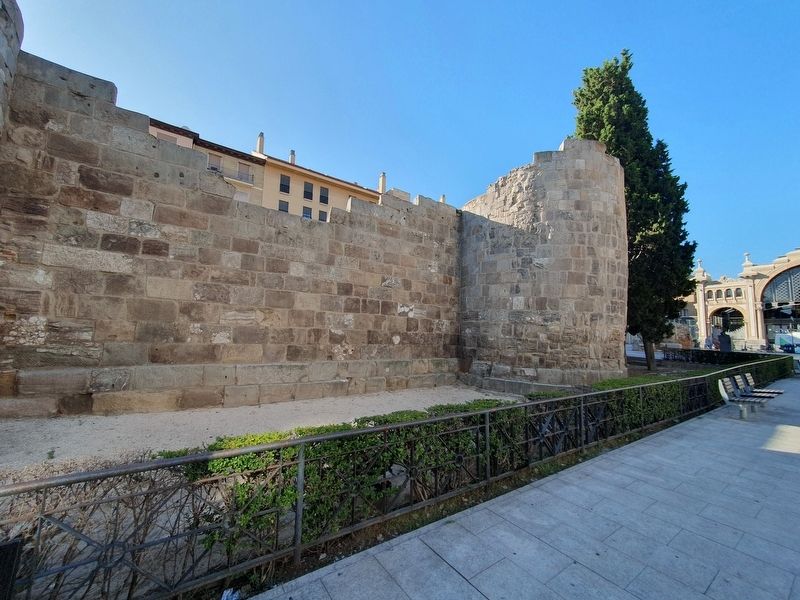
Caesaraugusta, asentada sobre el antiguo núcleo ibérico de Salduie, fue fundada como colonia de Roma unos años antes del cambio de era. Sus primeros pobladores romanos fueron veteranos licenciados de las legiones IV, VI y X tras su participación en las Guerras Cántabras. La ciudad nació como cabeza de puente y nudo de comunicaciones en la confluencia de los ríos Huerva, Gállego y Ebro, y en la cercanía del Jalón. La dimensión de la muralla de alabastro y hormigón que rodeaba la ciudad desde la segunda mitad del siglo III, es reflejo de su valor estratégico: de 2.650 m de longitud, casi 7 m de grosor, con unas 120 torres que defendían un recinto rectangular de 44 ha y cuatro puertas, situadas en el centro de sus lados. El punto en el que nos encontramos fue el ángulo noroeste de la ciudad romana, donde había grandes mansiones con ricos mosaicos, como el de Orfeo, que se puede contemplar en el Museo de Zaragoza. En época musulmana se edificó aquí el alcázar, La Zuda, símbolo y sede del poder. A este palacio pertenecen diferentes muros y la gran torre del homenaje, construida sobre un torreón de la muralla. En 1180 el rey de Aragón cedió a los Caballeros Hospitalarios de San Juan de Jerusalén parte de su palacio de la Zuda para convento, del que sólo restan la torre – modificada en los siglos XVI y XVII – y la contigua iglesia de San Juan de los Panetes, construida a comienzos del siglo XVIII.
Roman Walls and the Tower of Zuda
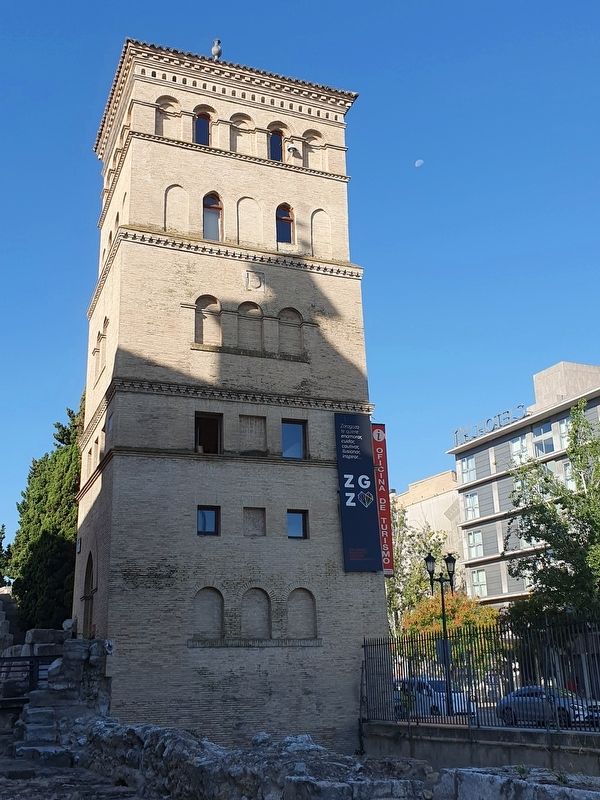
Caesaraugusta, settled on the ancient Iberian nucleus of Salduie, was founded as a colony of Rome a few years before the change of the era. Its first Roman settlers were veterans discharged from the legions IV, VI and X after their participation in the Cantabrian Wars. The city was born as a bridgehead and communications hub at the confluence of the Huerva, Gállego and the Ebro rivers, and in the vicinity of the Jalón. The dimension of the alabaster and concrete wall that surrounded the city since the second half of the third century is a reflection of its strategic value: 2,650 m long, almost 7 m thick, with about 120 towers that defended a rectangular enclosure of 44 ha and four gates, located in the center of its sides. The point where we find ourselves was the northwest corner of the Roman city, where there were large mansions with rich mosaics, such as that of Orpheus, which can be seen in the Museum of Zaragoza. In Muslim times the fortress was built here, La Zuda, symbol
and seat of power. To this palace belong different walls and the great keep, built on a tower of the wall. In 1180 the King of Aragon ceded to the Knights Hospitaller of San Juan de Jerusalem part of his palace of the Zuda for a convent, of which only the tower remains – modified in the sixteenth and seventeenth centuries – and the adjoining church of San Juan de los Panetes, built in the early eighteenth century.
Topics. This historical marker is listed in these topic lists: Anthropology & Archaeology • Forts and Castles.
Location. 41° 39.448′ N, 0° 52.901′ W. Marker is in Zaragoza, Aragón. It is in Casco Antiguo. Marker is at the intersection of Avenida de César Augusto and Echegaray y Caballero, on the right when traveling north on Avenida de César Augusto. Touch for map. Marker is at or near this postal address: Plaza César Augusto 3, Zaragoza, Aragón 50003, Spain. Touch for directions.
Other nearby markers. At least 8 other markers are within walking distance of this marker. Attack of January 30, 1987 (within shouting distance of this marker); Pope John Paul II in Zaragoza (approx. 0.3 kilometers away); El Pilar Cathedral in the Sieges (approx. 0.3 kilometers away); Calle de Don Alfonso I (approx. 0.4 kilometers away); Plaza de Santiago Sas (approx. 0.4 kilometers away); Escolapios y Palacio de los Luna (approx. 0.4 kilometers away); City Council Victims of 1936 Military Coup (approx. 0.4 kilometers away); Palacio de los Condes de Morata o de los Luna (approx. 0.4 kilometers away). Touch for a list and map of all markers in Zaragoza.
Credits. This page was last revised on September 22, 2023. It was originally submitted on September 22, 2023, by J. Makali Bruton of Accra, Ghana. This page has been viewed 47 times since then and 7 times this year. Photos: 1, 2, 3, 4. submitted on September 22, 2023, by J. Makali Bruton of Accra, Ghana.


