
Gerolzhofen in Schweinfurt, Bavaria, Germany — Central Europe
Schallfelder Tor
⎯⎯⎯
Schallfeld Gate
Photographed by Andrew Ruppenstein, September 21, 2023
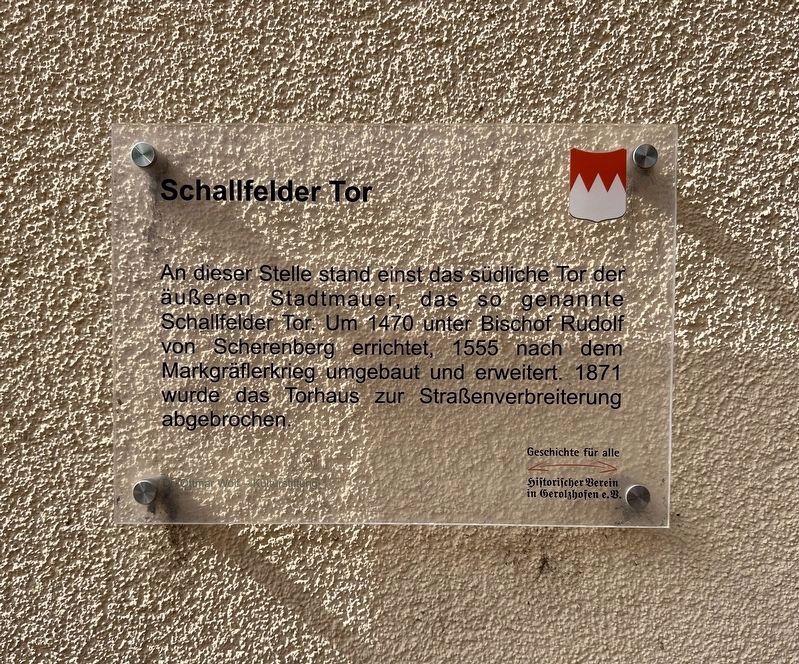
1. Schallfelder Tor / Schallfeld Gate Marker

An dieser Stelle stand einst das südliche Tor der außeren Stadtmauer, das so genannte Schallfelder Tor. Um 1470 unter Bischof Rudolf von Scherenberg errichtet, 1555 nach dem Markgräflerkrieg umgebaut und erweitert. 1871 wurde das Torhaus zur Straßenverbreiterung abgebrochen.
At this location on the outer city wall was the southern gate, the so called Scallfeld Gate. Built around 1470 under Bishop Rudolf Scherenberg, rebuilt and expanded in 1555 during the Margravial War. Demolished in 1871 due to road widening.
Erected by Historischer Verein in Gerolzhofen e.V.
Topics. This historical marker is listed in this topic list: Forts and Castles. A significant historical year for this entry is 1470.
Location. 49° 53.923′ N, 10° 21.097′ E. Marker is in Gerolzhofen, Bayern (Bavaria), in Schweinfurt. It is on Schallfelder Straße, on the left when traveling north. Touch for map. Marker is at or near this postal address: Schallfelder Straße 22, Gerolzhofen BY 97447, Germany. Touch for directions.

Regionally, it is in Europe, the European Union, Atlantic Europe, Central Europe, the
this page online
Other nearby markers. At least 8 other markers are within walking distance of this marker: The Decline of the Jewish Community of Gerolzhofen from January 30, 1933 (about 120 meters away, measured in a direct line); Spital Gate (about 150 meters away); The Former Adminstrative Building (about 180 meters away); The Beadle’s Tower (about 180 meters away); Bürgerspital / Municipal Hospital (about 210 meters away); Spottfratze, ca. 1450 (about 210 meters away); "Gerolzhöfer Frauenaufstand" / The Gerolzhofen "Womens' Revolt" (about 210 meters away); Dingolshäuser Gate (about 210 meters away). Touch for a list and map of all markers in Gerolzhofen.
Photographed by Andrew Ruppenstein, September 21, 2023
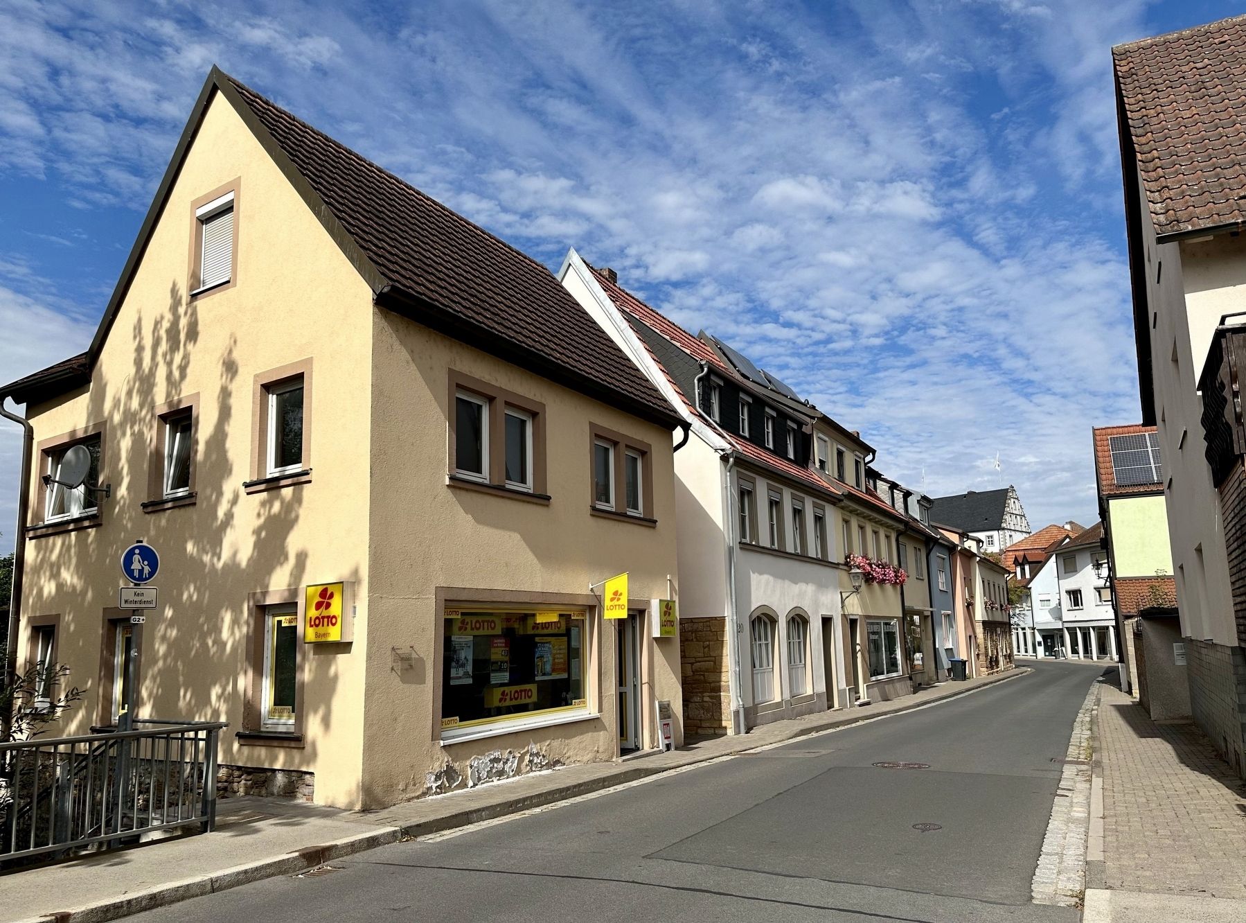
2. Schallfelder Tor / Schallfeld Gate Marker - wide view
The marker is visible here on the corner of the building with the “Lotto” signs.
Credits. This page was last revised on September 24, 2023. It was originally submitted on September 24, 2023, by Andrew Ruppenstein of Lamorinda, California. This page has been viewed 112 times since then and 7 times this year. Photos: 1, 2. submitted on September 24, 2023, by Andrew Ruppenstein of Lamorinda, California.
