Russellville in Conway County, Arkansas — The American South (West South Central)
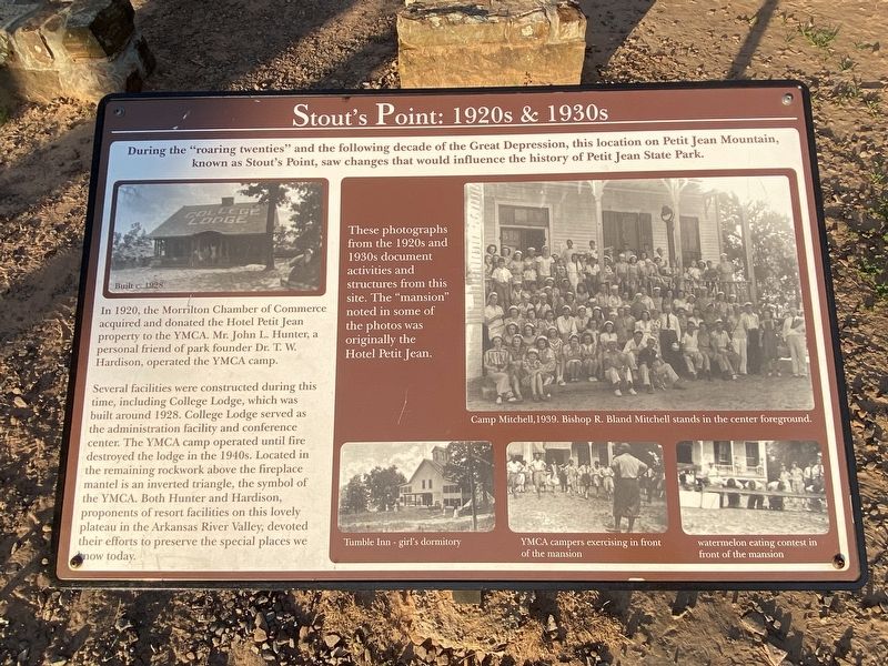
Stout's Point: 1920s & 1930s
In 1920, the Morrilton Chamber of Commerce acquired and donated the Hotel Petit Jean property to the YMCA. Mr. John L. Hunter, a personal friend of park founder Dr. T. W. Hardison, operated the YMCA camp.
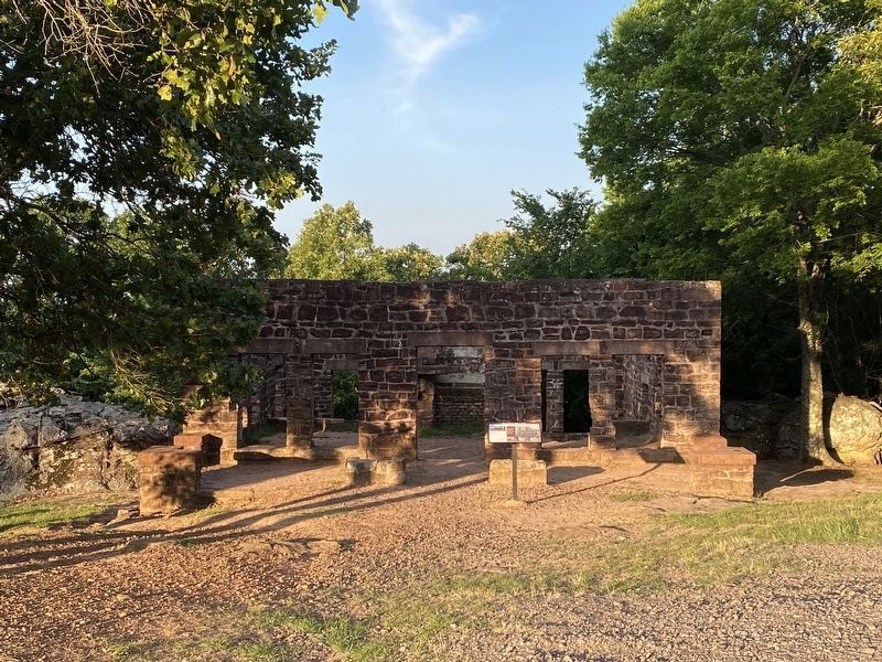
Several facilities were constructed during this time, including College Lodge, which was built around 1928. College Lodge served as the administration facility and conference center. The YMCA camp operated until fire destroyed the lodge in the 1940s. Located in the remaining rockwork above the fireplace mantel is an inverted triangle, the symbol of the YMCA. Both Hunter and Hardison, proponents of resort facilities on this lovely plateau in the Arkansas River Valley, devoted their efforts to preserve the special places we know today.
These photographs from the 1920s and 1930s document activities and structures from this site. The "mansion" noted in some of the photos was originally the Hotel Petit Jean.
Top photo caption: Camp Mitchell, 1939. Bishop R. Bland Mitchell stands in the center foreground.
Bottom left photo caption: Tumble Inn- girl's dormitory.
Bottom center photo caption: YMCA campers exercising in front of the mansion.
Bottom right photo caption: Watermelon eating contest in front of the mansion.
Topics. This historical marker is listed in these topic lists: Industry & Commerce • Parks & Recreational Areas.
Location. 35° 7.672′ N, 92° 50.44′ W. Marker is in Russellville, Arkansas, in Conway County. Marker is on Stouts Point, on the right when traveling east. Touch for map. Marker is in this post office area: Morrilton AR 72110, United States of America. Touch for directions.
Other nearby markers. At least 8 other markers are within 5 miles of this marker, measured as the crow flies. Stout's Point: Your Legacy (about 400 feet away, measured in a direct line); Petit Jean Mountain and the Trail of Tears (about 400 feet away); The Legend of Petit Jean (about 500 feet away); Arkansas River of Yesterday (about 500 feet away); A Vision for the Future (approx. 4.4 miles away); The CCC at Petit Jean State Park (approx. 4.7 miles away); Civilian Conservation Corps and the Building of Arkansas's First State Park (approx. 4.7 miles away); What was the Civilian Conservation Corps? (approx. 4.7 miles away). Touch for a list and map of all markers in Russellville.
Credits. This page was last revised on October 3, 2023. It was originally submitted on September 29, 2023, by Darren Jefferson Clay of Duluth, Georgia. This page has been viewed 60 times since then and 16 times this year. Photos: 1, 2. submitted on October 2, 2023, by Darren Jefferson Clay of Duluth, Georgia. • Andrew Ruppenstein was the editor who published this page.

