Jerusalem, Jerusalem District, Israel — The Middle East (West Asia)
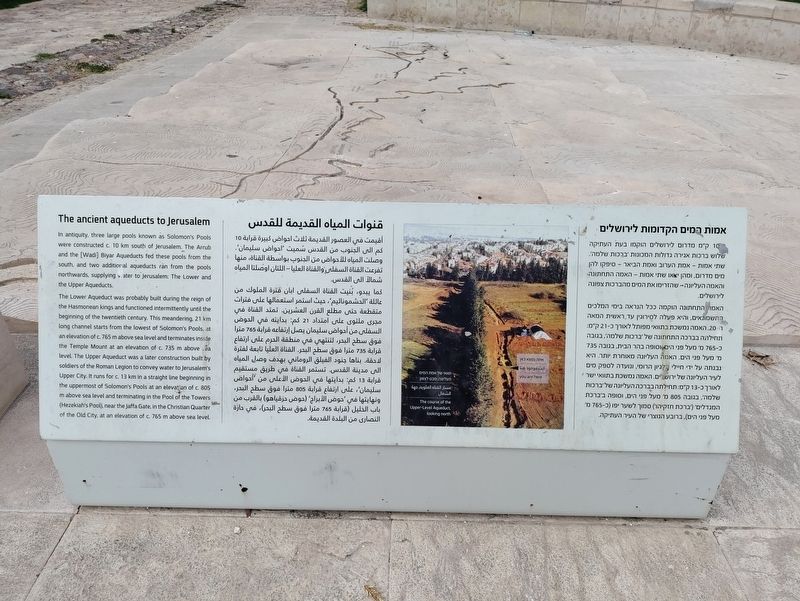
The ancient aqueducts to Jerusalem
כ10 ק״מ מדרום לירושלים הוקמו בעת העתיקה שלוש ברכות אגירה גדולות המכונות ׳ברכות שלמה׳. שתי אמות - אמת הערוב ואמת הביאר - סיפקו להן מים מדרום, ומהן יצאו שתי אמות - האמה התחתונה והאמה העליונה - שהזרימו את המים מהברכות צפונה לירושלים. האמה התחתונה הוקמה ככל הנראה בימי המלכים החשמונאים, והיא פעלה לסירוגין עד ראשית המאה ה-20. האמה נמשכת בתוואי מפותל לאורך כ-21 ק"מ ותחילתה בברכה התחתונה של ׳ברכות שלמה', בגובה כ-765 מ' מעל פני הים וסופה בהר הבית, בגובה 735 מ' מעל פני הים. האמה העליונה מאוחרת יותר, היא נבנתה על ידי חיילי הלגיון הרומי, ונועדה לספק מים לעיר העליונה של ירושלים. האמה נמשכת בתוואי ישר לאורך כ-13 ק"מ. תחילתה בברכה העליונה של ׳ברכות שלמה׳, בגובה 805 מ' מעל פני הים, וסופה ב׳ברכת המגדלים׳ (׳ברכת חזקיהו׳) סמוך לשער יפו (כ-765 מ' מעל פני הים), ברובע הנוצרי של העיר העתיקה.
أقيمت في العصور القديمة ثلاث احواض كبيرة قرابة 10 كم الى الجنوب من القدس شميت احواض سليمان. وصلت المياه للأحواض من الجنوب بواسطة القناة، منها تفرعت القناة السفلى والقناة العليا - اللتان أوصلتا المياه شمالاً إلى القدس. كما يبدو بنيت القناة السفلى ابان فترة الملوك من عائلة الحشموناثيم، حيث استمر استعمالها على فترات متقطعة حتى مطلع القرن العشرين تمتد القناة في مجری ملتوى على امتداد 21 كم: بدايته في الحوض السفلى من أحواض سليمان يصل ارتفاعه قرابة 765 مترا فوق سطح البحر، لتنتهي في منطقة الحرم على ارتفاع قرابة 735 مترا فوق سطح البحر. القناة العليا تابعة لفترة لاحقة بناها جنود الفيلق الروماني بهدف وصل المياه الى مدينة القدس. تستمر القناة في طريق مستقيم قرابة 13 كم بدايتها في الحوض الأعلى من أحواض سليمان على ارتفاع قرابة 805 مترا فوق سطح البحر. ونهايتها في حوض الأبراج (حوض (حزقياهو) بالقرب من باب الخليل (قرابة 765 مترا فوق سطح البحر)، في حارة النصارى من البلدة القديمة.
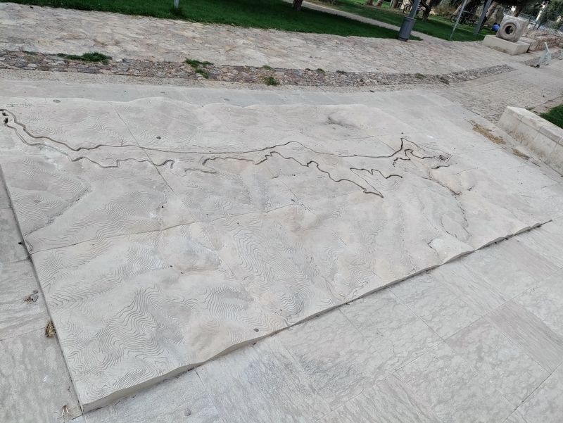
In antiquity, three large pools known as Solomon's Pools were constructed c. 10 km south of jerusalem. The Arub and the [Wadi] Biyar Aqueducts fed these pools from the south, and two additonal aqueducts ran from the pools northwards, supplying water to Jerusalem: The Lower and the Upper Aqueducts. The Lower Aqueduct was probably built during the reign of the Hasmonean kings and functioned intermittently until the beginning of the twentieth century. This meandering, 21 km long channel starts from the lowest of Solomons Pools, at an elevation of c. 765 m above sea level and terminates inside the Temple Mount at an elevation of c. 735 m above sea level. The Upper Aqueduct was a later construction built by solders of the Roman Legion to convey water to Jerusalem Upper City. It runs for c. 13 km in a straight line beginning in the uppermost of Soloman's Pools at an elevation of 805 above sea level and terminating in the Pool of the Towers (Hezekiah's Pool), near the Jaffa Gate, in the Christian Quarter of the Old City, at an elevation of c. 765 m above sea level.
Topics. This historical marker is listed in this topic list: Man-Made Features.
Location. 31° 44.713′ N, 35° 13.104′ E. Marker is in Jerusalem, Jerusalem District. Marker can be reached from Hashofet Haim Cohen Street. Touch for map. Marker is at or near this postal address: Hashofet Haim Cohen St 16, Jerusalem, Jerusalem District, Israel. Touch for directions.
Other nearby markers. At least 8 other markers are within 3 kilometers of this marker, measured as the crow flies. Arnona Neighborhood (approx. 0.4 kilometers away); Ben Yehuda House (approx. one kilometer away); Departure and Expulsion Memorial (approx. 2 kilometers away); The Temple Society People's House (approx. 2.5 kilometers away); Cave 24 (approx. 2.7 kilometers away); Ketef Hinnom (approx. 2.7 kilometers away); The Priestly Blessing (approx. 2.7 kilometers away); Tombs from the First Temple Period (approx. 2.8 kilometers away). Touch for a list and map of all markers in Jerusalem.
Also see . . .
1. Solomon's pools on Wikipedia. (Submitted on October 1, 2023, by Uri Mogilevsky of Jerusalem, Israel.)
2. A detailed article about the uncovering and preservation of the aqueduct remains (in Hebrew). (Submitted on October 1, 2023, by Uri Mogilevsky of Jerusalem, Israel.)
Credits. This page was last revised on October 6, 2023. It was originally submitted on October 1, 2023, by Uri Mogilevsky of Jerusalem, Israel. This page has been viewed 40 times since then and 6 times this year. Photos: 1, 2. submitted on October 1, 2023, by Uri Mogilevsky of Jerusalem, Israel. • Andrew Ruppenstein was the editor who published this page.

