Leesylvania in Prince William County, Virginia — The American South (Mid-Atlantic)
The Freestone Fisheries
February 18, 2008
1. The Freestone Fisheries Marker
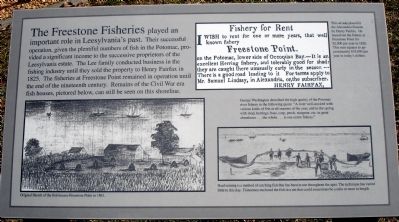
George Washington described the high quality of the Potomac river fishery in the following quote: "A river well-stocked with various kinds of fish at all seasons of the year, and in the spring with shad, herrings, bass, carp, perch, sturgeon, etc. in great abundance...the whole...is one entire fishery."
Erected by Leesylvania State Park.
Topics. This historical marker is listed in these topic lists: Industry & Commerce • Natural Resources. A significant historical year for this entry is 1825.
Location. 38° 35.385′ N, 77° 14.951′ W. Marker is in Leesylvania, Virginia, in Prince William
this page online

Regionally, this marker is in the Washington Metropolitan Area, in Northern Virginia, and in the Piedmont. It is also in the American South, specifically in the Upper South, in the Mid-Atlantic, and on the Eastern Seaboard. Globally, it is in the North Atlantic Region, North America, the Western Hemisphere, the Western World, and the Anglosphere. Historically, it finds itself in what was once the territory of the Mississippian Culture, one of the original Thirteen Colonies, one of the Confederate States of America, and the Antebellum South.
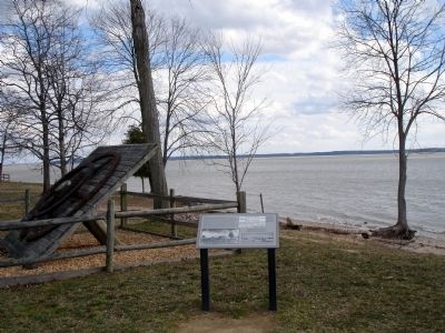
Other nearby markers. At least 8 other markers are within walking distance of this marker: Iron Pulley Wheel (here, next to this marker); Swimming in Bounty (within shouting distance of this marker); “Pleasureland of the East” (within shouting distance of this marker); "Light Horse Harry" Lee (about 500 feet away, measured in a direct
February 18, 2008
2. The Freestone Fisheries Marker
Another marker is no longer nearby. Freestone Point Earthworks (was about 600 feet away but has been permanently removed).
More about this marker. On the lower left of the marker is a sketch captioned, Original Sketch of the fish houses Freestone Point in 1861.
On the upper right of the marker is a reproduction captioned, This ad was placed in the Alexandria Gazette by Henry Fairfax. He leased out the fishery at Freestone Point for $2,000 per year in 1826. This sum equates to approximately $35,000 per year in today's dollars.
On the bottom right of the marker is a sketch captioned, Haul seining is a method of catching fish that has been in use throughout the ages. The technique has varied little to this day. Fishermen enclosed the fish in a net that could sometimes be a mile or more in length.
Also see . . .
1. Leesylvania State Park. (Submitted on December 6, 2008.)
2. Official records of the Union and Confederate Navies in the War of the Rebellion.
February 18, 2008
3. Iron Pulley Wheel
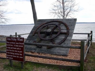
From the interperative marker: This artifact was found buried here. It likely served to help pull boats and or nets from the river as part of the fishing activity that occured here for over 100 years.
Credits. This page was last revised on October 20, 2023. It was originally submitted on December 6, 2008. This page has been viewed 1,164 times since then and 25 times this year. Last updated on October 3, 2023. Photos: 1, 2, 3. submitted on December 6, 2008. • Bill Pfingsten was the editor who published this page.
