Perth in Lanark County, Ontario — Central Canada (North America)
Tay Crossings
Stewart Park
— Tay River Trail • Overland, Over Water, Over Time —
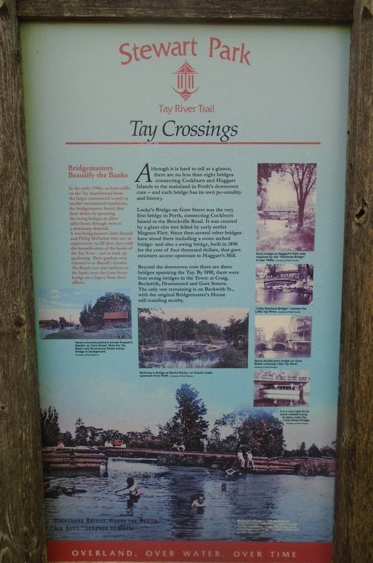
Although it is hard to tell at a glance, there are no less than eight bridges connecting Cockburn and Haggart Islands to the mainland in Perth's downtown core - and each bridge has its own personality and history.
Locke's Bridge on Gore Street was the very first bridge in Perth, connecting Cockburn Island to the Brockville Road. It was created by a giant elm tree felled by early settler Magnus Flett. Since then several other bridges have stood there including a stone arched bridge - and also a swing bridge, built in 1890 for the cost of four thousand dollars, that gave steamers access upstream to Haggart's Mill.
Beyond the downtown core there are three bridges spanning the Tay. By 1890, there were four swing bridges in the Town: at Craig, Beckwith, Drummond and Gore Streets. The only one remaining is on Beckwith St., with the original Bridgemaster's House still standing nearby.
Bridgemasters Beautify the Banks
In the early 1900s, as boat traffic on the Tay transformed from the larger commercial vessels to smaller recreational runabouts, the bridgemasters found that their duties in operating the swing bridges to allow taller boats through were at a minimum demand.
It was bridgemasters John Russell and Philip McParlan who saw an opportunity to fill their days with the beautification of the banks of the Tay River - and so took up gardening. These gardens were referred to as Russell's Garden. The floral crest and emblem on the banks near the Gore Street bridge are a legacy from their efforts.
[Photo captions, clockwise from top right, read]
• Early bridge at Haggart's Dam was replaced by the "Rainbow Bridge" in late 1900s.
• "Little Rainbow Bridge" crosses the Little Tay River.
• Stone double-arch bridge on Gore Street crossing Little Tay River.
• It is a very tight fit for some vessels trying to pass under the Craig Street Bridge.
• Matheson's Bridge in 1905 showing the "Perth Old Boys" swimming as part of a large reunion celebration. Today, this bridge leads to the Perth Links O'Tay - Canada's oldest golf course.
• McKinley's Bridge at Devil's Rock, on Grants Creek upstream from Perth.
• Hand-coloured postcard shows Russell's Garden on Gore Street. Note the Tay Basin and Drummond Street swing bridge in background.
Topics. This historical marker is listed in these topic lists: Bridges & Viaducts • Waterways & Vessels. A significant historical year for this entry is 1890.
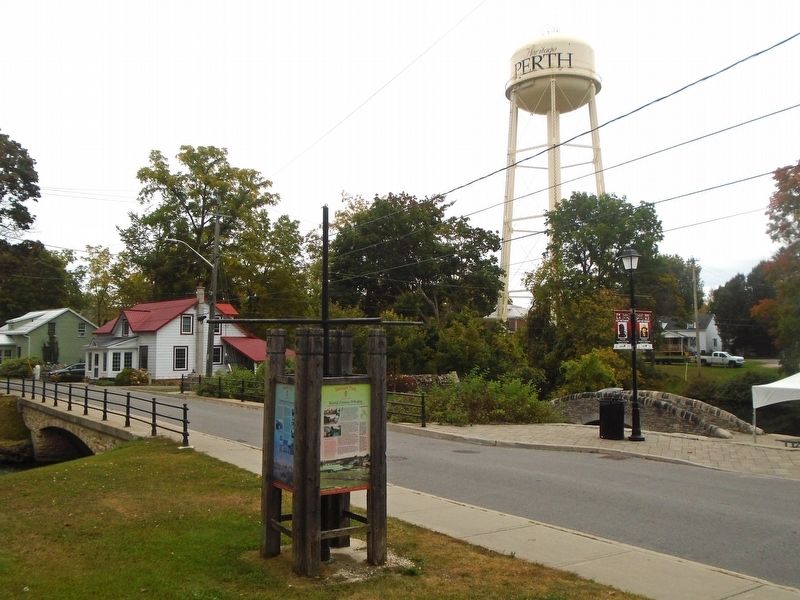
Location. 44° 53.878′ N, 76° 14.987′ W. Marker is in Perth, Ontario, in Lanark County. Marker is on Mill Street just south of Market Street, on the right when traveling
south. Marker is along the southern border of Stewart Park. Touch for map. Marker is at or near this postal address: 41 Mill Street, Perth ON K7H 1W2, Canada. Touch for directions.
Other nearby markers. At least 8 other markers are within walking distance of this marker. World-Famous Whiskey (here, next to this marker); Stewart's Legacy (here, next to this marker); Centrestage for Community (here, next to this marker); Perth Town Hall / l'Hôtel de Ville de Perth (about 150 meters away, measured in a direct line); The Prince of Wales Prize / Le Prix du Prince de Galles (about 150 meters away); Doran-Riverside Building (about 180 meters away); Perth Military Settlement 1816 (about 180 meters away); The Old Perth Post Office / The Crain Building (about 180 meters away). Touch for a list and map of all markers in Perth.
Also see . . . Bridges of Perth Walking Tour. (Submitted on October 3, 2023, by William Fischer, Jr. of Scranton, Pennsylvania.)
Additional keywords. Tay Crossings
Credits. This page was last revised on October 3, 2023. It was originally submitted on October 3, 2023, by William Fischer, Jr. of Scranton, Pennsylvania. This page has been viewed 38 times since then and 5 times this year. Photos: 1, 2. submitted on October 3, 2023, by William Fischer, Jr. of Scranton, Pennsylvania.

