Near Oroville in Butte County, California — The American West (Pacific Coastal)
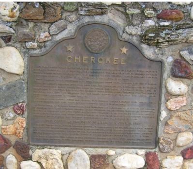
Cherokee
First diamonds in U.S. discovered here 1858. Hundreds found since. Largest weighing 6 carats.
Site of world's greatest hydraulic gold mine, the Spring Valley, a consolidation of smaller claims comprising 26,000 acres, 100 miles of tunnel and canal, 9 miles of sluice box, 11 reservoirs, 18 monitors, world-famous inverted flume, and the 40-mile "Cherokee Strip" to impound tailings. Over 300 men employed day and night. Illumined by brilliant arc lights, gold production exceeded 15-million dollars.
President Rutherford B. Hayes and General W. T. Sherman toured workings 1880. Thomas Edison, W. R. Vanderbilt, and Vice President T. A. Hendricks held interests here.
Notable pioneers included Louis Glass, Mine Secretary and Telegraph Agent 1871-89; and Gardner F. Williams, Mine Superintendent 1880-84. Glass pioneered the telephone industry of California, serving as director and vice president, Pacific Telephone & Telegraph Co. 1889-1919. Williams subsequently sailed for South Africa, where he and Cecil Rhodes amalgamated renowned Kimberley Diamond Mines into DeBeers Consolidated, which he managed 19 years.
—Dedicated at the dawn of a new era, June 11, 1967—
Plaque placed by California Heritage Council, in cooperation with the Cherokee Nation, DeBeers Consolidated Mines, Pacific Telephone & Telegraph Co., Butte County Historical Society, and Mr. & Mrs. James Lenhoff. Orator of the day: A. Gardner Williams, honored dignitaries: Governor Ronald Reagan, Chief W.W. Neeler, James G. Nisbey, Herbert Hoover III, Mattie R. Lund.
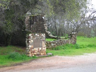
Monument erected from native Placer specimens, diamond ore from South Africa, and memorial stones from Cherokee Capitol and Hale Seminary, Tahlequah, Oklahoma. Ken L. Brockman, Mason.
Erected 1967 by California Heritage Council.
Topics and series. This historical marker is listed in these topic lists: Native Americans • Natural Resources • Settlements & Settlers. In addition, it is included in the Former U.S. Presidents: #40 Ronald Reagan series list. A significant historical month for this entry is June 1823.
Location. 39° 38.767′ N, 121° 32.312′ W. Marker is near Oroville, California, in Butte County. Marker is on Cherokee Road, 1˝ miles east of North General Sherman Way, on the left when traveling north. It is across the street from the Cherokee Museum. Touch for map. Marker is at or near this postal address: 4226 Cherokee Road, Oroville CA 95965, United States of America. Touch for directions.
Other nearby markers. At least 5 other markers are within 4 miles of this marker, measured as the crow flies. 1879 Site of Messilla Valley School (approx. 2˝ miles away); Nelsons Bar (approx. 3.7 miles away); Oregon City (approx. 3.7 miles away); Oregon City Cemetery (approx. 3.9 miles away); Yankee Hill (approx. 4.1 miles away). Touch for a list and map of all markers in Oroville.
Also see . . .
1. More Tales from the Mines. (Submitted on April 9, 2006, by Karen Key of Sacramento, California.)
2. The Remains of Cherokee: A California Gold Rush Town. (Submitted on April 9, 2006, by Karen Key of Sacramento, California.)
Credits. This page was last revised on July 14, 2019. It was originally submitted on April 9, 2006, by Karen Key of Sacramento, California. This page has been viewed 5,752 times since then and 379 times this year. Photos: 1, 2. submitted on April 9, 2006, by Karen Key of Sacramento, California. • J. J. Prats was the editor who published this page.

