Harpers Ferry in Jefferson County, West Virginia — The American South (Appalachia)
Racing West
Harpers Ferry National Historical Park
| — | National Park Service, U.S. Department of the Interior | — |
Photographed by Craig Swain, July 11, 2009
1. Racing West Marker
Erected by National Park Service, U.S. Department of the Interior.
Topics. This historical marker is listed in this topic list: Railroads & Streetcars. A significant historical year for this entry is 1838.
Location. 39° 19.447′ N, 77° 43.794′ W. Marker is in Harpers Ferry, West Virginia, in Jefferson County. It can be reached from Potomac Street, on the right when traveling west. Touch for map. Marker is in this post office area: Harpers Ferry WV 25425, United States of America. Touch for directions.

Regionally, this marker is in the Washington Metropolitan Area and in the Eastern Panhandle. It
this page online
Other nearby markers. At least 8 other markers are within walking distance of this marker: Smith and Forging Shop (a few steps from this marker); My Favorite Boat (a few steps from this marker); Found Underground (a few steps from this marker); Power of the Potomac (a few steps from this marker); Tailrace (within shouting distance of this marker); Home of Joseph Perkins (within shouting distance of this marker); A Perfect Heap of Ruins (within shouting distance of this marker); Daring Escapes (within shouting distance of this marker). Touch for a list and map of all markers in Harpers Ferry.
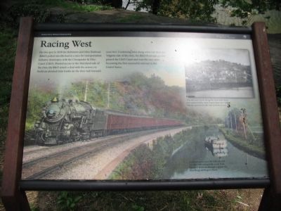
More about this marker. The background of the marker shows a train passing the C&O Canal. Unable to pass over the hills around you, the railroad and the canal both followed the river through a gap in the Blue Ridge at Harpers Ferry.
Photographed by Craig Swain, July 11, 2009
2. Racing West Marker
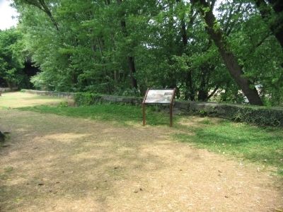
The marker stands next to the river wall along the Potomac.
Photographed by Craig Swain, July 11, 2009
3. Modern Railroad Bridge
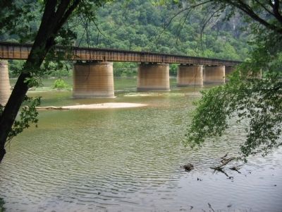
The B&O has shifted the rail lines at least three times. The first, mentioned on the marker, passed along the river wall. The second passed further inland along what is today a berm along Potomac Street. The last crosses the river at a less critical angle to a point roughly in the middle of the old Armory site.
Credits. This page was last revised on June 14, 2020. It was originally submitted on October 17, 2009, by Craig Swain of Leesburg, Virginia. This page has been viewed 888 times since then and 31 times this year. Photos: 1, 2, 3. submitted on October 17, 2009, by Craig Swain of Leesburg, Virginia.
