Ridgefield in Fairfield County, Connecticut — The American Northeast (New England)
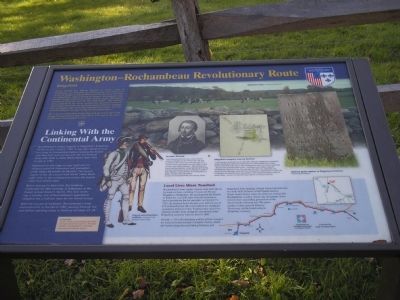
Washington – Rochambeau Revolutionary Route
Ridgefield
Inscription.
French General Jean-Baptiste Donatien de Vimeur, Comte de Rochambeau, and thousands of French ground and naval forces arrived in Newport in July of 1780 to assist the Americans in the War for Independence. After wintering in Newport, Rochambeau’s troops marched through Connecticut to join General George Washington’s Continental Army, just over the New York border. The combined forces moved down the eastern seaboard and confronted Lieutenant General Lord Cornwallis and the British army in Yorktown, Virginia. After a prolonged siege, Cornwallis surrendered on October 19, 1781, effectively ending the war and ensuring American independence.
This is one of 11 informative panels that mark the French route south through Connecticut from June 19 to July 2, 1781 and on the return north October 23 to November 9, 1782.
Linking with the Continental Army
Rochambeau’s troops camped in Ridgefield’s Ridgebury Parish on July 1 and 2, 1781. It was their eleventh and last camp in Connecticut before crossing the border into New York and joining the Continental Army near what is today White Plains, New York on July 3, 1781.
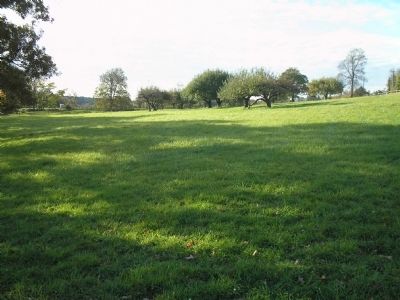
Deployed on the ridge to your right was his advance guard of chausseurs and grenadiers under Major Alexandre de Berthier. The Hussar Legion of duc de Lauzun took North Salem Road eight miles to the southwest to screen the French camp from British spies.
Before leaving for New York, Rochambeau celebrated his 56th birthday in Ridgebury at the Ensign Samuel Keeler’s Tavern. The next morning, a Sunday, one of Rochambeau’s regimental chaplains led a Catholic mass for the French troops.
After the success at Yorktown, Rochambeau’s army returned north in the fall of 1782, passing through the area before reaching camp in Danbury October 23-24.
Local Lives were Touched
Rochambeau’s army supply wagons were often driven by hired civilians, including 17-year-old Thomas Boughton of Ridgebury. He accompanied the French to Yorktown, over 400 miles from his hometown, and witnessed the British surrender on October 19, 1781. He returned home the next year with his pay of $75 in French silver. He soon married his childhood sweetheart, Rebecca Coley. Together they raised five children on their farm. Boughton was buried in the Ridgebury cemetery when he died in 1846.
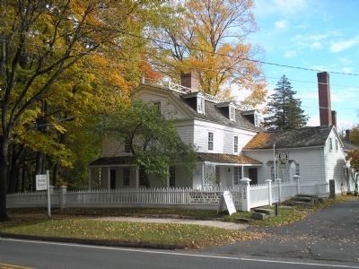
On July 1, 1781, Rochambeau and his officers stopped for water at the homestead of Stephen Norris, which still stands along the road linking Danbury and Ridgefield. That morning, Abigail Norris had delivered her sixth child. In honor of the French mission, Norris family history states the child was named after Rochambeau’s cavalry officer, duc de Lauzun. Town records show succeeding generations of the Norris family followed suit. The grave marker of nine-year-old Delazon Norris may still be found today in Ridgebury cemetery.
Topics and series. This historical marker is listed in this topic list: War, US Revolutionary. In addition, it is included in the Former U.S. Presidents: #01 George Washington, and the The Washington-Rochambeau Route series lists. A significant historical month for this entry is June 1838.
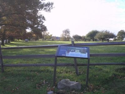
Location. 41° 20.841′ N, 73° 31.671′ W. Marker is in Ridgefield, Connecticut, in Fairfield County. Marker is at the intersection of Ridgebury Road and Old Stagecoach Road, on the left when traveling south on Ridgebury Road. Touch for map. Marker is in this post office area: Ridgefield CT 06877, United States of America. Touch for directions.
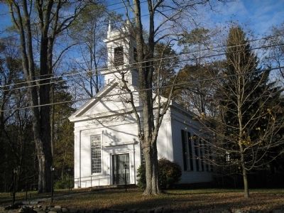
Other nearby markers. At least 8 other markers are within 4 miles of this marker, measured as the crow flies. Ridgebury Congregational Church (approx. 0.9 miles away); Ridgebury – George Washington Slept Here (approx. 0.9 miles away); Peach Pond Cemetery (approx. 2.2 miles away in New York); Balanced Rock (approx. 2½ miles away in New York); Gen. David Wooster (approx. 3.1 miles away); Place Where Wooster Fell (approx. 3.1 miles away); Our Warning Ring (approx. 3.3 miles away in New York); June Cemetery (approx. 3.4 miles away in New York). Touch for a list and map of all markers in Ridgefield.
More about this marker. Several pictures appear on the marker. The Berthler Portrait has a caption of “Louis Alexandre Berthier drew careful, precise maps of campsites for the French army. He was an officer in the French army since the age of 17, having learned cartography from his father, a court surveyor and military engineer. After returning to France, Berthier became a major general and during the French Revolution served as Napoleon’s chief of staff. Napoleon valued Berthier for his attention to detail, accuracy and organization. Courtesy of the Neuchotel Public and University Library” Next to the portrait of Berthler is an example of his work, entitled Ridgefield campsite map by Berthier. It has a caption of “A rural farming community of no more than 500 souls, Ridgebury’s population swelled significantly when the French army of 4,700 camped here. A map drawn by Berthler of the July 1, 1781 encampment shows two French regiments – Bourbonnais and Royal Deux-Ponts – encamped with artillery opposite the Ridgebury Meeting House. The next day, the other two regiments, the Soissonals and Saintonge, marched in from Newtown. Leveled by fire in 1851, the Congressional Meeting House was rebuilt on the original foundation where it stands today. Courtesy of the Berthler Map Collection of Princeton University.” Next to this is a photo of the “Delazon grave marker in Ridgebury Cemetery.
Photo by John Muldeon.” The bottom of the marker contains a map showing the locations of the Washington – Rochambeau Revolutionary Route markers located in Connecticut.
Credits. This page was last revised on June 16, 2016. It was originally submitted on October 17, 2009, by Bill Coughlin of Woodland Park, New Jersey. This page has been viewed 2,237 times since then and 42 times this year. Photos: 1, 2, 3, 4, 5, 6. submitted on October 17, 2009, by Bill Coughlin of Woodland Park, New Jersey.
