Dundas in Hamilton, Ontario — Central Canada (North America)
Dundas Driving Park: A Focal Point In Dundas For Over A Century
Inscription.
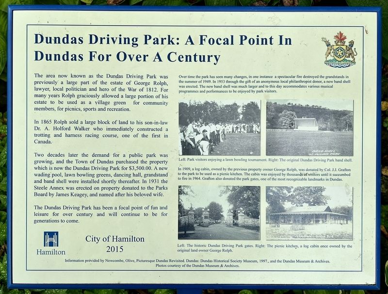
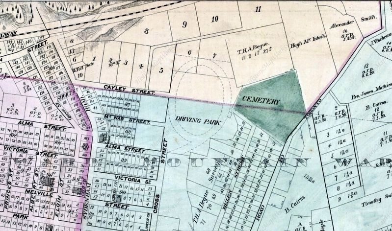
The area now known as the Dundas Driving Park was previously a large part of the estate of George Rolph, lawyer, local politician and hero of the War of 1812. For many years Rolph graciously allowed a large portion of his estate to be used as a village green for community members, for picnics, sports and recreation.
In 1865 Rolph sold a large block of land to his son-in-law Dr. A. Holford Walker who immediately constructed a trotting and harness racing course, one of the first in Canada.
Two decades later the demand for a public park was growing, and the Town of Dundas purchased the property which is now the Dundas Driving Park for $3,500.00. A new wading pool, lawn bowling greens, dancing hall, grandstand and band shell were installed shortly thereafter. In 1931 the Steele Annex was erected on property donated to the Parks Board by James Keagey, and named after his beloved wife.
The Dundas Driving Park has been a focal point of fun and leisure for over century and will continue to be for generations to come.
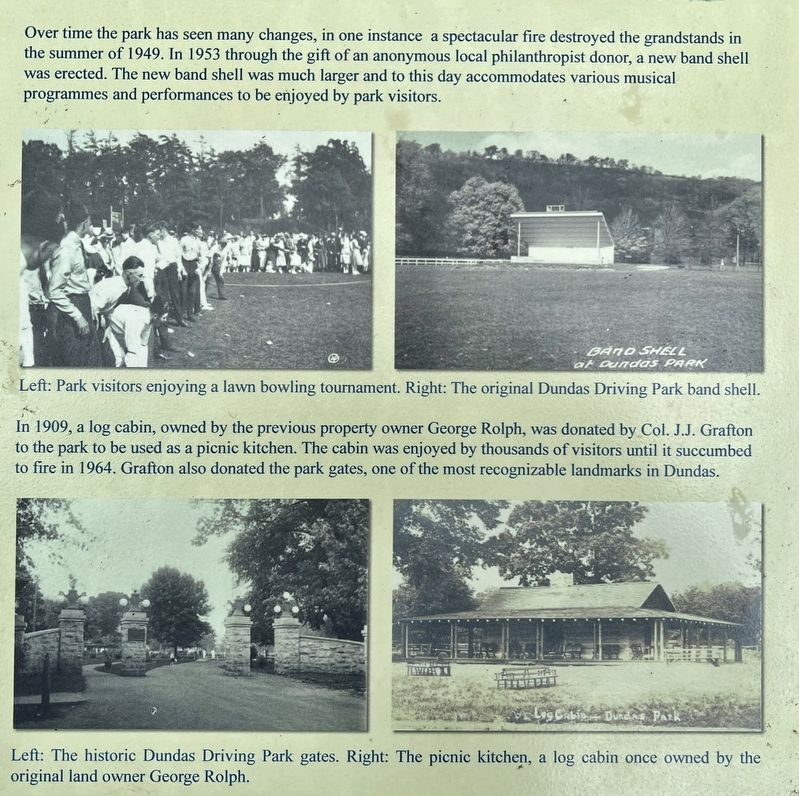
Over time the park has seen many changes, in one instance a spectacular fire destroyed the grandstands in the summer of 1949. In 1953 through the gift of an anonymous local philanthropist donor, a new band shell was crected. The new band shell was much larger and to this day accommodates various musical programmes and performances to be enjoyed by park visitors.
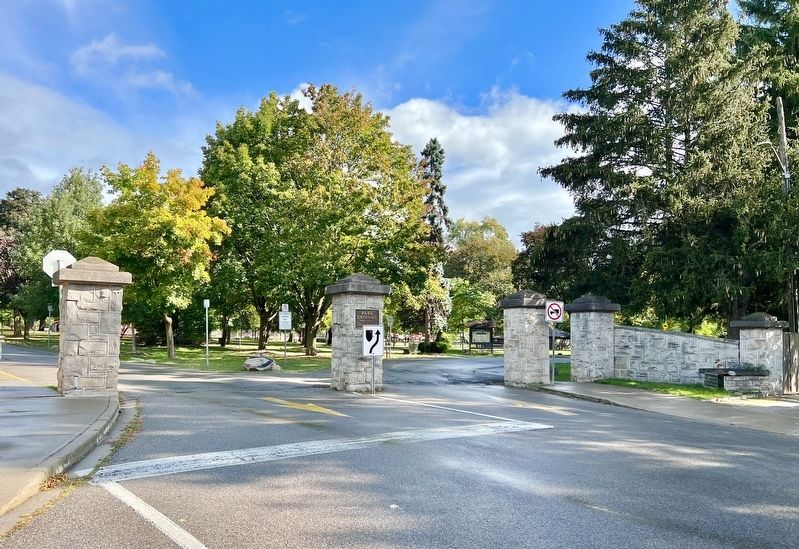
In 1909, a log cabin, owned by the previous property owner George Rolph, was donated by Col. J.J. Grafton to the park to be used as a picnic kitchen. The cabin was enjoyed by thousands of visitors until it succumbed to fire in 1964. Grafton also donated the park gates, one of the most recognizable landmarks in Dundas.
City of Hamilton
2015
Information provided by Newcombe, Olive, Picturesque Dundas Revisited. Dundas: Dundas Historical Society Museum, 1997., and the Dundas Museum & Archives. Photos courtesy of the Dundas Museum & Archives.
Erected 2015 by City of Hamilton.
Topics. This historical marker is listed in these topic lists: Parks & Recreational Areas • Settlements & Settlers. A significant historical year for this entry is 1812.
Location. 43° 16.284′ N, 79° 57′ W. Marker is in Hamilton, Ontario. It is in Dundas. Marker is on Dundas Driving Park Road, on the right. The marker is in the Dundas Driving Park, approx. 300 metres from the park entrance at Cross Street. Touch for map. Marker is in this post office area: Hamilton ON L9H L9H, Canada. Touch for directions.
Other nearby markers. At least 8 other markers are within walking distance of this marker. The Desjardins Canal (approx. 0.7 kilometers away); The Founding of Dundas (approx. 0.8 kilometers away); a different marker also
named The Desjardins Canal (approx. 0.9 kilometers away); The Dundas Town Hall (approx. 0.9 kilometers away); “Dundas Mills” (approx. 1.1 kilometers away); Sir William Osler in Canada (approx. 1.1 kilometers away); Dundas Cenotaph (approx. 1.2 kilometers away); 102nd Wentworth Field Battery, Royal Canadian Artillery (approx. 1.2 kilometers away). Touch for a list and map of all markers in Hamilton.
Credits. This page was last revised on October 8, 2023. It was originally submitted on October 8, 2023, by Tim Boyd of Hamilton, Ontario. This page has been viewed 95 times since then and 41 times this year. Photos: 1, 2, 3, 4, 5, 6. submitted on October 8, 2023, by Tim Boyd of Hamilton, Ontario. • Andrew Ruppenstein was the editor who published this page.
