Ridgebury near Ridgefield in Western Region, Connecticut — The American Northeast (New England)
Ridgebury Congregational Church
Photographed by Bill Coughlin, October 17, 2009
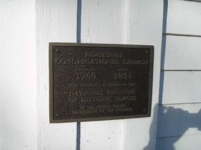
1. Ridgebury Congregational Church Marker
1760 1851
This property is listed in the
National Register
of Historic Places
by the United States
Department of the Interior
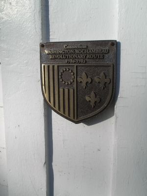
Connecticut
Washington – Rochambeau
Revolutionary Route
1780 - 1782
Topics and series. This historical marker is listed in these topic lists: Notable Buildings • Religion & Religious Structures • War, US Revolutionary. In addition, it is included in the Former U.S. Presidents: #01 George Washington, the George Washington Slept Here, and the The Washington-Rochambeau Route series lists. A significant historical year for this entry is 1760.
Location. 41° 21.645′ N, 73° 31.489′ W. Marker is near Ridgefield in Western Region, Connecticut. It is in Ridgebury. It is at the intersection of Ridgebury Road and George Washington Hwy., on the right when traveling south on Ridgebury Road. Touch for map. Marker is in this post office area: Ridgefield CT 06877, United States of America. Touch for directions.

Regionally, this marker is on the Connecticut Shoreline, on the Gold Coast, and in Greater Bridgeport. It is also in the American Northeast and in New England.
this page online
Other nearby markers. At least 8 other markers are within 4 miles of this marker, measured as the crow flies: Ridgebury – George Washington Slept Here (a few steps from this marker); Washington – Rochambeau Revolutionary Route (approx. 0.9 miles away); Peach Pond Cemetery (approx. 2.3 miles away in New York); First Engagement of the Battle of Ridgefield (approx. 3 miles away); Balanced Rock (approx. 3.1 miles away in New York); Gen. David Wooster (approx. 3.9 miles away); Place Where Wooster Fell (approx. 3.9 miles away); Our Warning Ring (approx. 3.9 miles away in New York). Touch for a list and map of all markers in Ridgefield.
Photographed by Bill Coughlin, October 17, 2009
2. Washington – Rochambeau Marker
Photographed by Bill Coughlin, October 17, 2009
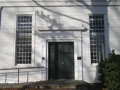
3. Ridgebury Congregational Church Markers
Markers are on either side of the front door of the church.
Photographed by Bill Coughlin, October 17, 2009
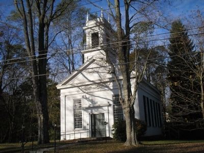
4. Ridgebury Congregational Church
A previous church, located on the foundations of this building, was part of Rochambeau's 1781 encampment. Gen. George Washington is said to have spent the night in the church while the French were here.
Credits. This page was last revised on September 10, 2026. It was originally submitted on October 18, 2009, by Bill Coughlin of Woodland Park, New Jersey. This page has been viewed 2,283 times since then and 39 times this year. Photos: 1, 2, 3, 4. submitted on October 18, 2009, by Bill Coughlin of Woodland Park, New Jersey.
