Ridgefield in Fairfield County, Connecticut — The American Northeast (New England)
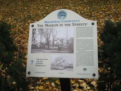
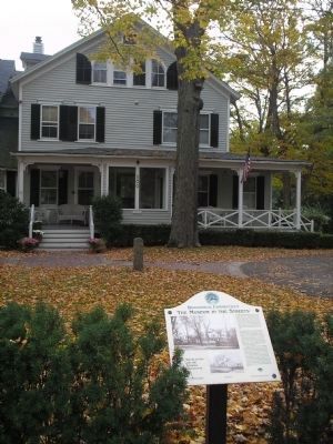
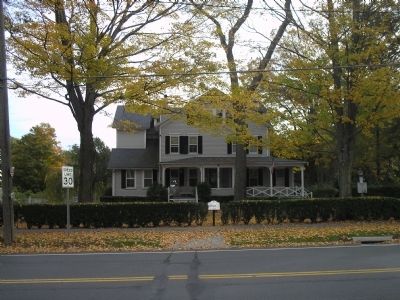
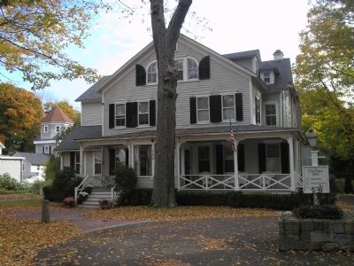
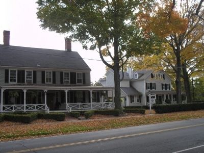
The Elms Inn and Stebbins Homestead
Ridgefield, Connecticut
— The Museum in the Streets —
In 1799, Thomas Rockwell opened a small carpentry shop which later became part of the Elms Inn. It was also a shoemaker’s shop and later, a tin shop operated by Francis Rockwell. Francis was also a vintner whose vineyard was across the street between Catoonah and Gilbert Streets. In 1860 John Rockwell opened the Elm Shade Cottages to serve wealthy New Yorkers arriving to vacation in the country during the summer months. The restaurant and inn still serve the public.
Dr. Amos Baker was a prominent physician in Ridgefield’s early history who served as surgeon’s mate with Colonel Philip Burr Bradley’s Battalion at the Battle of Ridgefield. He was also one of the early founders of the Methodist Church; classes in Methodism were held around his kitchen table. By chance, he discovered an apple. It is mentioned in The Apples of New York which states “ … that the original tree was in full bearing in its native place, Ridgefield, Conn. during the Revolutionary War.”
Benjamin Stebbins arrived in Ridgefield from Northampton, Massachusetts in 1714. He was granted a rocky plot at the northernmost part of Main Street in 1721 and built his home there six years later. He and his home were at the center of the Battle of Ridgefield in 1777 as it was next to the barricade set up to stop the British advance. Benjamin, then 86 and infirm, remained indoors throughout the battle as bullets and cannon balls struck the house. The several fires that started were soon extinguished. Stebbins lost his property soon after as he “ … joined the enemy & his Estate been by Law declared Forfeited to this State … ”
Erected by The Museum in the Streets®. (Marker Number 7.)
Topics and series. This historical marker is listed in these topic lists: Notable Buildings • War, US Revolutionary. In addition, it is included in the The Museum in the Streets®: Ridgefield, Connecticut series list. A significant historical year for this entry is 1799.
Location. 41° 17.103′ N, 73° 29.919′ W. Marker is in Ridgefield, Connecticut, in Fairfield County. Marker is at the intersection of Main Street (Connecticut Route 35) and Gilbert Street, on the right when traveling north on Main Street. Touch for map. Marker is in this post office area: Ridgefield CT 06877, United States of America. Touch for directions.
Other nearby markers. At least 8 other markers are within walking distance of this marker. The Gilbert House (about 300 feet away, measured in a direct line); The Battle of Ridgefield (about 400 feet away); Ridgefield (about 600 feet away); Smith Tavern – A Colonial Meeting Place (about 600 feet away); The Battle of Ridgefield, April 27, 1777 (about 600 feet away); Ballard Park (about 600 feet away); Battle of Ridgefield Dead (about 600 feet away); a different marker also named Battle of Ridgefield (about 700 feet away). Touch for a list and map of all markers in Ridgefield.
More about this marker. Old photographs of the Elms Inn and Stebbins Homestead appear on the marker, courtesy of the Keeler Tavern Museum and Ridgefield Historical Society.
Related markers. Click here for a list of markers that are related to this marker. Take the Museum in the Streets Walking Tour in Ridgefield, Connecticut.
Credits. This page was last revised on November 25, 2021. It was originally submitted on October 18, 2009, by Bill Coughlin of Woodland Park, New Jersey. This page has been viewed 1,681 times since then and 34 times this year. Photos: 1, 2, 3, 4, 5. submitted on October 18, 2009, by Bill Coughlin of Woodland Park, New Jersey.
