Marion in Crittenden County, Arkansas — The American South (West South Central)
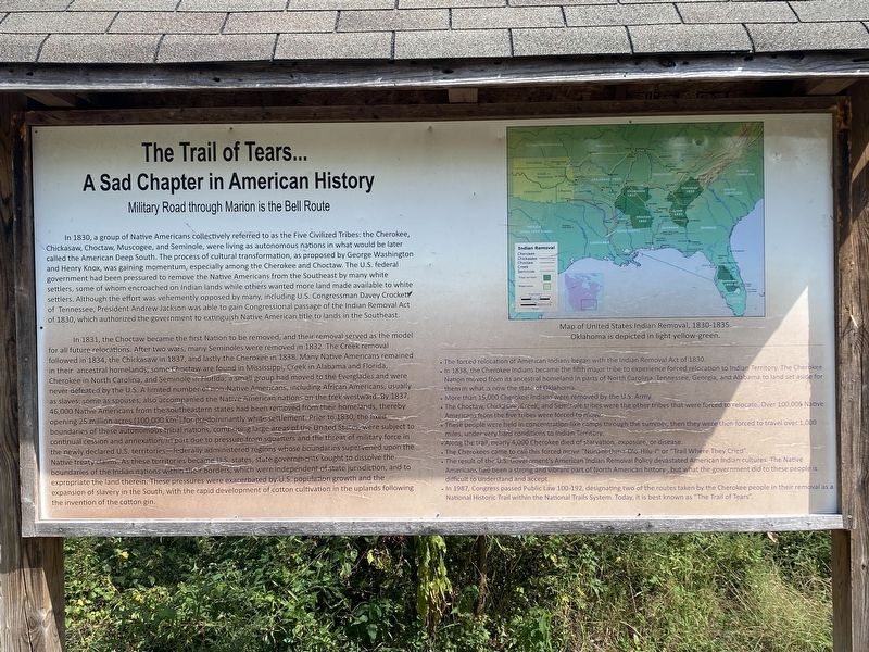
The Trail of Tears...A Sad Chapter in American History
Military Road through Marion is the Bell Route
Inscription.
In 1831, a group of Native Americans collectively referred to as the Five Civilized Tribes: the Cherokee, Chickasaw, Choctaw, Muscogee, and Seminole, were living as autonomous nations in what would be later called the American Deep South. The process of cultural transformation, as proposed by George Washington and Henry Knox, was gaining momentum, especially among the Cherokee and Choctaw. The U.S. federal government had been pressured to remove the Native Americans from the Southeast by many white settlers, some of whom encroached on Indian lands while others wanted more land made available to white settlers. Although the effort was vehemently opposed by many, including U.S. Congressman Davey Crockett of Tennessee, President Andrew Jackson was able to gain Congressional passage of the Indian Removal Act of 1830, which authorized the government to extinguish Native American title to lands in the Southeast.
In 1831, the Choctaw became the first Nation to be removed, and their removal served as the model for all future relocations. After two wars, many Seminoles were removed in 1832. The Creek removal followed in 1834, the Chickasaw in 1837, and lastly the Cherokee in 1838. Many Native Americans remained in their ancestral homelands, some Choctaw are found in Mississippi, Creek in Alabama and Florida, Cherokee in North Carolina, and Seminole in Florida; a small group had moved to the Everglades and were never defeated by the U.S. A limited number of non-Native Americans, including African Americans, usually as slaves; some as spouses, also accompanied the Native American nations on the trek westward. By 1837, 46,000 Native Americans from the southeastern states had been removed from their homelands, thereby opening 25 million acres (100,000 km²) for predominantly white settlement. Prior to 1830, the fixed boundaries of these autonomous tribal nations, comprising large areas of the United States, were subject to continual cession and annexation, in part due to pressure from squatters and the threat of military force in the newly declared U.S. territories - federally administered regions whose boundaries supervened upon the Native treaty claims. As these territories became U.S. states, state governments sought to dissolve the boundaries of the Indian nation within their borders, which were independent of state jurisdiction, and to expropriate the land therein. These pressures were exacerbated by U.S. population growth and the expansion of slavery in the South, with the rapid development of cotton cultivation in the uplands following the invention of the cotton gin.
•The forced relocation of American Indians began with the Indian Removal Act of 1830.
•In 1838, the Cherokee Indians became the
fifth major tribe to experience forced relocation to Indian Territory. The Cherokee Nation moved from its ancestral homeland in parts of North Carolina, Tennessee, Georgia, and Alabama to land set aside for them in what is now the state of Oklahoma.
•More than 15,000 Cherokee Indians were removed by the U.S. Army.
•The Choctaw, Chickasaw, Creek, and Seminole tribes were the other tribes that were forced to relocate. Over 100,000 Native Americans from the five tribes were forced to move.
•These people were held in concentration-like camps through the summer, then they were then forced to travel over 1,000 miles, under very hard conditions to Indian Territory.
•Along the trail, nearly 4,000 Cherokee died of starvation, exposure, or disease. •The Cherokees came to call this forced move "Nunahi-Duna-Dlo-Hilu-I" or “Trail Where They Cried”.
•The result of the U.S. Government's American Indian Removal Policy devastated American Indian cultures. The Native Americans had been a strong and vibrant part of North American history, but what the government did to these people is difficult to understand and accept.
•In 1987, Congress passed Public Law 100-192, designating two of the routes taken by the Cherokee people in their removal as a National Historic Trail within the National Trails System. Today, it is best known as "The Trail of Tears".
Topics and series. This historical marker is listed in this topic list: Native Americans. In addition, it is included in the Trail of Tears series list.
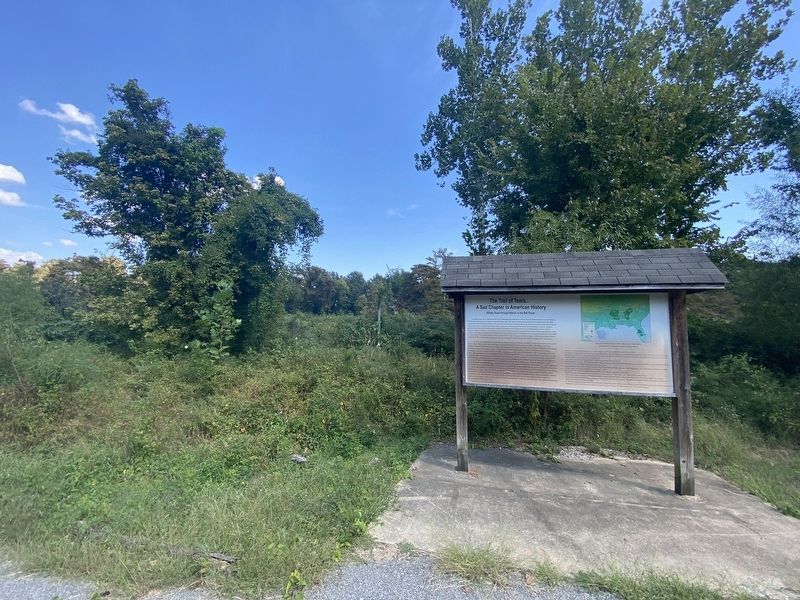
Location. 35° 12.936′ N, 90° 11.677′ W. Marker is in Marion, Arkansas, in Crittenden County. Marker can be reached from Cypress Drive. Touch for map. Marker is at or near this postal address: 104 Cypress Drive, Marion AR 72364, United States of America. Touch for directions.
Other nearby markers. At least 8 other markers are within walking distance of this marker. Father Jacques Marquette and Louis Joliet's French expedition arrived in Arkansas (within shouting distance of this marker); Hernando De Soto's expeditionary force entering Arkansas (within shouting distance of this marker); Old County Jail (within shouting distance of this marker); Marion Hotel (about 500 feet away, measured in a direct line); Crittenden Bank & Trust Company (about 600 feet away); Crittenden County Health Department (about 600 feet away); Forest Industry History in the Delta (about 600 feet away); Confederate Soldier's Memorial (about 700 feet away). Touch for a list and map of all markers in Marion.
More about this marker. The marker is located along the Marion Lake Walking Trail.
Credits. This page was last revised on November 2, 2023. It was originally submitted on October 14, 2023, by Darren Jefferson Clay of Duluth, Georgia. This page has been viewed 94 times since then and 36 times this year. Photos: 1, 2. submitted on October 25, 2023, by Darren Jefferson Clay of Duluth, Georgia. • Andrew Ruppenstein was the editor who published this page.

